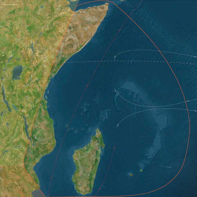
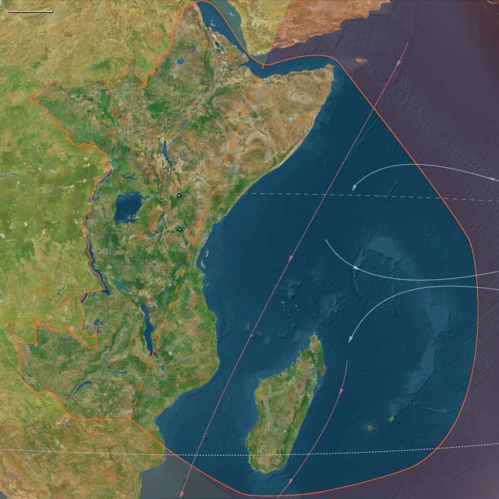
Maritime East Africa
Related Events
Filter results
Showing 10 events out of 287 total
The Indian Ocean World, one of the twelve divisions of the Earth, is centered on the Indian Ocean and encompasses Madagascar, several small island groups, Maritime East Africa, Southeastern Arabia, Southern India, Sri Lanka, and Aceh—the northernmost tip of Sumatra. Its southernmost point is Kerguelen Island.
To the north of Madagascar, the island nations of the Comoros and the Seychelles are situated in the western Indian Ocean, while Mauritius lies to the east of the great island.
On the African mainland, the region includes portions of Mozambique, Malawi, Tanzania, Kenya, and Somalia, all of which also have cultural and historical ties to Afroasia.
The Arabian nations of Yemen and Oman face the heart of the Indian Ocean World, with their division aligning with the traditional boundary separating North India from South India and Sri Lanka.
To the west of Southern India, the Maldives form a prominent island chain within this maritime world.
Along the northeastern boundary, only Aceh, the northwesternmost tip of Sumatra, belongs to the Indian Ocean World, distinguishing it from the rest of the Indonesian archipelago.
HistoryAtlas contains 1,059 entries for the Indian Ocean World from the Paleolithic period to 1899.
Narrow results by searching for a word or phrase or select from one or more of a dozen filters.
The Moderns are taller, more slender, and less muscular than the Neanderthals, with whom they share—perhaps uneasily—the Earth.
Though their brains are smaller in overall size, they are heavier in the forebrain, a difference that may allow for more abstract thought and the development of complex speech.
Yet, the inner world of the Neanderthals remains a mystery—no one knows the depths of their thoughts or how they truly expressed them.
Modern humans learn to modulate voice into audible oral speech in the period beginning around 70,000 BCE; this is a development apparently not accomplished by other archaic hominids and one peculiar to our species.
Some also learn at this time to count beyond “one, two, and many.”
The small population of moderns had spread from the Near East to South Asia by fifty thousand years ago, and on to Australia by forty thousand years ago, Homo sapiens for the first time colonizing territory never reached by Homo erectus.
It has been estimated that from a population of two thousand to five thousand individuals in Africa, only a small group, possibly as few as one hundred and fifty to one thousand people, crossed the Red Sea.
Of all the lineages present in Africa only the female descendants of one lineage, mtDNA haplogroup L3, are found outside Africa.
Had there been several migrations one would expect descendants of more than one lineage to be found outside Africa.
L3's female descendants, the M and N haplogroup lineages, are found in very low frequencies in Africa (although haplogroup M1 is very ancient and diversified in North and Northeast Africa) and appear to be recent arrivals.
A possible explanation is that these mutations occurred in East Africa shortly before the exodus and, by the founder effect, became the dominant haplogroups after the exodus from Africa.
Alternatively, the mutations may have arisen shortly after the exodus from Africa.
Some genetic evidence points to migrations out of Africa along two routes.
However, other studies suggest that only a few people left Africa in a single migration that went on to populate the rest of the world, based in the fact that only descents of L3 are found outside Africa.
From that settlement, some others point to the possibility of several waves of expansion.
East Africa (49,293 – 28,578 BCE): Upper Pleistocene I — Coastal Corridors, Rift Lakes, and Highland Refugia
Geographic and Environmental Context
By the late Pleistocene, East Africa was a mosaic of sharply differentiated landscapes, tied together by the seasonal flow of water and people.
Two primary subregions—Maritime East Africa and Interior East Africa—defined this composite world:
-
Maritime East Africa stretched from the Horn of Africa through Kenya and Tanzania to central Mozambique, encompassing offshore archipelagos such as Lamu, Zanzibar, Pemba, Mafia, and the Comoros, with distant Madagascar, Seychelles, and the Mascarene Islands still unpeopled.
At low sea stands (~100 m below modern), continental shelves widened dramatically, turning modern lagoons into open tidal flats and coral benches that extended kilometers offshore. -
Interior East Africa comprised the Ethiopian Highlands, Upper Nile wetlands, and the Great Rift Valley lakes (Victoria, Tanganyika, Malawi), descending southward through the Zambezi corridor into northern Zimbabwe and Mozambique.
Rift escarpments and lake basins alternated with dry plateaus, while the Ethiopian uplands provided perennial springs and montane forests.
Between these zones, people moved with water: rivers, lakes, and monsoon fronts tied coast, rift, and highlands into a single hydrological civilization of foragers.
Climate and Environmental Shifts
The era spanned the build-up to the Last Glacial Maximum, bringing cooler, drier conditions overall, but with strong internal contrasts.
-
Along the coast, reduced rainfall and lower sea levels shrank mangroves and estuaries; yet upwelling currents off Somalia, Kenya, and Tanzania sustained marine productivity, making reefs and tidal flats key food sources.
-
In the interior, grasslands expanded as forest belts contracted; glaciers capped the Rwenzori Mountains and high peaks of Ethiopia.
-
The Rift lakes fell below modern levels yet remained perennial oases—anchors of moisture and life in an increasingly arid hinterland.
-
Periodic monsoon rebounds (Bølling–Allerød interstadials) briefly greened savannas, allowing population expansions along both coast and rift.
Climatic patchiness, not uniform aridity, defined East Africa—a patchwork of micro-refugia sustaining continuity through global cold.
Lifeways and Settlement Patterns
Two complementary adaptations emerged: the littoral shell-gatherer and the inland lake-hunter–fisher.
-
Coastal foragers exploited shellfish, crabs, turtles, seabirds, and reef fish along the exposed shelves of Somalia, Kenya, and Tanzania.
Camps lay on fossil dunes and estuarine terraces, with movements timed to tidal cycles and monsoon winds.
Dugouts or raft craft may already have served for short river or lagoon crossings. -
Interior groups occupied lake margins, wetlands, and savanna–river ecotones.
Fish, hippo, crocodile, and waterfowl anchored lacustrine diets, while open-country hunts pursued antelope, zebra, and buffalo.
Highland refugia in Ethiopia and along the Rwenzori sustained small, cold-season populations dependent on montane roots and game.
Together these strategies formed a dual system of occupation—wetlands and coasts linked by migration corridors through the rift and Nile valleys.
Technology and Material Culture
East Africa’s Late Middle Stone Age legacy persisted but grew more specialized.
-
Stone industries remained flake- and core-based, with regional variants in obsidian, quartz, and chert; backed pieces and microlithic forms appeared late in the interval.
-
Bone technology diversified: barbed harpoons in lake basins, fine awls for hide working on the coast.
-
Symbolic artifacts—shell and ostrich-eggshell beads, perforated ornaments, and ground ochre—attest to body decoration and social display.
-
Water transport and netting technologies are inferred from site patterning and faunal remains; direct evidence is lost to submergence.
Across both subregions, the toolkit emphasized lightweight versatility—gear that could be carried from coast to upland within a few days’ walk.
Movement and Interaction Corridors
Water dictated mobility.
-
The Rift-Nile axis connected highland Ethiopia and the Great Lakes to the Sudanese and Egyptian corridors, linking East African populations with their North African counterparts.
-
Coastal routes traced the exposed continental shelf, enabling seasonal travel between estuaries and reef flats.
-
Trans-escarpment passes—through Kenya’s Taita Hills and Tanzania’s Usambara–Pare chain—linked interior valleys to the Indian Ocean, carrying tools, pigment, and ornament styles between zones.
These arteries produced not isolation but a chain of interconnected refuges, each contributing to a continental network of information and alliance.
Cultural and Symbolic Expressions
Symbolic behavior flourished despite climatic stress.
Beadwork in ostrich eggshell and shell spread from interior lakes to coastal dunes, implying exchange or shared ritual codes.
Ochre pigments, applied to skin or burial contexts, signified continuity with earlier Middle Stone Age symbolic traditions.
Rock shelters with ochre grinding stones in both Rift and coastal zones served as loci of aggregation and ceremony.
Through these media, East African foragers expressed belonging within landscapes whose waters rose and fell but never disappeared.
Environmental Adaptation and Resilience
Resilience came from mobility, ecological breadth, and knowledge of timing.
When monsoons failed, people retreated to Rift-lake refuges; when floods receded, they followed river fish and grazing herds; when sea levels dropped, they expanded onto the continental shelf.
Ostrich-eggshell water storage, portable shelters, and cooperative social networks ensured survival through alternating wet and dry pulses.
Unlike the glaciated north, East Africa remained continuously habitable, a keystone in humanity’s Ice-Age persistence.
Transition Toward the Last Glacial Maximum
By 28,578 BCE, East Africa’s dual lifeways—coastal reef foraging and rift-lake hunting–fishing—had stabilized into enduring patterns.
Maritime populations thrived along lowstand shores; interior groups clustered around the Great Lakes and highland springs.
Though rainfall waned, ecological diversity prevented collapse.
East Africa thus embodied the Twelve Worlds principle: a region not defined by uniform geography but by interlocking worlds of water, stone, and movement, whose people turned environmental fragmentation into a lasting form of resilience.
Maritime East Africa (49,293–28,578 BCE) Upper Pleistocene I — Lowstand Shores, Forager Refugia, and Reef Flats
Geographic and Environmental Context
Maritime East Africa includes littoral and nearshore islands from Somalia through Kenya and Tanzania to northern/central Mozambique and southern Malawi, plus Lamu–Pate–Mombasa, Zanzibar–Pemba–Mafia, Kilwa Kisiwani–Songo Mnara, the Comoros, Madagascar, Seychelles, and the Mascarene Islands.
-
Anchors: Lamu archipelago, Mombasa–Kilifi, Zanzibar–Pemba–Mafia, Kilwa Kisiwani–Songo Mnara, Comoros (Ngazidja, Nzwani, Mwali), Madagascar highlands/coasts, Seychelles/Mascarene atolls.Sea level ~100 m lower, exposing broad Somali–Kenyan–Tanzanian shelves
- Sea level ~100 m lower, exposing broad Somali–Kenyan–Tanzanian shelves.
-
Lagoons diminished; tidal flats and coral benches stretched far offshore.
-
Madagascar isolated but unpeopled; Seychelles/Mascarene uninhabited volcanic/atoll systems.
Climate & Environmental Shifts
-
LGM: cooler, drier, but upwelling supported marine productivity.
-
Inland savannas contracted; mangroves shrank.
Subsistence & Settlement
-
Littoral foragers in Somalia/Kenya harvested shellfish, crabs, turtles.
-
Fish taken in estuaries; dugouts possible in rivers.
-
No Madagascar/Seychelles/Mascarene settlement.
Technology & Material Culture
-
Flake–core stone tools; shell scrapers; bone points.
-
Beads from shell/ostracods.
Movement & Interaction Corridors
-
Seasonal shuttles between estuaries and reefs; Red Sea/Horn linked culturally.
Cultural & Symbolic Expressions
-
Early shell beads/ochre body paint indicate symbolic networks.
Environmental Adaptation & Resilience
-
Mobility along coast buffered aridity; fallback on reefs.
Transition
By 28,578 BCE, a durable littoral foraging adaptation persisted along the coast, absent offshore settlement.
The Arrival of Early Modern Humans in Eurasia
Homo sapiens sapiens, the same physical type as modern humans, appeared in various regions by at least 50,000 BCE. These Early European Modern Humans (EEMH), formerly known as Cro-Magnon peoples, represent the first anatomically modern humans in Europe.
Migration into Eurasia
- Early modern humans entered Eurasia via the Arabian Peninsula approximately 60,000 years ago.
- One group rapidly settled coastal areas around the Indian Ocean, expanding into South and Southeast Asia.
- Another group migrated north, reaching the steppes of Central Asia and eventually spreading into Europe.
Coexistence with Neanderthals
- Neanderthals and modern humans coexisted across Europe and western Asia for thousands of years.
- Evidence suggests that interactions may have been peaceful, with possible cultural exchanges.
Interbreeding and Genetic Legacy
- Genetic studies indicate that Neanderthals and modern humans interbred occasionally, with non-African populations today carrying traces of Neanderthal DNA.
- However, there is no strong evidence supporting the existence of true Neanderthal-modern hybrids as a distinct population. Instead, interbreeding events were limited, contributing only small genetic fragments to the modern human genome.
The arrival of modern humans in Eurasia marked a significant turning point, eventually leading to the replacement of Neanderthals, though traces of their genetic legacy remain in human populations today.
East Africa (28,577 – 7,822 BCE): Late Pleistocene–Early Holocene — Rising Seas, Lake Highstands, and Semi-Sedentary Foragers
Geographic & Environmental Context
During the long deglaciation from the Last Glacial Maximum to the Early Holocene, East Africa cohered as a single water-anchored world. Two tightly linked spheres structured lifeways:
-
Maritime belt — the Somalia–Kenya–Tanzania–N/central Mozambique littoral and near-shore islands (Lamu–Pate–Mombasa, Zanzibar–Pemba–Mafia, Kilwa Kisiwani–Songo Mnara, the Comoros, with Madagascar, Seychelles, and the Mascarene atolls still unpeopled). Rapid sea-level rise drowned glacial terraces, carving estuaries, embayments, and mangrove belts along newly formed lagoons.
-
Interior belt — the Ethiopian Highlands and Upper Nile–Sudd, the Rift Valley belts and Great Lakes(Victoria, Tanganyika, Malawi), the Rwenzori–Virunga highlands, and the Zambezi corridor. Deglaciation and monsoon rebound drove lake expansions and wetland growth, then contractions during short arid pulses, before Early Holocene stabilization.
Together, these belts formed one hydrological engine: headwaters to lakes, lakes to rivers, rivers to estuaries and reef-lined coasts.
Climate & Environmental Shifts
-
Bølling–Allerød (c. 14.7–12.9 ka): Warmer, wetter conditions strengthened the monsoon. Mangroves expanded along the coast; Rift lakes rose; wetlands multiplied.
-
Younger Dryas (c. 12.9–11.7 ka): A brief cool–dry pulse. Mangrove margins retreated and some reefs were exposed; lake levels fell, narrowing floodplains and concentrating foragers at dependable springs and outlets.
-
Early Holocene (after 11.7 ka): Renewed warmth and moisture. Sea level continued to rise, maturing lagoons and estuaries; Great Lakes highstands returned; highland forests spread.
This cadence favored flexible rounds keyed to flood pulses, fish runs, and coastal productivity.
Subsistence & Settlement
A broad-spectrum, water-anchored economy matured across both spheres:
-
Coast & lagoons: Semisedentary shell-midden villages developed around Lamu–Zanzibar–Kilwa embayments. Diets leaned on shellfish, reef and estuarine fish, dugong, and turtle, with seasonal waterfowl. Camps lengthened stays at lagoon mouths and mangrove creeks as sea level stabilized.
-
Great Lakes & highlands: Lake-shore hamlets intensified fishing with barbed harpoons and nets, paired with hunting of reduncine antelopes, buffalo, and giraffe on adjacent plains. In the Ethiopian Highlands, repeated occupations near springs and passes combined small-game hunts with gathering of wild tubers, seeds, and fruits. The Upper Nile–Sudd supported fish-and-fowl economies anchored to levees and backwaters.
Across both spheres, settlements repeatedly reoccupied dune bars, levees, outlet fans, rock shelters, and spring mounds, creating place-memory landscapes and an incipient rhythm of semisedentism without architecture.
Technology & Material Culture
Toolkits remained light, portable, and tuned to water:
-
Microlithic industries (backed bladelets, geometric segments) for composite arrows and spears.
-
Fishing gear: bone harpoons (often barbed), gorges, net sinkers, basket traps, and weir elements.
-
Processing tools: grindstones for seeds and geophytes; shell scrapers for fish and hide work.
-
Watercraft: evidence for dugouts/rafts in sheltered estuaries and along quiet river reaches.
-
Ornaments & pigments: shell beads and red ochre in domestic and mortuary contexts; bead strings curated at long-used nodes.
Movement & Interaction Corridors
Braided corridors integrated coast and interior:
-
Coastal cabotage stitched lagoon to lagoon along the Horn → Kenya → Tanzania rim, moving fish, shell, salt, and fibers.
-
Victoria–Nile axis linked Great Lakes fishing communities northward to the Upper Nile and, ultimately, Egypt.
-
Highland passes connected Ethiopian uplands to Rift escarpments and the Red Sea margin.
-
Zambezi–Chobe–Caprivi and feeder rivers circulated people and materials across wetlands and savannas.
These redundancies turned late floods, short droughts, or storm seasons into manageable detours.
Cultural & Symbolic Expressions
Waterfront places became ritual topographies:
-
Shell middens functioned as ancestral markers at coastal landings; first-fish and turtle-season feasts renewed access rules to weirs and groves.
-
Lake-margin burials with ochre, beads, and curated tools anchored claims to beaches, outlets, and fishing grounds.
-
In the Ethiopian–Sudanese arc, early rock art (cattle and hunting motifs) and pigment caches appear at springs and pass-shelters, signaling deepening ritual relationships to water and herd landscapes.
Environmental Adaptation & Resilience
Security rested on storage + scheduling + multi-ecozone use:
-
Smoked/dried fish and meats, rendered oils, and roasted seeds bridged lean months and the Younger Dryas setback.
-
Dual estuary–reef strategies on the coast and lake–plain alternation inland spread risk across habitats and seasons.
-
Settlement anchoring at rich nodes (lagoons, outlets, springs) with mobile spokes to uplands and plains balanced permanence and flexibility.
Long-Term Significance
By 7,822 BCE, East Africa had stabilized into a water-anchored forager world: semisedentary shell-midden villages along the monsoon coast and durable lake-shore communities around Great Lakes highstands. The operating code—portfolio subsistence, storage, lagoon/lake anchoring with seasonal mobility, and ritual governance of access—set a resilient foundation for the Early Holocene, foreshadowing later pastoral spread in the highlands and the growth of Indian Ocean exchange along the same monsoon shores.
Maritime East Africa (28,577–7,822 BCE) Upper Pleistocene II — Deglaciation, Rising Seas, and Lagoon Productivity
Geographic and Environmental Context
Maritime East Africa includes littoral and nearshore islands from Somalia through Kenya and Tanzania to northern/central Mozambique and southern Malawi, plus Lamu–Pate–Mombasa, Zanzibar–Pemba–Mafia, Kilwa Kisiwani–Songo Mnara, the Comoros, Madagascar, Seychelles, and the Mascarene Islands.
-
Anchors: Lamu archipelago, Mombasa–Kilifi, Zanzibar–Pemba–Mafia, Kilwa Kisiwani–Songo Mnara, Comoros (Ngazidja, Nzwani, Mwali), Madagascar highlands/coasts, Seychelles/Mascarene atolls.Sea level ~100 m lower, exposing broad Somali–Kenyan–Tanzanian shelves
-
Rapid sea rise drowned terraces, creating estuaries and mangroves.
-
Offshore islands remained unpeopled.
Climate & Environmental Shifts
-
Bølling–Allerød: wetter, mangroves expanded.
-
Younger Dryas: aridity; reefs exposed.
-
Early Holocene: warm/moist stability.
Subsistence & Settlement
-
Broad diets: shellfish, fish, dugong, estuarine mollusks, turtle.
-
Coastal settlements became more fixed around lagoons.
Technology & Material Culture
-
Microlithic industries; fish gorges, harpoons.
-
Net weights suggest weirs.
Movement & Interaction Corridors
-
Coastal canoe traffic stitched lagoons; seasonal movement along Horn → Kenya.
Cultural & Symbolic Expressions
-
Shell middens served as ancestral markers.
-
Ritual feasts around fish runs.
Adaptation & Resilience
-
Dual estuary–reef strategy maintained resilience.
Transition
By 7,822 BCE, estuarine foragers built semi-sedentary shell-midden villages.