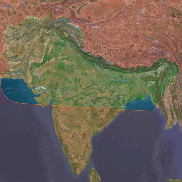
Upper South Asia
Related Events
Filter results
Showing 10 events out of 1451 total
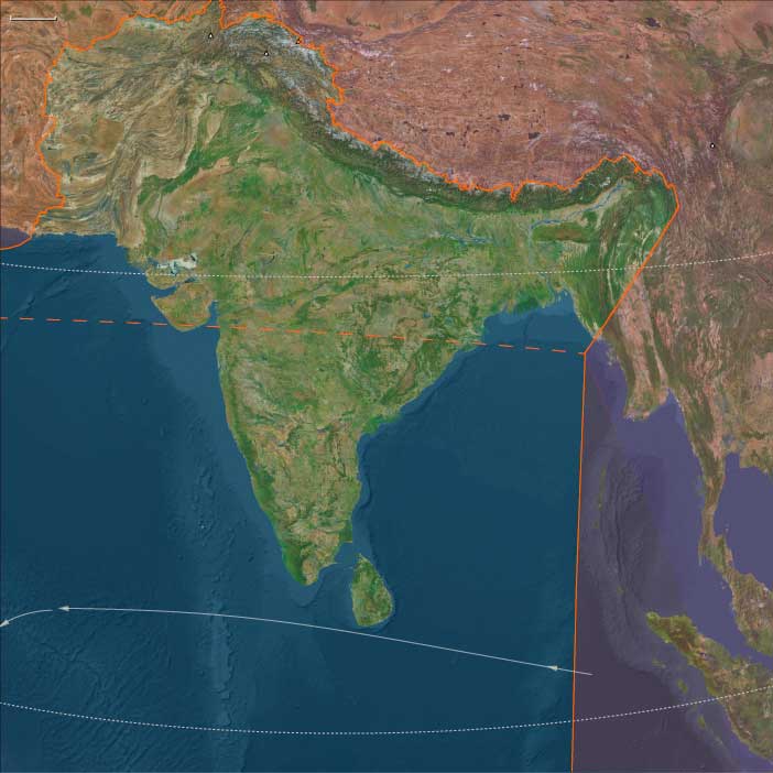
The Great Crossroads, one of the twelve divisions of the globe, is centered on Eurasia, with its northernmost extent meeting Northern Oceania and The Atlantic World at the North Pole. This vast region excludes the eastern, western, and southern extremities of the Eurasian landmass, which spans a significant portion of the Earth's surface.
The Ural Mountains, running approximately north to south, serve as the traditional boundary between Europe and Asia, as well as between Russia proper and Siberia.
For the purposes of this framework, The Great Crossroads includes Mongolia; western China, including Xinjiang and the Tibetan Plateau; the northern half of the Indian subcontinent; Afghanistan; the Iranian Plateau; Mesopotamia; eastern Arabia; the northern Levant; northeastern Cyprus; western and southwestern Anatolia; the Caucasus; Eastern Europe; Siberia; the Eastern Balkans; Eastern Scandinavia; the Baltic Sea basin; and Middle Europe.
- The southwestern boundary runs diagonally from south-central Germany, through the eastern Alps, the Balkans, and western Asia, terminating in the southern third of the Arabian Peninsula in the vast desert known as the Rub’ al Khali.
- The southern boundary divides South India from North India, following the generally recognized demarcation that includes the Narmada River, and separates the Indian Ocean-facing southeastern Arabian coast from the Persian Gulf-focused eastern Arabia.
- The southeastern boundary runs diagonally from the Bay of Bengal, following India’s border with Myanmar, marking the division between South Asia and both Southeast Asia and Eastern Asia.
Narrow results by searching for a word or phrase or select from one or more of a dozen filters.
Paleolithic sites in Potohar near Pakistan's capital Islamabad, will yield the stone tools of the Soan Culture, an archaeological culture of the Lower Paleolithic (from around 1,800,000 to about 300,000 BP) in Pakistan, contemporary to the Acheulean.
It is named after the Soan River Valley in the Sivalik Hills, Pakistan.
The bearers of this culture are thought to be Homo erectus.
Hundreds of edged pebble tools will be discovered in Adiyala and Khasala, about sixteen kilometers (ten miles) from Rawalpindi terrace on the bend of the river.
Hand axes and cleavers will be found at Chauntra.
No human skeletons of this age have yet been found.
The Moderns are taller, more slender, and less muscular than the Neanderthals, with whom they share—perhaps uneasily—the Earth.
Though their brains are smaller in overall size, they are heavier in the forebrain, a difference that may allow for more abstract thought and the development of complex speech.
Yet, the inner world of the Neanderthals remains a mystery—no one knows the depths of their thoughts or how they truly expressed them.
The descendants of the immigrants to West Asia who had remained in the south (or taken the southern route) had spread generation by generation around the coast of Arabia and the Iranian plateau until they reached India.
One of the groups that had gone north (east Asians were the second group) had ventured inland and radiated to Europe, eventually displacing the Neanderthals.
They had also radiated to India from Central Asia.
The former group headed along the southeast coast of Asia, reaching Australia between fifty-five thousand and thirty thousand years ago, with most estimates placing it about forty-six thousand to forty-one thousand years ago.
Sea level is much lower during this time, and most of Maritime Southeast Asia is one land mass known as the lost continent of Sunda.
The settlers probably continued on the coastal route southeast until they reached the series of straits between Sunda and Sahul, the continental land mass that was made up of present-day Australia and New Guinea.
The widest gaps are on the Weber Line and are at least ninety kilometers wide, indicating that settlers had knowledge of seafaring skills.
Archaic humans such as Homo erectus never reached Australia.
If these dates are correct, Australia was populated up to ten thousand years before Europe.
This is possible because humans avoided the colder regions of the North favoring the warmer tropical regions to which they were adapted given their African homeland.
Another piece of evidence favoring human occupation in Australia is that about forty-six thousand years ago, all large mammals weighing more than one hundred kilograms suddenly became extinct.
The new settlers were likely to be responsible for this extinction.
Many of the animals may have been accustomed to living without predators and become docile and vulnerable to attack (as will occur later in the Americas).
South Asia (49,293 – 28,578 BCE): Upper Pleistocene I — Loess Terraces, Rock Shelters, and Monsoon Pathways
Geographic & Environmental Context
During the late Pleistocene, South Asia was shaped by the contrasts of a weakened monsoon, extensive river terraces, and broad, exposed coastal plains.
The subcontinent spanned two dynamic realms:
-
Upper South Asia: From the Hindu Kush–Karakoram–Himalaya and Indus–Ganga–Brahmaputra basins to the Siwalik and Terai foothills. Here, braided rivers sculpted loess-covered terraces, and glaciers capped the higher Himalaya.
-
Maritime South Asia: The Deccan Peninsula and Sri Lanka—a world of rock shelters, tropical forests, and widened shelf coasts, joined intermittently by land bridges across the Palk Strait.
Together these landscapes supported highly mobile foragers who tracked monsoon pulses between upland caves, plains rivers, and coastal lagoons.
Climate & Environmental Shifts
The epoch unfolded under glacial–interglacial oscillations that reshaped both monsoon and river regimes:
-
Cool, dry glacial intervals weakened the Indian summer monsoon; winter westerlies dominated northwest India and the Himalayan forelands.
-
Interstadials briefly restored humidity, recharging lakes and river discharge across the Ganga–Yamuna and Brahmaputra systems.
-
Expanding glaciers in the Karakoram and Greater Himalaya coincided with broad Indus and Ganga terracesbuilt under fluctuating discharge.
-
Peninsular India and Sri Lanka saw contraction of rainforests and expansion of deciduous woodland and savanna under reduced precipitation.
Subsistence & Settlement
Upper South Asia
-
Settlement Patterns:
Seasonal mobility between mountain caves (Swat, Kashmir), Siwalik rock shelters, and riverine terraces along the Indus and Ganga plains. -
Diet and Hunting:
Herd-following economies targeting wild equids, aurochs, nilgai, blackbuck, ibex, markhor, and red deer. River and oxbow habitats supplied fish and waterfowl during interstadials. -
Habitation Evidence:
Caves and open-air hearths in Gandhara, the Rohri chert zone, and the Ganga–Yamuna Doab show continuity from Middle to Upper Paleolithic phases.
Maritime South Asia
-
Rock-Shelter Foragers:
Occupations at Kurnool, Jurreru, and other Deccan sites, where microlithic toolkits indicate long continuity of human presence. -
Coastal Economies:
As sea level fell, broad shelf plains opened along the Konkan–Malabar–Coromandel coasts; foragers gathered shellfish, fish, crabs, and turtles on tidal flats. -
Sri Lanka’s Balangoda Culture:
Hunter–gatherers at Fa-Hien Lena and Batadomba-lenā exploited rainforest mammals (monkeys, porcupine), freshwater fish, and yams, marking one of the world’s earliest successful tropical rainforest adaptations.
Technology & Material Culture
-
Stone Industries:
Blade–flake and geometric microlithic traditions in both northern and southern India mark the full establishment of an Upper Paleolithic trajectory. Rohri chert quarries (Sindh) became major lithic source zones. -
Organic Technologies:
Bone points, eyed needles, and hafted scrapers reflect tailored clothing and woodworking. Digging sticks and hammerstones aided tuber extraction and nut cracking. -
Symbolism and Ornament:
Ochre for body paint or adhesive; perforated beads and pendants appear in late-phase contexts. -
Fire and Cooking:
Structured hearths and roasting pits in caves and dunes suggest deliberate heat control for cooking and toolmaking.
Movement & Interaction Corridors
-
Northwest Passes: Khyber, Kurram, and Bolan gateways linked the Indus basin with Iranian and Central Asian plateaus.
-
River Pathways: Indus, Ganga–Yamuna, and Brahmaputra terraces served as highways for seasonal migration and exchange.
-
Foothill Routes: Siwalik and Terai corridors connected Himalayan uplands to fertile plains.
-
Peninsular Arteries: Godavari–Krishna–Tungabhadra valleys, Palghat and Palakkad gaps across the Western Ghats, and the Palk Strait (often a dry bridge) tied peninsular India to Sri Lanka and beyond.
Cultural & Symbolic Expressions
-
Ritual & Art:
Hearth renewals, engraved bones, and faunal motifs from northern caves reflect animistic and ritual awareness. Early rock art in southern India (and ochred burials) suggests regional symbolism. -
Social Structure:
Kin-based bands with cooperative foraging and shared tool production; roles in leadership and knowledge (e.g., hunting, healing, or navigation) were situational and seasonal.
Environmental Adaptation & Resilience
-
Mobility as Strategy: Alternation between upland shelters in cool dry months and river–delta plains during warmer seasons buffered against climatic unpredictability.
-
Ecological Breadth: Combination of hunting, fishing, and plant foraging provided resilience through monsoon weakening.
-
Technological Flexibility: Microblade composites and hafted multipurpose tools allowed rapid adaptation to varied ecologies—from the Thar scrub to the Deccan forests.
-
Maritime Awareness: Knowledge of tidal rhythms and coastal resource scheduling foreshadowed the later Holocene seafaring and shell-working traditions of peninsular India and Sri Lanka.
Transition Toward the Last Glacial Maximum
By 28,578 BCE, South Asia’s foragers had diversified into distinct but interconnected ecocultural systems:
-
In the north, cold-adapted upland–river foragers navigated the loess plains beneath glaciated peaks.
-
In the south, microlithic cave dwellers and coastal collectors exploited tropical forests and widening shelves.
Both traditions thrived through technological ingenuity, mobility, and deep ecological knowledge—foundations that would carry them through the Last Glacial Maximum and into the Holocene’s emerging monsoon world.
Upper South Asia (49,293 – 28,578 BCE) Upper Pleistocene I — Loess Terraces, Cave Shelters, and Monsoon Windows
Geographic and Environmental Context
Upper South Asia includes Afghanistan, Pakistan, North India, Nepal, Bhutan, Bangladesh, and northwestern Myanmar (the northern Arakan/Rakhine sector and Chindwin valley).-
Anchors: the Hindu Kush–Kabul–Gandhara gates (Kabul, Swat, Peshawar), the Indus–Punjab (Ravi, Beas, Chenab, Jhelum, Sutlej), the Thar–Ghaggar margins, the Ganga–Yamuna Doab and Middle Ganga plain, Kashmir and Siwalik/Terai belts, the Brahmaputra–Meghna delta (Sundarbans) and Chittagong Hill Tracts, and the Chindwin–northern Arakan corridor.
Climate & Environmental Shifts
-
Late Pleistocene oscillations with cooler/drier phases; weakened summer monsoon, stronger winter westerlies. Glaciers capped the High Himalaya; broad Indus and Ganga terraces formed under braided rivers.
Subsistence & Settlement
-
Highly mobile foragers used caves and rock shelters in Swat, Kashmir, and the Siwalik foothills; open camps along Indus and Doab bluffs.
-
Prey portfolios: wild equids, aurochs, nilgai, blackbuck, ibex, and markhor; opportunistic fish/waterfowl.
Technology & Material Culture
-
Late Middle → Upper Paleolithic microlithic trajectories (e.g., Rohri chert landscapes in Sindh); bladelets, burins, geometric microliths; bone points and eyed needles for tailored clothing.
Movement & Interaction Corridors
-
Khyber–Kurram–Bolan passes knit Gandhara to Iranian plateaus; Indus and Ganga benches guided seasonal migrations; Terai gaps connected foothills to plains.
Symbolism & Ritual
-
Ochred features, curated ornaments; hearth renewals in caves; prey-animal engravings on bone/stone.
Adaptation & Resilience
-
Upland–lowland switching across seasons buffered aridity; riverine fishing supplemented lean hunts.
Archaeologists also find evidence of Stone Age technology in Aq Kopruk and Hazar Sum in north central Afghanistan.
Plant remains in the foothills of the Hindu Kush mountains indicate that northern Afghanistan is one of the earliest places to domestic plants and animals.
Paleolithic peoples had probably roamed Afghanistan as early as 100,000 BCE.
A cave at Darra-i-Kur in Badakhshan, where twentieth-century archaeologists will discover a transitional Neanderthal skull fragment in association with Mousterian-type tools, is the earliest definite evidence of human occupation; the remains are of the Middle Paleolithic, dating about 30,000 years BCE.
South Asia (28,577 – 7,822 BCE): Late Pleistocene–Early Holocene — Monsoon Revival, River Lifeways, and Coastal Horizons
Geographic & Environmental Context
During the Late Pleistocene and early Holocene, South Asia evolved from a continent of glacial desiccation to one of rivers, wetlands, and rich coastal ecosystems.
At the Last Glacial Maximum (26,500–19,000 BCE), the Himalayan cryosphere reached its widest extent, depressing regional monsoons and transforming much of northern India into cool steppe and dry savanna. As deglaciation progressed, rivers reawakened, deltas prograded, and the subcontinent’s modern hydrographic architecture—Indus, Ganga, and Brahmaputra—took recognizable form.
Two interconnected ecological spheres emerged:
-
Upper South Asia, encompassing the Hindu Kush–Indus–Ganga–Brahmaputra corridor, where monsoon recovery and floodplain formation drew foragers to riverine habitats.
-
Maritime South Asia, covering Peninsular India, Sri Lanka, and the Indian Ocean islands, where rising seas created estuaries, lagoons, and archipelagos, transforming coastlines into lifelines.
Climate & Environmental Shifts
The transition from glacial to Holocene climates was expressed through distinct monsoonal rhythms:
-
Last Glacial Maximum: Cold, dry; weak southwest monsoon; widespread grasslands in northern India; Sri Lanka connected to the mainland by the Palk Isthmus.
-
Bølling–Allerød (14,700–12,900 BCE): Rapid warming strengthened monsoons, expanding forests and wetlands; rainfall rejuvenated Indus and Ganga catchments.
-
Younger Dryas (12,900–11,700 BCE): Short cooling reversed humid gains; savannas expanded; floodplains shrank; seasonal mobility intensified.
-
Early Holocene (after 11,700 BCE): Monsoon stabilized at near-modern strength; deltaic and estuarine systems matured; Sri Lanka was isolated by sea-level rise, and the Deccan coasts took their present form.
The interplay of glacial retreat and monsoon renewal created a mosaic of forests, grasslands, and wetlands, inviting new settlement strategies.
Subsistence & Settlement
South Asian foragers adopted increasingly river-anchored and coastal-integrated lifeways, balancing mobility and sedentarism:
-
Upper South Asia:
In the Punjab Doabs, Siwalik foothills, and Middle Ganga plains, groups focused on riverine ecologies—fishing, trapping turtles, hunting marsh deer, and gathering nuts and reeds.
At sites such as Sanghao Cave (northwest Pakistan) and foothill springs in the Siwaliks and Kashmir, repeated occupations suggest semi-sedentary foraging linked to predictable monsoon resources.
Broad-spectrum diets evolved: fish and shellfish joined deer, boar, and bovid hunting, while gathered fruits, nuts, and seeds supplemented protein. -
Maritime South Asia:
Along the Konkan, Malabar, and Coromandel coasts, shell middens mark growing dependence on marine resources—fish, mollusks, turtles, and seabirds.
Inland groups in the Deccan river basins hunted antelope and boar, gathered wild yams and nut mast, and reoccupied caves and shelters seasonally.
In Sri Lanka, the long microlithic sequence of sites such as Fa Hien and Batadomba-lena shows persistent rainforest foraging, with deer, monkeys, and fruit forming the dietary core.
Settlements followed river confluences, lagoons, and monsoon-fed springs, producing a landscape of enduring camps that presaged later village permanence.
Technology & Material Culture
Technological continuity and adaptation reflected a balance of ancient traditions and new environmental challenges:
-
Microlithic industries (triangles, trapezes, lunates) proliferated from the Thar to Sri Lanka, providing lightweight, versatile hunting tools.
-
Grinding stones appeared for processing wild grains and nuts.
-
Bone harpoons and fish gorges, along with net weights and fiber cordage, signaled intensive riverine fishing.
-
Early dugout canoe precursors likely aided Palk Strait crossings and coastal travel.
-
Ochre, shell beads, and geometric engravings reveal enduring symbolic practices in both caves and open sites.
These innovations signaled a society in technological equilibrium—mobile yet inventive, grounded in tradition but adaptive to changing coasts and climates.
Movement & Interaction Corridors
South Asia’s geography fostered movement along both hydrological and maritime axes:
-
Indus and Ganga–Yamuna river systems linked the Himalayan piedmont with lowland plains, serving as arteries of migration and exchange.
-
Palaeochannels such as the Ghaggar–Hakra acted as wet-season corridors.
-
Deccan rivers (Godavari, Krishna, Kaveri, Tungabhadra) joined interior and coastal ecologies.
-
Ghats passes allowed trans-peninsular mobility between the western and eastern coasts.
-
In the south, Palk Strait crossings persisted until sea-level rise demanded raft or canoe passage, maintaining ties between the Tamil–Andhra coast and Sri Lanka.
These routes enabled not only resource exchange but also the diffusion of ideas, materials, and seasonal alliances—the first web of South Asia’s interconnected cultural geography.
Cultural & Symbolic Expressions
Cultural expression remained rich and regionally distinctive:
-
Ochre burials and riverbank offerings along Indus–Ganga corridors suggest ritual engagement with water as a living entity.
-
Cave art and bead assemblages across peninsular India and Sri Lanka reflect continuity of symbolic behavior spanning tens of millennia.
-
Feasting middens and shell deposits indicate communal rituals centered on shared consumption and renewal.
-
Seasonal rituals tied to first-fish and large game echoed early cosmologies of abundance and cyclical renewal.
These symbolic systems intertwined ecological rhythms with social memory, anchoring communities to the monsoon’s pulse.
Environmental Adaptation & Resilience
Resilience in Late Pleistocene–Holocene South Asia derived from ecological intelligence and mobility:
-
Dietary breadth and food preservation (smoked fish, dried meat, nut pastes) mitigated climatic volatility during the Younger Dryas.
-
Mobility tracking monsoon fronts ensured access to water and seasonal foods.
-
Dual foraging strategies—riverine and coastal—buffered inland drought and forest contraction.
-
Emergent plant management, including proto-horticultural care of tubers and grain grasses, reflected early adaptation toward food security.
These patterns demonstrate how monsoon variability acted not as constraint but as teacher, cultivating resilience through flexibility.
Long-Term Significance
By 7,822 BCE, South Asia had achieved an environmental and cultural synthesis that bridged glacial foraging and Holocene settlement:
-
Upper South Asia was fully reforested and hydrologically stable, hosting broad-spectrum riverine economies.
-
Maritime South Asia had turned coasts and estuaries into centers of abundance and exchange.
-
Sri Lanka’s rainforest foragers maintained cultural continuity stretching back over 40,000 years.
Together, these traditions set the stage for the Neolithic transitions of Mehrgarh and the Ganga Plain, the maritime horizons of the Arabian Sea, and the enduring dialogue between river, monsoon, and coast that would define South Asia’s Holocene civilizations.