Southern North America
Related Events
Filter results
Showing 10 events out of 1080 total
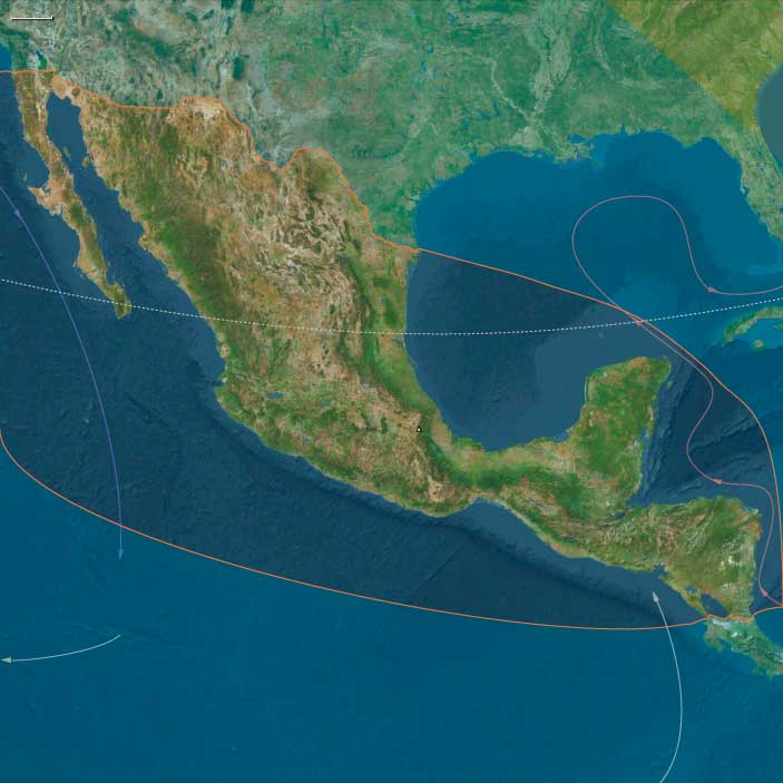
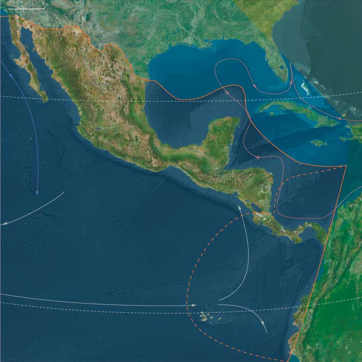
The Far West, encompassing the southwestern section of the North American continent along with the Caribbean Sea, the Gulf of Mexico, and the Pacific Ocean, includes the Galápagos Islands, the five countries of Central America, Mexico, and the Gulf and Western United States, as well as Cuba, Jamaica, the Cayman Islands, and the northwestern and southwestern regions of Haiti on Hispaniola.
Within the United States, the following states are entirely within The Far West:
Florida, Mississippi, Louisiana, Arkansas, Texas, Oklahoma, Kansas, Nebraska, Colorado, Wyoming, New Mexico, Arizona, California, and Nevada.
Portions of other states also belong to this world, including:
- Southwestern Georgia
- Most of Alabama
- Southeastern Tennessee
- Southeastern Missouri
- Southwestern South Dakota
- Most of Montana, except its northeastern and northwestern corners
- Southern Idaho
- Southeastern Oregon
HistoryAtlas contains 3707 entries for The Far West from the Paleolithic period to 1899.
Narrow results by searching for a word or phrase or select from one or more of a dozen filters.
Middle America (49,293 – 28,578 BCE): Upper Pleistocene I — Lowland Corridors, Refugial Forests, and Kelp-Edge Gateways
Geographic and Environmental Context
The realm of Middle America joined two distinct but converging landscapes:
the Southern North American isthmus of Mexico and northern Central America, and the Isthmian America belt of Costa Rica, Panama, and the Pacific-Caribbean narrows reaching toward South America.
-
In Southern North America, broad coastal plains flanked the Mexican Plateau and the volcanic highlands of Oaxaca, Chiapas, and the Yucatán. Sea level stood about 100 m lower, exposing vast Gulf and Pacific shelves, wide deltas, and dune-laced lagoons. The interior plateaus were cooler and semi-arid, while pockets of humid gallery forest persisted along the great rivers—the Pánuco, Papaloapan, Grijalva, and Usumacinta.
-
Farther south, Isthmian America narrowed to a rugged volcanic spine split by deep valleys and rain-shadowed coasts. The Darién–Chocó and Nicoya–Azuero zones formed the last humid forest refugia before the Andean world. Off the Pacific, the Galápagos stood as isolated volcanic outposts in a nutrient-rich Humboldt upwelling; to the north, San Andrés and the Caribbean shelves formed the opposite, coral-reef frontier.
Together these subregions already embodied the principle at the heart of The Twelve Worlds: a single “region” composed of two natural worlds—one continental, one inter-oceanic—each more closely tied ecologically to neighbors beyond its borders than to one another.
Climate and Environmental Shifts
Approaching the Last Glacial Maximum, global cooling reshaped Middle America’s climates without erasing their tropical gradients.
-
Cooling and aridity depressed cloud-forest belts and contracted tropical rainforests into riparian refugia.
-
Weakened summer monsoons and stronger winter trades brought long dry seasons to the Mexican Plateau and Pacific slope, while the Caribbean lowlands and Darién retained humid pockets.
-
Upwelling along the Pacific intensified under stronger winds, enriching near-shore fisheries and kelp forests.
-
Sea-level fall widened continental shelves on both coasts, joining islands to mainlands and revealing broad estuarine flats that would later drown beneath Holocene seas.
The result was a continent-spanning ecological mosaic—dry uplands, moist valleys, mangrove estuaries, and kelp-fringed shores—linked by seasonally reliable water corridors.
Lifeways and Early Presence
Direct evidence for people earlier than 30 ka BP remains debated, yet environmental reconstructions show multiple habitable refugia where early foragers could have persisted or passed through:
-
On the Mexican Plateau and Balsas grasslands, hunters followed herds of camelids, horses, bison, and deer across open steppe; small camps clustered near springs and extinct lake margins.
-
Along the Gulf and Caribbean coasts, broad mangrove estuaries offered shellfish, fish, and waterfowl. Cenote chains in the Yucatán provided reliable freshwater in an otherwise dry landscape.
-
The Pacific slope of Chiapas, Oaxaca, and Costa Rica, cooler and drier than today, supported thorn scrub interlaced with riparian woodland—a corridor of perennial rivers and volcanic caves.
-
Within Isthmian America, the Azuero–Nicoya capes and Darién forest refugia combined small-game hunting with reef and mangrove collecting; offshore islands such as San Andrés may have seen brief, resource-tracking visits.
Wherever present, human groups would have lived light on the land, following fresh water and seasonally abundant game, tethered to springs, cenotes, and coasts.
Technology and Material Culture
Toolkits likely mirrored other late Pleistocene foragers of the Americas and adjacent Asia:
-
Flake- and blade-based lithics from local chert, basalt, and obsidian; expedient scrapers and points rather than heavy bifaces.
-
Organic technologies—digging sticks, nets, baskets, and cordage—are inferred from regional parallels.
-
Pigments and ornaments—ochre nodules, shell or tooth beads—suggest symbolic behaviors aligned with global Upper Paleolithic norms.
-
Watercraft were probably dugouts or lashed-bamboo rafts, sufficient for short estuarine crossings along the Gulf or Pacific shelves.
Movement and Interaction Corridors
Middle America’s geography made it both a barrier and a bridge.
-
The Pacific “kelp-edge” highway ran continuously from California through Tehuantepec to Azuero, offering near-shore resources for any south-moving explorers.
-
Inland, the Balsas–Grijalva–Usumacinta–San Juan network formed a continental trunkline between plateau and coast.
-
The Tehuantepec and Nicoya gaps provided the easiest overland passages between oceans.
-
Eastward, the Caribbean strandlines and Yucatán shelves connected into the Antillean realm that would later become the Western West Indies.
These corridors pre-figured the trade, migration, and cultural flows that would dominate the Holocene.
Cultural and Symbolic Expressions
Symbolic evidence, if any, would have been subtle: ochre-stained hearths, bead caches, repeated camp refurbishing—the first marks of territorial familiarity. The interplay of mountain passes, coastal routes, and springs forged a cognitive map of place memory long before agriculture or architecture.
Environmental Adaptation and Resilience
Across both subregions, survival hinged on mobility anchored to water:
-
Refugial tethering—to cenotes, lagoons, and springlines—ensured security during dry phases.
-
Dual coast–interior scheduling diversified diets: marine protein in the dry season, inland plant and game resources when rains returned.
-
Flexibility across ecozones—plateau grasslands, mangrove flats, reef slopes—provided redundancy against climatic oscillation.
In ecological terms, the subregions were already complementary: the continental North offered broad grazing and inland rivers, the Isthmian South condensed resources into humid belts and fertile upwellings.
Transition Toward the Holocene
By 28,578 BCE, the two worlds of Middle America stood poised for transformation:
-
Deglaciation would flood their continental shelves, converting exposed plains into lagoons and archipelagos.
-
Monsoonal recovery would re-link the rainforests of Chiapas, Darién, and the Chocó into one continuous green bridge.
-
Coastal fisheries and freshwater wetlands would become long-term settlement magnets.
When people fully occupied these corridors millennia later, they inherited landscapes already structured by the interlocking logic of refuge and passage—a geography that made Middle America not one land but a hinge between the continents, two natural worlds joined by water and time.
Southern North America (49,293 – 28,578 BCE): Upper Pleistocene I — Lowland Corridors, Plateau Refugia, and Coastal Steppes
Geographic & Environmental Context
Southern North America spans the modern Mexico–Central America transition, including the Mexican Plateau, Gulf and Pacific lowlands, and the Central American volcanic front north of Costa Rica.
It embraces:
-
The Mexican Plateau (Basin of Mexico, Puebla–Tlaxcala, Zacatecas)
-
The Gulf lowlands (Tamaulipas–Veracruz–Tabasco)
-
The Pacific slope (Balsas and Soconusco valleys, Chiapas highlands, Tehuantepec Isthmus)
-
The Yucatán Peninsula and its northern carbonate shelf
Sea level stood roughly 100 m lower, expanding both Gulf and Pacific coastal plains. The Yucatán karst exposed vast dry basins dotted with cenotes; the Basin of Mexico held cool upland lakes; the Tehuantepec Isthmus served as a biogeographic hinge between the two oceans.
Climate & Environmental Shifts
-
Global cooling during the Last Glacial Maximum produced stronger seasonality and drier interiors, while storm intensity rose along both coasts.
-
Northern trade winds strengthened; monsoonal rains weakened.
-
The Mexican Plateau became semi-arid grassland; Gulf lowlands retained gallery forest refugia along rivers; Pacific slopes alternated between thorn scrub and riparian woodland.
-
In the Yucatán, rainfall declined and aquifers fell, exposing deeper cenotes but preserving groundwater access for future foragers.
Subsistence & Settlement
Definitive human presence before 30 ka BP is debated. If early occupants existed, they would have:
-
Favored springs, cenotes, and coastal wetlands as perennial refugia.
-
Hunted camelids, horses, bison, deer, and peccary on the Mexican Plateau and Balsas grasslands.
-
Harvested shellfish, fish, and turtles along widened Gulf and Pacific shelves.
-
Gathered palms, tubers, and cactus fruits in semi-arid zones and riparian belts.
Camps were likely ephemeral, situated on lake terraces, dune ridges, or rock shelters near reliable water.
Technology & Material Culture
-
Late Middle / Early Upper Paleolithic flake-blade industries in local chert, obsidian, and basalt.
-
Expedient core tools, backed flakes, and occasional bifacial points; heavy reliance on organic implements—digging sticks, nets, and carrying bags—now lost to preservation.
-
Pigments and ornaments (ochre, marine shell) probable in later phases by analogy to adjacent regions.
Movement & Interaction Corridors
-
Pacific coastal shelf provided a potential “kelp-edge” route southward into the Isthmian world.
-
Gulf strandlines and river deltas (Pánuco–Papaloapan–Grijalva–Usumacinta) served as east-coast arteries linking inland plateaus to mangrove margins.
-
Interior passes through Oaxaca and Chiapas connected the Plateau with Pacific and Caribbean slopes, anticipating later Mesoamerican exchange geography.
-
The Yucatán–Petén corridor remained a porous bridge between northern and equatorial biotas.
Cultural & Symbolic Expressions
If present, symbolic behavior paralleled broader Upper Pleistocene traditions:
-
Ochre for body or tool treatment, shell ornaments, and hearth structuring in caves or rock overhangs.
-
Recurrent camp refurbishing and stone caching imply cognitive mapping of place—early expressions of landscape memory.
Environmental Adaptation & Resilience
Adaptive success depended on water-tethered mobility:
-
Refugia anchoring—cenotes, lagoons, riverine forests—offset the risk of drought.
-
Dual coast–interior scheduling allowed seasonal access to fish, shellfish, and migratory game.
-
Diverse ecozones (arid plateau, humid gulf, marine shelf) provided fallback options during climate swings.
Transition
By 28,578 BCE, Southern North America had become a patchwork of viable refugia linked by coastlines and valleys that would guide later migrations southward.
As deglaciation advanced, rising seas would flood the exposed shelves and restore monsoonal rainfall, binding the Mexican isthmus and Isthmian corridor into a continuous tropical–subtropical world—the stage for the fully peopled Middle America of the next epoch.
Middle America (28,577 – 7,822 BCE): Upper Pleistocene II → Early Holocene — Deglaciation, Lagoons, and the First Garden–Sea Networks
Geographic & Environmental Context
Middle America—bridging Southern North America and Isthmian America—formed a dynamic, interlocking world of mountains, lakes, rainforests, and coastal lagoons extending from Mexico to Panama.
-
Southern North America encompassed the highland basins and coasts of Mexico, Guatemala, Belize, Honduras, El Salvador, and Nicaragua: the Basin of Mexico, Balsas–Tehuacán and Oaxaca valleys, Usumacinta–Grijalva and Motagua rivers, Yucatán karst plains, and Pacific and Caribbean lagoons.
-
Isthmian America included Costa Rica, Panama, Darién–Chocó, the San Andrés archipelago, and the Ecuadorian Capes (Manta–Santa Elena)—a narrow, humid bridge between the continents lined with mangroves, lagoons, and volcanic capes.
As glaciers retreated worldwide, sea level rose 60–80 m, drowning continental shelves and transforming river mouths into estuaries and back-reef lagoons. Inland, highland lakes stabilized, and rainforests rebounded, reconnecting once-fragmented refugia.
Climate & Environmental Shifts
-
Bølling–Allerød (c. 14.7–12.9 ka): Warming and moisture recovery filled lakes, lagoons, and aquifers; forests returned to valleys and coasts; productive coral and kelp systems matured along both Pacific and Caribbean margins.
-
Younger Dryas (c. 12.9–11.7 ka): A cool–dry relapse tightened rainfall belts; many basins lowered; coastal foragers pivoted toward reefs, mangroves, and shellfish “fallback foods.”
-
Early Holocene (after 11.7 ka): Stabilizing warmth and rainfall restored monsoon regularity; estuaries and freshwater systems reached near-modern configurations.
This environmental rhythm produced predictable seasonality—a foundation for the mixed terrestrial–aquatic economies that followed.
Subsistence & Settlement
Across Middle America, foragers developed broad-spectrum and water-anchored economies with early plant tending, semi-sedentary rounds, and localized intensification:
-
Highlands and valleys:
Seasonal camps in Tehuacán, Oaxaca, Balsas, and Puebla–Tlaxcala valleys combined hunting (deer, peccary) with gathering of wild tubers, seeds, and fruits. By 10–9 ka, foragers were managing teosinte, squash, amaranth, chile, and avocado near springs and rock shelters—proto-horticultural systems that foreshadowed agriculture.
Grinding stones and manos–metates spread through uplands, signaling increased seed and tuber processing. -
Lakes and wetlands:
Basin of Mexico and Chalco–Xochimilco-like wetlands supported fish, waterfowl, turtles, reeds, and rushes. Seasonal return to these resource-rich zones led to place memory and early social anchoring. -
Karst plains (Yucatán–Belize):
Foragers clustered around cenotes and bajos, where water and game remained dependable; fruit, palm, and root foraging merged with early tree management. -
Pacific and Gulf coasts:
Lagoon and estuary camps—from Soconusco and Guerrero to Papaloapan and Tabasco—focused on shellfish, fish, turtle, and mangrove crab.
Darién–Chocó, Nicoya–Azuero, and Manta–Santa Elena formed a continuum of littoral economies, where reef, estuary, and upland game overlapped.
Shell-midden villages emerged along tidal flats and springheads; canoes or rafts enabled short-hop movement between lagoons and coves. -
Islands:
San Andrés and other banks served as occasional fishing or foraging stops; Galápagos remained unpeopled.
Across the region, semi-recurrent encampments at coves, lagoons, springs, and lake terraces formed enduring ritual and ancestral landscapes.
Technology & Material Culture
-
Microlithic flake–blade industries: backed bladelets, trapezes, and triangular points for bows and atlatls.
-
Aquatic toolkits: bone and shell gorges, harpoons, and net weights; basketry and weir elements in placid rivers.
-
Grinding technology: manos, metates, and mortars for seeds, roots, and pigments.
-
Watercraft: rafts and early dugouts supported lagoon and short coastal travel.
-
Adornment: shell and seed beads, teeth pendants, ochre body paints; occasional carved stones and incised pebbles.
Movement & Interaction Corridors
Braided corridors of movement and exchange stitched the highlands to the seas:
-
Pacific coast: Manta–Santa Elena ⇄ Nicoya/Azuero ⇄ Darién canoe circuits connected fishing communities across the isthmus; a precursor to later maritime networks.
-
Gulf and Caribbean side: Papaloapan–Pánuco–Campeche–Tabasco mangrove belts offered long-range lagoon navigation.
-
Riverine interior: Usumacinta–Grijalva–Motagua and Balsas–Tehuacán–Oaxaca channels tied interior valleys to coastal nodes.
-
Isthmus of Tehuantepec and Central American saddles: allowed rapid cross-coast exchange of stone, pigment, fiber, and dried fish.
-
Mountain corridors: trans-volcanic and Chiapan passes linked Basin of Mexico, Oaxaca, and Soconusco spheres.
These networks carried not only materials but shared ritual knowledge—seasonal timing, water control, and navigation cues.
Cultural & Symbolic Expressions
-
Caves and springs functioned as ritual thresholds—painted, replastered, and revisited through generations.
-
Shell middens doubled as feast archives and ancestral monuments, marking rights to fisheries or freshwater outlets.
-
Bead strings, pigment caches, and curated hearths signal identity continuity and kin-line memory.
-
Early clearing and fire rites in garden zones connected planting to rainfall and renewal, blending subsistence and cosmology.
Environmental Adaptation & Resilience
Resilience derived from ecological layering and scheduling:
-
Coast–upland mobility synchronized with wet–dry cycles and resource peaks.
-
Storage and preservation—smoked fish, roasted seeds, dried roots—bridged climatic downturns like the Younger Dryas.
-
Water–land redundancy: lagoons, cenotes, and spring-fed basins hedged against drought or flood.
-
Early niche engineering: plant tending, fire use, and patch management increased stability in fluctuating climates.
Long-Term Significance
By 7,822 BCE, Middle America had become a lattice of semi-sedentary, water-centered forager communities—anchored by lagoon villages, spring gardens, and lake terraces, yet bound together by canoe routes and mountain passes.
This was the proto-Mesoamerican world in embryo:
broad-spectrum subsistence, incipient horticulture, food storage, ritualized water and land use, and dense ecological knowledge spanning coast to highland.
As seas and forests stabilized, these systems evolved seamlessly into the Holocene heartlands that would nurture the world’s earliest tropical agricultural traditions.
Southern North America (28,577 – 7,822 BCE): Upper Pleistocene II — Deglaciation, Lake–Lagoon Worlds, and Gardens-in-the-Making
Geographic & Environmental Context
Southern North America spans Mexico and the northern Central American isthmus (Guatemala, Belize, Honduras, El Salvador, Nicaragua): a lattice of caldera lakes (Basin of Mexico, Puebla–Tlaxcala), valley strings (Balsas–Tehuacán, Oaxaca, Motagua), karst plateaus (Yucatán aguadas/bajos), great rivers (Usumacinta–Grijalva), the Isthmus of Tehuantepec saddle, and dual coasts—Pacific coves (Soconusco–Guerrero) and Gulf/Caribbean lagoons–mangroves.
-
Deglaciation dropped eustatic sea level rise into motion: Pacific pocket bays and Gulf lagoons took shape; lake stands in closed basins were high and productive; braided terraces formed along the Ebro-like Balsas/Motagua analogs of Mesoamerica.
Climate & Environmental Shifts
-
Last Glacial Maximum (26.5–19 ka): cooler/drier; expanded grass–shrub in rain shadows; mangroves contracted; many basins held shallower lakes.
-
Bølling–Allerød (14.7–12.9 ka): warm/wet pulse—lake levels rose, springs strengthened, riparian gallery woods returned; reef productivity climbed offshore.
-
Younger Dryas (12.9–11.7 ka): brief cool/dry relapse—basin vegetation opened, coastal reliance increased, mobility widened.
-
Early Holocene (post-11.7 ka): stabilized warmth and monsoons—lagoons and estuaries matured, cenotes/aguadas recharged, and valley soils rejuvenated.
Subsistence & Settlement
A broad-spectrum, water-anchored foraging economy crystallized, with early plant tending in favored pockets:
-
Lakes & wetlands (Basin of Mexico, Chalco–Xochimilco analogs; highland basins): fish, waterfowl, turtles; reed/rush use; manos–metates for seeds/tubers.
-
Valleys & slopes (Balsas–Tehuacán, Oaxaca): recurrent terrace/spring camps; teosinte, squash/gourd, chile, amaranth and avocado tended near shelters; agave, palms, and oak mast rounded diets.
-
Karst lowlands (Yucatán/Belize): aguada/bajo nodes with deer, peccary, tapir, wild fruits; wet–dry scheduling around water pockets.
-
Coasts (Soconusco–Guerrero; Gulf/Caribbean lagoons): shellfish, reef fish, turtles; strandings; mangrove crabs; seasonal tunny/sardine pulses.
Camps became semi-recurrent at river mouths, cenotes/springs, dune bars, and rock shelters, forming place-memory landscapes that prefigure village permanence.
Technology & Material Culture
-
Lithics: microlithic flake–blade sets (backed bladelets, triangles, trapezes); atlatl/dart systems; scrapers and burins.
-
Aquatic gear: net weights, basket traps, gorges/harpoons; weir elements appear late in calm reaches.
-
Processing: grinding stones/querns common by late Pleistocene–early Holocene for seeds, geophytes, and pigments.
-
Watercraft: rafts/early dugouts for lagoon and short cove-to-cove runs.
-
Symbolics: ochre, shell/seed/teeth beads, engraved pebbles; curated hearths.
Movement & Interaction Corridors
-
Pacific cape chain: Soconusco ⇄ Tehuantepec ⇄ Guerrero coves (short-hop “kelp-edge” analog) for fish, shell, and stone.
-
Gulf/Caribbean lagoons: Papaloapan–Pánuco and Campeche–Tabasco mangrove belts knit coastal nodes.
-
River spines: Usumacinta–Grijalva–Motagua ferried stone, pigments, dried fish, and seeds between interior gardens and shore; portages bridged short divides.
-
Isthmus passes: Tehuantepec saddles enabled quick coast-to-coast transfers and knowledge flow.
Cultural & Symbolic Expressions
-
Cave–spring sanctuaries: repeated hearth replastering, pigment floors, and small deposits mark ritualized tenure over water and gardens.
-
Shell-midden feasts at lagoon inlets signal aggregation and first-fish/first-turtle rites; bead strings and curated stones served as identity tokens.
-
Early clearing shrines at plot margins tied plant tending to season-opening fires and rains.
Environmental Adaptation & Resilience
-
Portfolio subsistence: lagoon fish/shell + slope gardens + basin wetlands buffered Younger Dryas stress.
-
Storage: smoked/dried fish and meats; roasted seeds/nuts; geophyte caches extended stays.
-
Refugium tethering: anchoring at reliable springs, cenotes, levees, and coves, with mobile spokes to uplands/coasts, spread risk across micro-climates.
Transition Toward the Early Holocene
By 7,822 BCE, Southern North America was a proto-horticultural heartland: semi-recurrent lake and lagoon hamlets, garden-in-embryo plots near springs and shelters, and braided river/coast corridors. These lifeways—route scheduling, niche engineering, grove/plot curation, storage, and ritual governance of landings and water—set the stage for the Early Holocene’s semi-sedentary rounds and, much later, the formal village economies of Middle America.
The first humans in the Americas are descendants of northeast Asian nomads who had taken part in a series of migrations across the Bering Strait perhaps as early as 30,000 BCE.
Chips of stone tools found near campfire remains in the Valley of Mexico and radiocarbon-dated to around 21,000 BCE represent the earliest evidence of humans in Mexico.
The specifics of Paleo-Indian migration remain subject to ongoing research. The traditional 'Clovis First' theory placed human arrival around 13,000 years ago via the Beringia land bridge. However, recent evidence suggests humans reached North America between 15,000-20,000 years ago, with some sites like White Sands potentially dating to 21,000-23,000 years ago.
Two main migration routes are proposed: an inland ice-free corridor between the Laurentide and Cordilleran ice sheets, and a Pacific coastal route. The coastal route is supported by evidence that ice-free coastlines existed earlier than inland corridors. Any early coastal archaeological evidence would indeed be submerged by post-glacial sea level rise.
Current archaeological evidence indicates widespread human habitation occurred during the late glacial period (roughly 16,000-13,000 years ago), well after the Last Glacial Maximum (26,500-19,000 years ago).
Advancements in Weapon Construction by 18,000 BP
By 18,000 BP, early humans had made significant technological advancements in weapon-making, improving the efficiency and accuracy of their hunting tools.
Innovations in Projectile Construction
-
Flint Points Secured with Sinews
- Flint projectile points were now firmly attached to split wooden shafts using sinews as binding material.
- This technique increased durability and impact strength, making weapons more effective for hunting large game.
-
The Use of Fletching for Greater Accuracy
- Feathers were carefully glued and bound to projectile shafts, introducing fletching—a technique that improved stability and accuracy in flight.
- This innovation allowed projectiles to travel farther and hit targets more precisely, making hunting more efficient and reliable.
Impact on Upper Paleolithic Hunting and Warfare
- These advancements enhanced hunting efficiency, leading to greater success in capturing fast-moving prey.
- The use of composite tools, with multiple materials such as wood, sinew, stone, and feathers, reflects increasing technological sophistication.
- The refinements in projectile design paved the way for the later development of bows and arrows, revolutionizing prehistoric hunting and combat strategies.
By 18,000 BP, humans were not only mastering stone tool production but also incorporating aerodynamic principles and multi-material engineering, demonstrating an advanced understanding of physics, materials science, and hunting strategy.
The first evidence of human settlers in Guatemala goes back to at least 12,000 BCE.
There is evidence that may put this date as early as 18,000 BCE, such as obsidian arrow heads, both the northern "Clovis" and southern "fishtail" styles, have been found in different parts of Guatemala such, as Piedra Parada near Guatemala city, Chivacabé in Huehuetenango, Chajbal in Quiché, Nahualá in Sololá, and other regions.
A settlement at Los Taplales, Guatemala may be twelve thousand nine hundred years old.
Paleo-Indians expand across the American continent around 13,000 years ago, with their hunting potentially contributing to megafaunal extinctions alongside climate change. The traditional 'Clovis First' theory placed initial human arrival at this time via the Beringia land bridge. However, mounting evidence suggests humans reached North America much earlier, possibly 15,000-23,000 years ago.
Two primary migration routes are proposed: an inland ice-free corridor between the Laurentide and Cordilleran ice sheets, and a Pacific coastal route using watercraft. Coastal archaeological evidence would be submerged under post-glacial sea level rise of up to 100 meters.
The timing remains hotly debated, but scholars agree on Central Asian origins and widespread continental habitation during the late glacial period (16,000-13,000 years ago), when warming climates following the Last Glacial Maximum (26,500-19,000 years ago) enabled accelerated deglaciation and population expansion.