Isthmian America
Related Events
Filter results
Showing 10 events out of 200 total
Middle America (49,293 – 28,578 BCE): Upper Pleistocene I — Lowland Corridors, Refugial Forests, and Kelp-Edge Gateways
Geographic and Environmental Context
The realm of Middle America joined two distinct but converging landscapes:
the Southern North American isthmus of Mexico and northern Central America, and the Isthmian America belt of Costa Rica, Panama, and the Pacific-Caribbean narrows reaching toward South America.
-
In Southern North America, broad coastal plains flanked the Mexican Plateau and the volcanic highlands of Oaxaca, Chiapas, and the Yucatán. Sea level stood about 100 m lower, exposing vast Gulf and Pacific shelves, wide deltas, and dune-laced lagoons. The interior plateaus were cooler and semi-arid, while pockets of humid gallery forest persisted along the great rivers—the Pánuco, Papaloapan, Grijalva, and Usumacinta.
-
Farther south, Isthmian America narrowed to a rugged volcanic spine split by deep valleys and rain-shadowed coasts. The Darién–Chocó and Nicoya–Azuero zones formed the last humid forest refugia before the Andean world. Off the Pacific, the Galápagos stood as isolated volcanic outposts in a nutrient-rich Humboldt upwelling; to the north, San Andrés and the Caribbean shelves formed the opposite, coral-reef frontier.
Together these subregions already embodied the principle at the heart of The Twelve Worlds: a single “region” composed of two natural worlds—one continental, one inter-oceanic—each more closely tied ecologically to neighbors beyond its borders than to one another.
Climate and Environmental Shifts
Approaching the Last Glacial Maximum, global cooling reshaped Middle America’s climates without erasing their tropical gradients.
-
Cooling and aridity depressed cloud-forest belts and contracted tropical rainforests into riparian refugia.
-
Weakened summer monsoons and stronger winter trades brought long dry seasons to the Mexican Plateau and Pacific slope, while the Caribbean lowlands and Darién retained humid pockets.
-
Upwelling along the Pacific intensified under stronger winds, enriching near-shore fisheries and kelp forests.
-
Sea-level fall widened continental shelves on both coasts, joining islands to mainlands and revealing broad estuarine flats that would later drown beneath Holocene seas.
The result was a continent-spanning ecological mosaic—dry uplands, moist valleys, mangrove estuaries, and kelp-fringed shores—linked by seasonally reliable water corridors.
Lifeways and Early Presence
Direct evidence for people earlier than 30 ka BP remains debated, yet environmental reconstructions show multiple habitable refugia where early foragers could have persisted or passed through:
-
On the Mexican Plateau and Balsas grasslands, hunters followed herds of camelids, horses, bison, and deer across open steppe; small camps clustered near springs and extinct lake margins.
-
Along the Gulf and Caribbean coasts, broad mangrove estuaries offered shellfish, fish, and waterfowl. Cenote chains in the Yucatán provided reliable freshwater in an otherwise dry landscape.
-
The Pacific slope of Chiapas, Oaxaca, and Costa Rica, cooler and drier than today, supported thorn scrub interlaced with riparian woodland—a corridor of perennial rivers and volcanic caves.
-
Within Isthmian America, the Azuero–Nicoya capes and Darién forest refugia combined small-game hunting with reef and mangrove collecting; offshore islands such as San Andrés may have seen brief, resource-tracking visits.
Wherever present, human groups would have lived light on the land, following fresh water and seasonally abundant game, tethered to springs, cenotes, and coasts.
Technology and Material Culture
Toolkits likely mirrored other late Pleistocene foragers of the Americas and adjacent Asia:
-
Flake- and blade-based lithics from local chert, basalt, and obsidian; expedient scrapers and points rather than heavy bifaces.
-
Organic technologies—digging sticks, nets, baskets, and cordage—are inferred from regional parallels.
-
Pigments and ornaments—ochre nodules, shell or tooth beads—suggest symbolic behaviors aligned with global Upper Paleolithic norms.
-
Watercraft were probably dugouts or lashed-bamboo rafts, sufficient for short estuarine crossings along the Gulf or Pacific shelves.
Movement and Interaction Corridors
Middle America’s geography made it both a barrier and a bridge.
-
The Pacific “kelp-edge” highway ran continuously from California through Tehuantepec to Azuero, offering near-shore resources for any south-moving explorers.
-
Inland, the Balsas–Grijalva–Usumacinta–San Juan network formed a continental trunkline between plateau and coast.
-
The Tehuantepec and Nicoya gaps provided the easiest overland passages between oceans.
-
Eastward, the Caribbean strandlines and Yucatán shelves connected into the Antillean realm that would later become the Western West Indies.
These corridors pre-figured the trade, migration, and cultural flows that would dominate the Holocene.
Cultural and Symbolic Expressions
Symbolic evidence, if any, would have been subtle: ochre-stained hearths, bead caches, repeated camp refurbishing—the first marks of territorial familiarity. The interplay of mountain passes, coastal routes, and springs forged a cognitive map of place memory long before agriculture or architecture.
Environmental Adaptation and Resilience
Across both subregions, survival hinged on mobility anchored to water:
-
Refugial tethering—to cenotes, lagoons, and springlines—ensured security during dry phases.
-
Dual coast–interior scheduling diversified diets: marine protein in the dry season, inland plant and game resources when rains returned.
-
Flexibility across ecozones—plateau grasslands, mangrove flats, reef slopes—provided redundancy against climatic oscillation.
In ecological terms, the subregions were already complementary: the continental North offered broad grazing and inland rivers, the Isthmian South condensed resources into humid belts and fertile upwellings.
Transition Toward the Holocene
By 28,578 BCE, the two worlds of Middle America stood poised for transformation:
-
Deglaciation would flood their continental shelves, converting exposed plains into lagoons and archipelagos.
-
Monsoonal recovery would re-link the rainforests of Chiapas, Darién, and the Chocó into one continuous green bridge.
-
Coastal fisheries and freshwater wetlands would become long-term settlement magnets.
When people fully occupied these corridors millennia later, they inherited landscapes already structured by the interlocking logic of refuge and passage—a geography that made Middle America not one land but a hinge between the continents, two natural worlds joined by water and time.
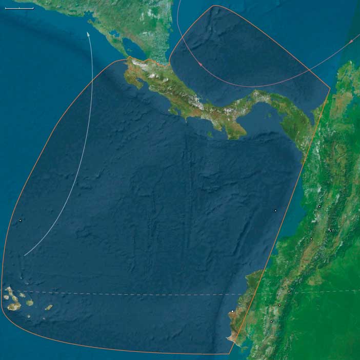
Isthmian America (49,293 to 28,578 BCE) Upper Pleistocene I — Shelf Lowstands, Rainforest Refugia, and Kelp-Edge Seas
Geographic & Environmental Context
Isthmian America includes Costa Rica, Panama, Darién (Panama–Colombia), San Andrés Archipelago, Galápagos Islands, and the Ecuadorian Capelands (Cabos Manglares, San Francisco, Pasado, San Lorenzo, Punta Santa Elena; Manta; western Esmeraldas, Manabí, Guayas, Santa Elena).
Anchors: Panama isthmus and Azuero; Darién–Chocó rainforests; Costa Rica Central Valley and Nicoya; San Andrés banks; Galápagos volcanic outliers; Manta–Santa Elena capes and lagoons.
-
Sea level ~100 m lower exposed Pacific & Caribbean benches; Azuero/Nicoya capes extended; Manta–Santa Elena had broader strand-plains; Galápagos remained far-oceanic.
-
Darién–Chocó held humid forest refugia; Central American volcanic spine cooler/drier.
Climate & Environmental Shifts
-
LGM: cooler, drier; monsoon weakened; upwelling strengthened along Humboldt contact; Caribbean trade winds intensified.
Subsistence & Settlement
-
No secure evidence for people this early is expected in this corridor; any presence would hug refugia (Darién springs, Azuero coves), exploiting shellfish, reef fish, deer, peccary.
Technology & Material Culture
-
Flake–core industries if present; expedient shell tools; organic nets/baskets (poorly preserved).
Movement & Interaction Corridors
-
Pacific kelp-edge & Caribbean strandlines offered rich “highways” if used episodically; gap crossings shortest near Darién.
Cultural & Symbolic Expressions — Inferred only (ochre, shell beads) by analogy to nearby regions.
Environmental Adaptation & Resilience
-
Refugial tethering (springs & coves) + mixed coast/inland foraging buffered LGM stress.
Transition
-
Deglaciation will flood benches, build lagoons, and stabilize rainforest corridors for sustained occupation.
Middle America (28,577 – 7,822 BCE): Upper Pleistocene II → Early Holocene — Deglaciation, Lagoons, and the First Garden–Sea Networks
Geographic & Environmental Context
Middle America—bridging Southern North America and Isthmian America—formed a dynamic, interlocking world of mountains, lakes, rainforests, and coastal lagoons extending from Mexico to Panama.
-
Southern North America encompassed the highland basins and coasts of Mexico, Guatemala, Belize, Honduras, El Salvador, and Nicaragua: the Basin of Mexico, Balsas–Tehuacán and Oaxaca valleys, Usumacinta–Grijalva and Motagua rivers, Yucatán karst plains, and Pacific and Caribbean lagoons.
-
Isthmian America included Costa Rica, Panama, Darién–Chocó, the San Andrés archipelago, and the Ecuadorian Capes (Manta–Santa Elena)—a narrow, humid bridge between the continents lined with mangroves, lagoons, and volcanic capes.
As glaciers retreated worldwide, sea level rose 60–80 m, drowning continental shelves and transforming river mouths into estuaries and back-reef lagoons. Inland, highland lakes stabilized, and rainforests rebounded, reconnecting once-fragmented refugia.
Climate & Environmental Shifts
-
Bølling–Allerød (c. 14.7–12.9 ka): Warming and moisture recovery filled lakes, lagoons, and aquifers; forests returned to valleys and coasts; productive coral and kelp systems matured along both Pacific and Caribbean margins.
-
Younger Dryas (c. 12.9–11.7 ka): A cool–dry relapse tightened rainfall belts; many basins lowered; coastal foragers pivoted toward reefs, mangroves, and shellfish “fallback foods.”
-
Early Holocene (after 11.7 ka): Stabilizing warmth and rainfall restored monsoon regularity; estuaries and freshwater systems reached near-modern configurations.
This environmental rhythm produced predictable seasonality—a foundation for the mixed terrestrial–aquatic economies that followed.
Subsistence & Settlement
Across Middle America, foragers developed broad-spectrum and water-anchored economies with early plant tending, semi-sedentary rounds, and localized intensification:
-
Highlands and valleys:
Seasonal camps in Tehuacán, Oaxaca, Balsas, and Puebla–Tlaxcala valleys combined hunting (deer, peccary) with gathering of wild tubers, seeds, and fruits. By 10–9 ka, foragers were managing teosinte, squash, amaranth, chile, and avocado near springs and rock shelters—proto-horticultural systems that foreshadowed agriculture.
Grinding stones and manos–metates spread through uplands, signaling increased seed and tuber processing. -
Lakes and wetlands:
Basin of Mexico and Chalco–Xochimilco-like wetlands supported fish, waterfowl, turtles, reeds, and rushes. Seasonal return to these resource-rich zones led to place memory and early social anchoring. -
Karst plains (Yucatán–Belize):
Foragers clustered around cenotes and bajos, where water and game remained dependable; fruit, palm, and root foraging merged with early tree management. -
Pacific and Gulf coasts:
Lagoon and estuary camps—from Soconusco and Guerrero to Papaloapan and Tabasco—focused on shellfish, fish, turtle, and mangrove crab.
Darién–Chocó, Nicoya–Azuero, and Manta–Santa Elena formed a continuum of littoral economies, where reef, estuary, and upland game overlapped.
Shell-midden villages emerged along tidal flats and springheads; canoes or rafts enabled short-hop movement between lagoons and coves. -
Islands:
San Andrés and other banks served as occasional fishing or foraging stops; Galápagos remained unpeopled.
Across the region, semi-recurrent encampments at coves, lagoons, springs, and lake terraces formed enduring ritual and ancestral landscapes.
Technology & Material Culture
-
Microlithic flake–blade industries: backed bladelets, trapezes, and triangular points for bows and atlatls.
-
Aquatic toolkits: bone and shell gorges, harpoons, and net weights; basketry and weir elements in placid rivers.
-
Grinding technology: manos, metates, and mortars for seeds, roots, and pigments.
-
Watercraft: rafts and early dugouts supported lagoon and short coastal travel.
-
Adornment: shell and seed beads, teeth pendants, ochre body paints; occasional carved stones and incised pebbles.
Movement & Interaction Corridors
Braided corridors of movement and exchange stitched the highlands to the seas:
-
Pacific coast: Manta–Santa Elena ⇄ Nicoya/Azuero ⇄ Darién canoe circuits connected fishing communities across the isthmus; a precursor to later maritime networks.
-
Gulf and Caribbean side: Papaloapan–Pánuco–Campeche–Tabasco mangrove belts offered long-range lagoon navigation.
-
Riverine interior: Usumacinta–Grijalva–Motagua and Balsas–Tehuacán–Oaxaca channels tied interior valleys to coastal nodes.
-
Isthmus of Tehuantepec and Central American saddles: allowed rapid cross-coast exchange of stone, pigment, fiber, and dried fish.
-
Mountain corridors: trans-volcanic and Chiapan passes linked Basin of Mexico, Oaxaca, and Soconusco spheres.
These networks carried not only materials but shared ritual knowledge—seasonal timing, water control, and navigation cues.
Cultural & Symbolic Expressions
-
Caves and springs functioned as ritual thresholds—painted, replastered, and revisited through generations.
-
Shell middens doubled as feast archives and ancestral monuments, marking rights to fisheries or freshwater outlets.
-
Bead strings, pigment caches, and curated hearths signal identity continuity and kin-line memory.
-
Early clearing and fire rites in garden zones connected planting to rainfall and renewal, blending subsistence and cosmology.
Environmental Adaptation & Resilience
Resilience derived from ecological layering and scheduling:
-
Coast–upland mobility synchronized with wet–dry cycles and resource peaks.
-
Storage and preservation—smoked fish, roasted seeds, dried roots—bridged climatic downturns like the Younger Dryas.
-
Water–land redundancy: lagoons, cenotes, and spring-fed basins hedged against drought or flood.
-
Early niche engineering: plant tending, fire use, and patch management increased stability in fluctuating climates.
Long-Term Significance
By 7,822 BCE, Middle America had become a lattice of semi-sedentary, water-centered forager communities—anchored by lagoon villages, spring gardens, and lake terraces, yet bound together by canoe routes and mountain passes.
This was the proto-Mesoamerican world in embryo:
broad-spectrum subsistence, incipient horticulture, food storage, ritualized water and land use, and dense ecological knowledge spanning coast to highland.
As seas and forests stabilized, these systems evolved seamlessly into the Holocene heartlands that would nurture the world’s earliest tropical agricultural traditions.
Isthmian America (28,577 to 7,822 BCE) Upper Pleistocene II — Deglaciation, Lagoon Growth, First Littoral Camps
Geographic & Environmental Context
Isthmian America includes Costa Rica, Panama, Darién (Panama–Colombia), San Andrés Archipelago, Galápagos Islands, and the Ecuadorian Capelands (Cabos Manglares, San Francisco, Pasado, San Lorenzo, Punta Santa Elena; Manta; western Esmeraldas, Manabí, Guayas, Santa Elena).
Anchors: Panama isthmus and Azuero; Darién–Chocó rainforests; Costa Rica Central Valley and Nicoya; San Andrés banks; Galápagos volcanic outliers; Manta–Santa Elena capes and lagoons.
Climate & Environmental Shifts
-
Bølling–Allerød: wetter/warmer; forests expanded; lagoons formed.
-
Younger Dryas: brief cool/dry; reef reliance spikes.
-
Early Holocene: stable warmth, predictable rains.
Subsistence & Settlement
-
Darién–Chocó and Nicoya/Azuero: seasonal shell-midden camps; fish, turtle, mangrove crabs; inland deer/peccary.
-
Ecuadorian Capes (Manta–Santa Elena): surf-facing coves supported rich fisheries.
-
San Andrés: occasional fishing stops; Galápagos: still uninhabited.
Technology & Material Culture
-
Microliths; bone gorges/harpoons; net sinkers; early dugouts/rafting regionally.
Movement & Interaction Corridors
-
Manta–Santa Elena ⇄ Nicoya/Azuero ⇄ Darién canoe hops; Caribbean San Andrés on long-haul spearing circuits.
Cultural & Symbolic Expressions
-
Shell-heap feasts; beadwork; ritual hearths near capes/springs.
Adaptation & Resilience
-
Diet breadth + reef “fallback foods” buffered Younger Dryas reversals.
Transition
-
Early Holocene hydrology enables semi-sedentary rounds at lagoons and springheads.
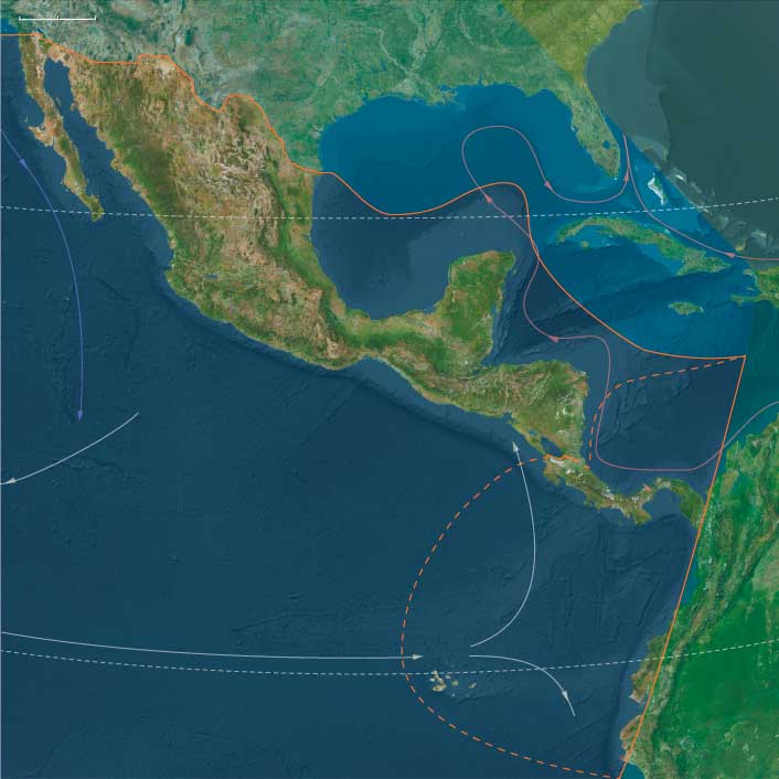
Middle America (7,821–6,094 BCE): Early Holocene — Two Oceans, One Corridor Civilization-in-Embryo
Geographic & Environmental Context
Middle America joins Southern North America (Mexico → Nicaragua) with Isthmian America (Costa Rica–Panama–Darién and Ecuador’s capes).
Volcanic piedmonts and lake basins step down to mangrove estuaries, bar-built lagoons, and cape-bound bays on the Pacific; karst lowlands and lagoon coasts fringe the Gulf/Caribbean. Short isthmian portages and tidal creeks tie the seas.
Anchors: Basin of Mexico lakes; Balsas–Tehuacán–Oaxaca valleys; Usumacinta–Grijalva–Motagua; Soconusco/Nicoya/Azuero coves; Manta–Santa Elena capes & lagoons; Darién–Chocó rainforests; seasonal San Andrés node; Galápagos unpeopled outliers.
Climate & Environmental Shifts
Holocene optimum delivered reliable wet–dry seasonality. Lakes and estuaries stabilized; Pacific upwelling kept nearshore fisheries rich; karst aguadas and lee-basin tank beds buffered drier pulses. Perfect conditions for semi-sedentary rounds and garden tending.
Subsistence & Settlement
A coast–river–valley portfolio matured across both spheres:
-
Southern North America: lake/river hamlets with broad-spectrum fishing–foraging; slope gardens of teosinte, squash/gourd, chile, amaranth, avocado near camps; cove–lagoon villages on Pacific/Gulf with shellfish, fish, turtles.
-
Isthmian America: recurrent hamlets on Nicoya, Azuero, Manta–Santa Elena exploiting estuarine fish/turtle/shellfish with inland tubers/fruits; Darién rounds added upland hunts and sago-like palms; San Andrés used seasonally; Galápagos remained unpeopled.
Everywhere, settlement was semi-sedentary and nodal, returning to springs, levees, dunes, and capes.
Technology & Material Culture
Ground-stone mortars/querns, polished adzes; nets, weirs, basket traps; dugouts (improving hulls along Pacific capes); coarse early pottery appears late at some capes/estuaries; barkcloth, cordage, and drying racks supported storage.
Movement & Interaction Corridors
Braided logistics defined the region:
-
Pacific cape trunklines: Manta/Santa Elena ⇄ Panamá ⇄ Nicoya.
-
Isthmian portages through Darién linked oceans.
-
River spines (Usumacinta–Grijalva–Motagua) ferried stone, pigments, salt, and cured foods between interior gardens and the littoral.
These redundancies turned storms or late runs into manageable detours.
Cultural & Symbolic Expressions
Shrine-stones at springheads and landings; shell-midden ancestral places at bays and river mouths; feast cycles timed to fish/turtle seasons; cave altars and garden-edge offerings wove tenure and reciprocity into everyday subsistence.
Environmental Adaptation & Resilience
Security rested on storage + transported landscapes + exchange: smoked fish, dried mollusks, nut/fruit pastes; multi-ecozone rounds (cape slope plot + levee grove + dune bar camp); cabotage and portage obligations redistributed surpluses after shocks.
Long-Term Significance
By 6,094 BCE, Middle America functioned as an interoceanic corridor world: semi-sedentary lagoons and lake margins, slope gardens in embryo, and canoe freight knitting capes to caves. These habits—route scheduling, niche engineering, grove curation, and feast-based governance—compose the operating code from which later gold–shell–cotton networks, ceramic florescence, and formal seaside polities would grow.
Isthmian America (7,821 to 6,094 BCE) Early Holocene — Semisedentary Lagoons and Proto-Garden Tending
Geographic & Environmental Context
Isthmian America includes Costa Rica, Panama, Darién (Panama–Colombia), San Andrés Archipelago, Galápagos Islands, and the Ecuadorian Capelands (Cabos Manglares, San Francisco, Pasado, San Lorenzo, Punta Santa Elena; Manta; western Esmeraldas, Manabí, Guayas, Santa Elena).
Anchors: Panama isthmus and Azuero; Darién–Chocó rainforests; Costa Rica Central Valley and Nicoya; San Andrés banks; Galápagos volcanic outliers; Manta–Santa Elena capes and lagoons.
Subsistence & Settlement
-
Recurrent hamlets on Nicoya, Azuero, Manta–Santa Elena; estuarine fish, turtle, shellfish; inland tubers/fruits.
-
Darién foragers added upland hunts & sago-like palms; San Andrés used seasonally.
Technology & Material Culture
-
Ground-stone mortars/querns; net/weir systems; improved dugouts; coarse early pottery at some capes (late in the window).
Movement & Interaction Corridors
-
Canoe trunklines Manta/Santa Elena ⇄ Panamá⇄ Nicoya; portage through Darién passes.
Cultural & Symbolic Expressions
-
Shrine-stones at springheads; shell-midden ancestral places; feast cycles.
Adaptation & Resilience
-
Storage (smoked fish, dried mollusks, nut pastes) + multi-ecozone rounds stabilized settlement.
Transition
-
Seeds of proto-horticulture and longer stays at lagoons set the stage for village life.
Middle America (6,093–4,366 BCE): Middle Holocene — Two Oceans, One Corridor World
Geographic & Environmental Context
Middle America integrates Southern North America (Mexico → Nicaragua) with Isthmian America (Costa Rica–Panama–Darién and Ecuador’s capes). Volcanic piedmonts and basins step to mangrove estuaries, bar-built lagoons, and cape-bound embayments on the Pacific; karst lowlands and Caribbean lagoons fringe the opposite coast. Short isthmian portages tie seas; interior rivers (Usumacinta–Grijalva–Motagua, Chiriquí–Tuira) bind gardens to fisheries.
Climate & Environmental Shifts
Hypsithermal warmth delivered reliable wet–dry seasonality. Basin lakes and estuaries stabilized; Pacific upwelling kept nearshore fisheries rich; localized dry pulses in rain-shadows were offset by spring-fed seeps, karst aguadas, and perennial mangroves—perfect conditions for semi-sedentary rounds.
Subsistence & Settlement
A continent–isthmus portfolio economy matured:
-
Southern North America: semi-sedentary gardens (teosinte/squash/gourd/chile, tree crops) paired with lake–lagoon fisheries and upland hunts; recurring cave–spring villages and bayside hamlets.
-
Isthmian America: cape-and-lagoon hamlets (Nicoya–Azuero–Manta/Santa Elena) with tended root gardens and palms at freshwater seeps; levee camps in Darién; San Andrés as a provisioning node; Galápagos unpeopled.
Everywhere: drying/smoking, shell and turtle rookeries, and grove curation created dependable food banks.
Technology & Material Culture
Shared land–sea toolkit: polished adzes, manos/metates, nets, basketry, fish weirs, dugouts (and in calm bays sewn-plank builds). Pottery was patchy but growing in isthmian/coastal belts; elsewhere clay served as lining and small objects. Ornaments in shell/seed/stone, pigments, and occasional figurines marked houses and lineages.
Movement & Interaction Corridors
Middle America functioned as braided logistics:
-
Pacific cape circuits—Manta ⇄ Santa Elena ⇄ Nicoya ⇄ Azuero—moved salt, resins, cured fish, shells, fibers.
-
Isthmian pull-overs and portages shuttled goods between Pacific and Caribbean.
-
Interior river spines (Usumacinta–Grijalva–Motagua) ferried stone and pigments to coasts, and salt/fish inland.
These redundant lanes turned storms or local shortfalls into manageable detours.
Cultural & Symbolic Expressions
Capes and caves were sacred thresholds: ancestral canoe cults enacted ritual landings; garden-edge shrines petitioned rain and tuber fertility; feasting middens on beaches and lake margins fixed rights and memory. Stone markers and carved prows signaled tenure over landings, groves, and weirs.
Environmental Adaptation & Resilience
Resilience rested on transported landscapes and social insurance: multi-site tending (cape garden + terrace plot + levee grove), diversified food webs (reef/mangrove + roots/fruits + hunt), storage by smoke/drying, and exchange obligations across kin routes and portages.
Long-Term Significance
By 4,366 BCE, Middle America was an interoceanic corridor civilization-in-embryo: semi-sedentary gardens, fish weirs, canoe freight, and ceremonial governance of routes and landings. These habits—route scheduling, niche engineering, grove curation, and feast-based reciprocity—prepare the ground for later gold–shell–cotton networks, pottery florescence, and the formal seascape polities of the next ages.
Isthmian America (6,093 to 4,366 BCE) Middle Holocene — Proto-Horticulture, Canoe Exchange, Cape Polities-in-Embryo.
Geographic & Environmental Context
Isthmian America includes Costa Rica, Panama, Darién (Panama–Colombia), San Andrés Archipelago, Galápagos Islands, and the Ecuadorian Capelands (Cabos Manglares, San Francisco, Pasado, San Lorenzo, Punta Santa Elena; Manta; western Esmeraldas, Manabí, Guayas, Santa Elena).
Anchors: Panama isthmus and Azuero; Darién–Chocó rainforests; Costa Rica Central Valley and Nicoya; San Andrés banks; Galápagos volcanic outliers; Manta–Santa Elena capes and lagoons.
Subsistence & Settlement
-
Tending taro, yam, bananas, palms in Nicob… (analogy) — here: coast slopes & freshwater seeps around Manta–Santa Elena and Nicoya; fisher–forager hamlets semi-permanent.
-
Darién: large seasonal camps on levees; San Andrés: provisioning stop; Galápagos still unpeopled.
Technology & Material Culture
-
Polished adzes; wider pottery use; sewn-plank dugouts in calm Pacific bays.
Movement & Interaction Corridors
-
Canoe caravans ferried dried fish, shells, resins, salt among coast capes; short overland portages across Isthmus.
Cultural & Symbolic Expressions
-
Ancestral canoe cults; ritual landings; capes as sacred thresholds.
Adaptation & Resilience
-
Transported landscapes (tended groves/gardens) stabilized calories in poor years.
Transition
-
Proto-horticultural coast villages & canoe exchange mature, foreshadowing later gold–shell–cotton networks.
Middle America (4,365 – 2,638 BCE): Late Neolithic / Chalcolithic — Capes, Corridors, and Canoe Worlds
Geographic & Environmental Context
Middle America cohered as a two-ocean hinge linking the tropical Gulf–Caribbean to the upwelling-rich eastern Pacific. River terraces, volcanic piedmonts, and dry tropical capes graded into mangrove lagoons and coral shelves; interior basins stepped upward to cloud-forest ridges and back down to Pacific embayments. Along the inter-isthmian narrows, short portages and tidal creeks stitched watersheds together, while to the south the Manta–Santa Elena capes faced Nicoya–Azuero across predictable wind and swell windows. Offshore, the San Andrés banks sustained seasonal fisheries; the Galápagos remained unpeopled yet figured in the maritime imagination as bird, turtle, and driftwood outliers. This was a single environmental engine—garden rivers + reef lagoons + capes and passes—that made movement as fundamental as place.
Climate & Environmental Shifts
The epoch was broadly warm and seasonally reliable, with a monsoon-like alternation of wet and dry. Cyclone clusters were episodic on the Caribbean side; ENSO-like pulses periodically re-tuned Pacific fisheries and nearshore productivity. River meanders refreshed floodplain soils, mangroves trapped sediment behind barrier spits, and fog-laden dry seasons along exposed capes favored arboriculture and drought-tolerant plots. Predictable winds and currents created repeatable voyaging windows, the meteorological grammar of later canoe economies.
Subsistence & Settlement
A portfolio subsistence matured across coastal and near-interior belts. Shoreline villages paired gardens (early maize, gourds, squashes; regional roots and tree crops) with reef–lagoon fisheries, shellfish, and sea turtles. Estuary levees hosted hamlets with canoe sheds, drying racks, and smokehouses; river-hamlet strings climbed into foothills to tap palms, fibers, and lithic sources. On the Pacific capes and peninsulas, courtyard hamlets organized field-and-fish schedules; within the Azuero–Nicoya–Manta triangle, provisioning sites supplied water, salt, fuel, and cured fish for inter-cape voyages. Farther east, Darién waterways nurtured garden-forager mosaics that brokered goods between seas. The Galápagos remained unoccupied but were seasonally surveyed as ecological beacons.
Technology & Material Culture
Toolkits blended groundstone adzes, shell and bone points, and increasingly diverse pottery (cooking jars, necked storage, griddles where cassava processing emerged). Barkcloth and plant-fiber cordage, net floats, and basketry underwrote fishing and storage. Canoes standardized toward longer, lighter hulls suitable for coast-hugging and short open-water hops; in places, outrigger and lashed-plank refinements improved stability in cross-sea. Shell ornaments, drilled teeth, and selected stones signaled house and lineage identity; fine polishing and incising grew alongside exchange.
Movement & Interaction Corridors
Middle America functioned as a braided corridor system:
-
Coast-to-coast inter-isthmian links (portages, tidal creeks) moved dried fish, salt, resins, fibers, and river stones between the two oceans.
-
North–south cape circuits ran Manta ⇄ Santa Elena ⇄ Nicoya ⇄ Azuero, timing departures to seasonal winds and countercurrents.
-
Caribbean littoral lanes connected bank fisheries and mangrove saltworks to river valleys and island shelves (including San Andrés).
These routes overlapped to form redundant exchange webs—if one sea ran rough, the other sea or an inland trunk carried the traffic.
Belief & Symbolism
Capes, bars, and river mouths acted as ritual thresholds. Ancestor veneration clustered at shell middens and prominent headlands; canoe-burial markers and cairns signposted tenure over landing places and fishing stations. Feasting at provisioning nodes reaffirmed passage rights and alliance. House altars curated shells, polished stones, and figurines—tokens tying dwellings to winds, currents, and kin.
Adaptation & Resilience
Communities hedged risk through garden–reef–mangrove–river layering. Drought meant pivoting to shellfish and lagoon fish; storm years leaned on stored roots, smoked meats, and inter-village reciprocity. Settlement fabrics were modular and mobile—hamlets could bud off to a new levee or sand-spit while keeping ritual ties to ancestral places. Exchange obligations redistributed protein and starch across bad seasons; canoe repair and net-mending anchored the dry-season work calendar.
Long-Term Significance
By 2,638 BCE, Middle America had crystallized as an interoceanic gateway: coastal horticulture, standardized canoeing, and reliable portage links forged a managerial landscape without cities. The habits formed here—schedule-keeping by winds and currents, redundancy across food webs, and ritual governance of landing rights—prepared the narrows for the metallurgical and goldworking chiefdoms, long-haul circuits, and ceremonial seascapes that rise in subsequent ages.
The Valdivia culture, on the northwestern shore of South America at present Valdivia, Ecuador, is the first culture where significant remains have been discovered.
Their civilization dates back as early as 3500 BCE.
The first Americans to use pottery, the Valdivians create bowls, jars, and female statues out of clay, both for everyday life and for use in religious ceremonies.
They navigate the seas on rafts with sails and establish a trade network with tribes in the Andes and the Amazon.
Valdivia art and artifacts have been found throughout the country.
An extensive collection is on display at the Museo Fianco Banco Central in Quito and the UEES in Guayaquil.