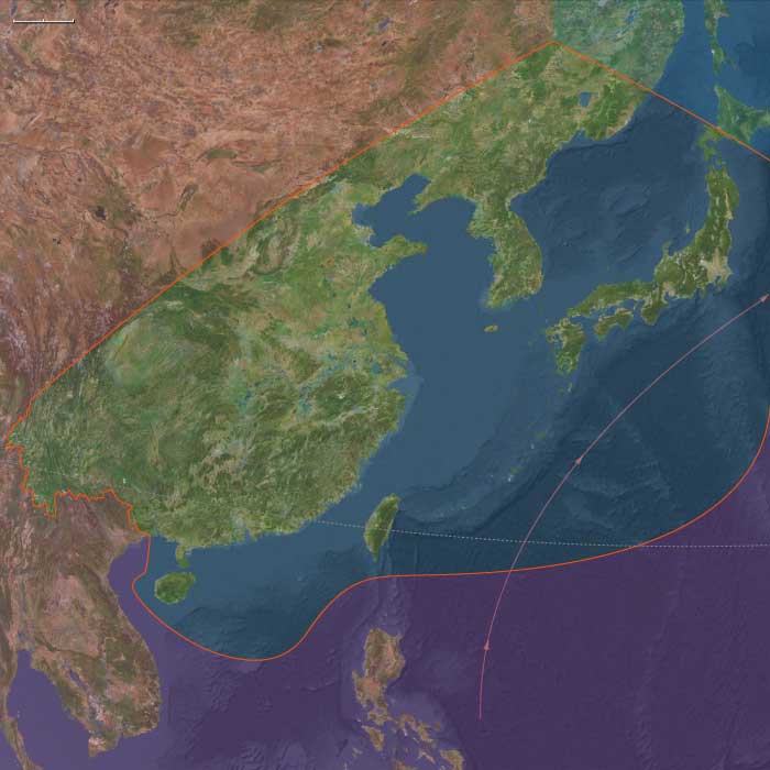
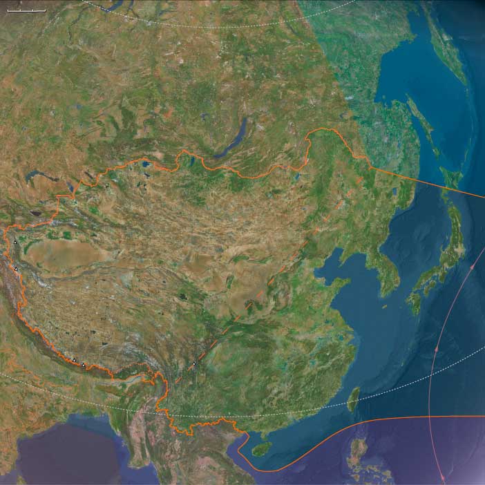
Maritime East Asia
Related Events
Filter results
Showing 10 events out of 2970 total
Homo erectus inhabited what is now China more than a million years ago.
Xiaochangliang, the site of some of the earliest Paleolithic remains in East Asia, located in the Nihewan Basin in Yangyuan County, Hebei, is most famous for the stone tools discovered there, including side and end scrapers, notches, burins, and disc cores.
Although it is generally more difficult to date Asian sites than African sites because Asian sites typically lack volcanic materials that can be dated isotropically, the age of the tools has been magnetostratigraphically dated as 1.36 million years.
This method is more accurate than carbon dating since it uses the data of changes caused by earth's magnetic field.
The archaeological site of Xihoudu in Shanxi Province is the earliest recorded use of fire by Homo erectus, which is dated 1.27 million years ago.
The excavations at Yuanmou and later Lantian show early habitation.
The so-called Peking Man, discovered in 1923-27 at Zhoukoudian, near Beijing, is perhaps the most famous specimen of Homo erectus found in China.
More recently, the finds have been dated from roughly five hundred thousand years ago, although a new 26Al/10Be dating suggests the remains may be as much as six hundred and eighty thousand to seven hundred and eighty thousand years old.
Homo erectus, long settled in sparse communities throughout East Asia, probably becomes extinct in China before 200,000 BCE, evidently replaced by Homo sapiens.
The Moderns are taller, more slender, and less muscular than the Neanderthals, with whom they share—perhaps uneasily—the Earth.
Though their brains are smaller in overall size, they are heavier in the forebrain, a difference that may allow for more abstract thought and the development of complex speech.
Yet, the inner world of the Neanderthals remains a mystery—no one knows the depths of their thoughts or how they truly expressed them.
The descendants of the immigrants to West Asia who had remained in the south (or taken the southern route) had spread generation by generation around the coast of Arabia and the Iranian plateau until they reached India.
One of the groups that had gone north (east Asians were the second group) had ventured inland and radiated to Europe, eventually displacing the Neanderthals.
They had also radiated to India from Central Asia.
The former group headed along the southeast coast of Asia, reaching Australia between fifty-five thousand and thirty thousand years ago, with most estimates placing it about forty-six thousand to forty-one thousand years ago.
Sea level is much lower during this time, and most of Maritime Southeast Asia is one land mass known as the lost continent of Sunda.
The settlers probably continued on the coastal route southeast until they reached the series of straits between Sunda and Sahul, the continental land mass that was made up of present-day Australia and New Guinea.
The widest gaps are on the Weber Line and are at least ninety kilometers wide, indicating that settlers had knowledge of seafaring skills.
Archaic humans such as Homo erectus never reached Australia.
If these dates are correct, Australia was populated up to ten thousand years before Europe.
This is possible because humans avoided the colder regions of the North favoring the warmer tropical regions to which they were adapted given their African homeland.
Another piece of evidence favoring human occupation in Australia is that about forty-six thousand years ago, all large mammals weighing more than one hundred kilograms suddenly became extinct.
The new settlers were likely to be responsible for this extinction.
Many of the animals may have been accustomed to living without predators and become docile and vulnerable to attack (as will occur later in the Americas).
Some settlers cross into Australia, while others may have continued eastwards along the coast of Sunda eventually turning northeast to China and finally reaching Japan, leaving a trail of coastal settlements.
This coastal migration leaves its trail in the mitochondrial haplogroups descended from haplogroup M, and in Y-chromosome haplogroup C.
Thereafter, it may have become necessary to venture inland, possibly bringing modern humans into contact with archaic humans such as H. erectus.
Recent genetic studies suggest that Australia and New Guinea were populated by one single migration from Asia as opposed to several waves.
The land bridge connecting New Guinea and Australia became submerged approximately eight thousand years ago, thus isolating the populations of the two landmasses.
East Asia (49,293 – 28,578 BCE): Upper Pleistocene I — River Plains, Exposed Shelves, and Steppe–Taiga Frontiers
Geographic & Environmental Context
At glacial lowstand (~60–90 m below present), East Asia spanned two interlocking realms that shared people, tools, and seasonal movements:
-
Maritime East Asia: broad exposed shelves along the Yellow Sea, East China Sea, and Taiwan Strait; extended lower courses of the Yangtze, Yellow (Huang He), and Liao formed vast estuarine wetlands far seaward of today’s coasts. Honshu–Shikoku–Kyushu were joined into a single main Japanese island with enlarged lowlands; Taiwan was intermittently land-bridged or separated by narrow straits.
-
Upper East Asia: steppe–taiga mosaics from Mongolia and the Amur–Sungari–Liao basins to Primorye and the Sea of Japan/East Sea rim. Wider coastal plains in Primorye and narrowed straits between Sakhalin–Hokkaidō–the mainland reshaped corridors for game and people.
Together, these lands offered a full spectrum of habitats—river valleys, shelf coasts, temperate forests, taiga, and open steppe—stitched by monsoon rhythms and cold-season winds.
Climate & Environmental Shifts
Glacial climate imposed strong seasonality and pulsed between cooler/drier stadials and warmer/wetter interstadials:
-
Dansgaard–Oeschger warm phases: stronger summer monsoon, broadleaf forest expansion, higher river productivity, and stable estuaries.
-
Heinrich/cold stadials & approach to the LGM: weakened monsoon, steppe and open woodland spread over lowlands; heavier dust flux from inland deserts; longer, colder winters in northern China and Korea.
-
Regional contrast: the Amur basin remained a relatively milder corridor than the Mongolian plateaus; shelf coasts stayed productive even in cool phases.
Subsistence & Settlement
Foragers mastered dual terrestrial–aquatic economies, moving seasonally across coast–river–upland belts:
-
Lowlands & coasts: hunted red deer, sika deer, boar, wild cattle; fished estuaries, tidal flats, and shelf-edge bays; collected shellfish and seaweeds in sheltered embayments.
-
Uplands & interior valleys: pursued sika/red deer, elk/moose, gazelle or wild horse on steppe margins; gathered nuts, fruits, tubers during interstadials.
-
Northern rivers & coasts: targeted anadromous fish (salmon runs) and marine mammals in ice-free seasons.
-
Mobility: regular river-valley⇄upland⇄coastal rounds; winter aggregation near protected river benches or rock shelters; warm-season dispersal to hunt, fish, and collect plant foods.
Technology & Material Culture
Toolkits reflected both cold adaptation and aquatic specialization:
-
Lithics: flake and blade industries across the south; widespread microblade complexes in the north and east for composite weapons suited to mobile hunting. Raw materials ranged from fine chert and quartzite to obsidian in the Russian Far East.
-
Organic tools: bone points, gorges, barbed tips for fish and marine mammals; hide/fiber nets, traps, and probable weirs along major waterways.
-
Processing & craft: grindstones for nuts/seeds, bark- and hide-working; ochre as pigment and adhesive additive; shell and tooth ornaments signaling identity and alliances.
-
Clothing & shelter: tailored furs and layered garments; insulated dwellings and hearths for severe winters.
Movement & Interaction Corridors
-
Shelf-coast routes linked populations along the exposed Yellow/East China Sea margins, easing movement between mainland China, Taiwan, and southern Japan.
-
River corridors—especially the Yangtze and Yellow, and in the north the Amur–Liao—connected interior foragers with estuary fishers and shellfishers, enabling seasonal aggregation and exchange.
-
Strait crossings narrowed between Korea and the Japanese archipelago and between Sakhalin–Hokkaidō–the mainland, allowing occasional maritime passages in favorable windows.
-
Khingan passes and Primorye coast provided east–west and north–south conduits during mild summers.
Cultural & Symbolic Expressions
-
Ornaments: perforated shells and animal teeth, beads, and pendants mark social ties and group identity.
-
Pigment: ochre for body decoration, hide treatment, and ritual.
-
Mark-making: probable early engravings/paint in caves and shelters; structured hearths and curated spaces suggest seasonal aggregation rites tied to monsoon peaks, fish runs, and game migrations.
Environmental Adaptation & Resilience
-
Risk buffering: dual reliance on terrestrial hunting and aquatic foraging mitigated monsoon variability and winter scarcity.
-
Seasonal scheduling: coast/river/upland alternation matched spawning runs, mast pulses, and herd movements.
-
Preservation: drying/smoking of fish and meat, storage of nuts and tubers, and hide processing bridged cold seasons.
-
Habitat flexibility: readiness to pivot between forest refugia, steppe edges, and estuarine flats as climates oscillated.
Toward the Last Glacial Maximum
By 28,578 BCE, East Asian foragers were fully at home in a cold, highly seasonal world—ranging across exposed shelves, great river plains, and steppe–taiga frontiers with microblade weaponry, watercraft-assisted mobility, and wide social networks.
These lifeways—broad-spectrum diets, corridor travel, cold-weather craft, and shared symbolism—formed the durable base from which Early Holocene communities would later develop low-level plant tending (proto-rice in the lower Yangtze, millet in the north) and more permanent coastal settlement as seas rose and forests recovered.