South Polynesia
Related Events
Filter results
Showing 10 events out of 56 total
Australasia (49,293 – 28,578 BCE): Upper Pleistocene I — Continental Shelves, Fire Country, and the Unpeopled Islands of the Far South
Geographic & Environmental Context
During the long glacial prime of the Late Pleistocene, Australasia stretched as a single vast, connected super-land: the Sahul continent, where Australia, New Guinea, and Tasmania were joined by the broad Arafura and Carpentaria shelves, while across the Tasman Sea, the New Zealand–Norfolk–Kermadec arc stood isolated, volcanically active, and entirely uninhabited by humans.
The region’s physiography displayed extremes of exposure and contrast:
-
To the north, tropical savannas and monsoon coasts extended from Kimberley and Arnhem Land through Cape York to the low divide of southern New Guinea, while the Gulf of Carpentaria held a vast inland sea–wetland complex.
-
Across central and southern Australia, vast dune fields, salt lakes, and desert basins alternated with fertile riverine corridors like the Murray–Darling and the Willandra Lakes.
-
In the south, the Bassian Plain connected the mainland to Tasmania, while New Zealand remained beyond human reach—its forests, volcanic zones, and seabird cliffs untouched.
Sea level lay ~100 m below present, enlarging the continental shelves and exposing wide coastal plains, which were colonized by both humans (in Australia) and dense faunal populations.
Climate & Environmental Shifts
-
Early Glacial Phase (~49–35 ka): Gradual cooling, declining precipitation in continental interiors, and expansion of arid belts; forest contraction in the tropics and southeast.
-
Approach to the Last Glacial Maximum (~35–28 ka): Sharper temperature drop, stronger seasonality, and intensified westerlies and trade winds. Northern monsoons weakened, and interior lakes fell or dried episodically.
-
Regional Contrasts:
• Northern Australia remained humid enough for monsoon-driven wet–dry cycles, sustaining aquatic ecosystems along rivers and coasts.
• Southern Australia and Tasmania cooled markedly, with snowfall on upland ranges and alpine conditions in the Great Dividing Range and Tasmanian highlands.
• New Zealand entered full glaciation: the Southern Alps carried expanded glaciers, and snowlines dropped by hundreds of meters.
The climate oscillated between long cold stasis and short, mild interstadials—conditions that defined both human adaptive strategies and the evolutionary dynamics of uninhabited island ecologies.
Human Presence and Lifeways
Human societies were firmly established across the Australian continent and the connected Sahul landmass, but absent east of the Tasman frontier.
Northern Australasia (Sahul Tropics)
-
Occupation and Range:
Continuous habitation in Arnhem Land, the Kimberley, Cape York, and the Gulf lowlands; movement extended across the Arafura Plain into southern New Guinea. -
Economy:
Broad-spectrum foraging—fish, shellfish, turtles, dugong, and small terrestrial game. During glacial lowstands, coastal groups ranged across the now-submerged shelf flats, exploiting estuaries and reefs. -
Technology:
Sophisticated flake–blade industries, hafted points, resin adhesives, and early ground ochre use; fiber and wooden implements (spears, nets, traps) widely employed. -
Symbolism:
Earliest rock art phases—engraving and pigment painting—appeared in the Kimberley and Arnhem Land, along with structured burials and cremations. -
Resilience:
Estate-based mobility tracked monsoon pulses; access to the flooded Carpentaria lowland and inland freshwater refugia buffered against droughts.
Southern Australasia (Southern Australia, Tasmania, South Island New Zealand)
-
Australia:
Long-settled communities adapted to harsh continental variability. Along the Willandra Lakes and Murray–Darling Basin, people fished, hunted marsupials, collected seeds and tubers, and practiced ceremonial cremation and burial rites (Mungo).
On the expanded southern shelf coasts, foragers harvested shellfish, seals, pinnipeds, and stranded whales, while inland hunters pursued kangaroos, emus, and small marsupials.
The use of fire to manage vegetation—so-called fire-stick farming—maintained open grasslands and supported reliable game. -
Tasmania (then mainland-connected):
Populations ranged across the Bassian Plain, exploiting riverine corridors and coastal flats for waterfowl and fish; early cold-adapted hearth traditions emerged. -
New Zealand and sub-Antarctic arcs:
Entirely uninhabited, though South Island glaciers carved fjords and plains later to support Holocene ecosystems.
Unpeopled Frontiers: South Polynesia and Oceanic Arcs
East of Sahul, the South Polynesian sector (New Zealand, Norfolk, Kermadec, Chatham Islands) remained a wilderness of volcanic highlands, periglacial coasts, and seabird colonies.
The Oruanui eruption (c. 25.5 ka BP) from the Taupō caldera in New Zealand blanketed the North Island and offshore ridges with tephra, reshaping soils, lakes, and drainage systems.
Forests shifted between podocarp–broadleaf canopies and scrub–grassland mosaics; moa and Haast’s eagle dominated terrestrial food webs, while offshore seabird realms thrived on predator-free islets.
Technology & Material Culture
Across Sahul, technology mirrored a mature foraging economy:
-
Stone: flake–blade cores, backed microliths, and grindstones; heat treatment and resin hafting.
-
Organic: spears, clubs, nets, and wooden shields; fiber technology for carrying and trapping.
-
Pigment and ornament: widespread ochre use for painting, body decoration, and burial; shell and tooth ornaments signal social identity.
-
Fire technology: mastery of landscape burning as a central environmental tool.
Movement & Interaction Corridors
-
Land and River Networks: the Murray–Darling, Willandra, and Lake Eyre basins functioned as arteries linking interior and coast.
-
Shelf and Coast Routes: mobile bands traversed the exposed Sahul shelves, harvesting estuarine resources and migrating seasonally.
-
Northern Gateways: travel between northern Australia and southern New Guinea maintained genetic and cultural interchange across the connected shelf.
-
Southern Pathways: the Bassian Plain allowed movement between mainland and Tasmania until postglacial flooding severed the link.
Cultural & Symbolic Expressions
-
Ritual landscapes: rock shelters and burial grounds (e.g., Willandra) reveal early ceremonial organization.
-
Artistic innovation: hand stencils, engraved motifs, and ochre figurative painting predate 30 ka in northern Australia.
-
Fire and mythic space: controlled burning likely embedded in cosmological understanding of land stewardship.
Environmental Adaptation & Resilience
Australasia’s Pleistocene societies mastered the ecology of variability:
-
Mobility with continuity: shifting among waterholes, estuaries, and resource belts on seasonal rhythms.
-
Storage through knowledge: environmental mapping replaced physical storage—knowing when and where resources renewed was key.
-
Fire as technology: selective burning maintained mosaics that sustained wildlife and plant yields.
-
Refugia strategies: wetlands and monsoon belts offered fallback zones through glacial droughts.
The unpeopled islands to the east, by contrast, evolved ecological self-sufficiency—volcanic fertility, avian abundance, and intact forests awaiting future colonists.
Transition Toward the Next Epoch
By 28,578 BCE, the Australasian world stood poised at the threshold of deglaciation:
-
Sea-level minima connected lands and compressed ecologies into wide continental shelves.
-
Human societies in Sahul had adapted to every climate zone, from arid interior to reef coast, with rich symbolic traditions already in place.
-
Islands beyond the Sahul frontier—New Zealand, Norfolk, Chatham, Kermadec—remained avian kingdoms without humans.
As ice sheets began their slow retreat, the landscapes and coastlines that would shape the Holocene—estuaries, islands, and archipelagos—were already being prepared by the patient interplay of fire, flood, and time.
Australasia (28,577 – 7,822 BCE): Late Pleistocene–Early Holocene — From Glacial Plains to Island Worlds
Geographic & Environmental Context
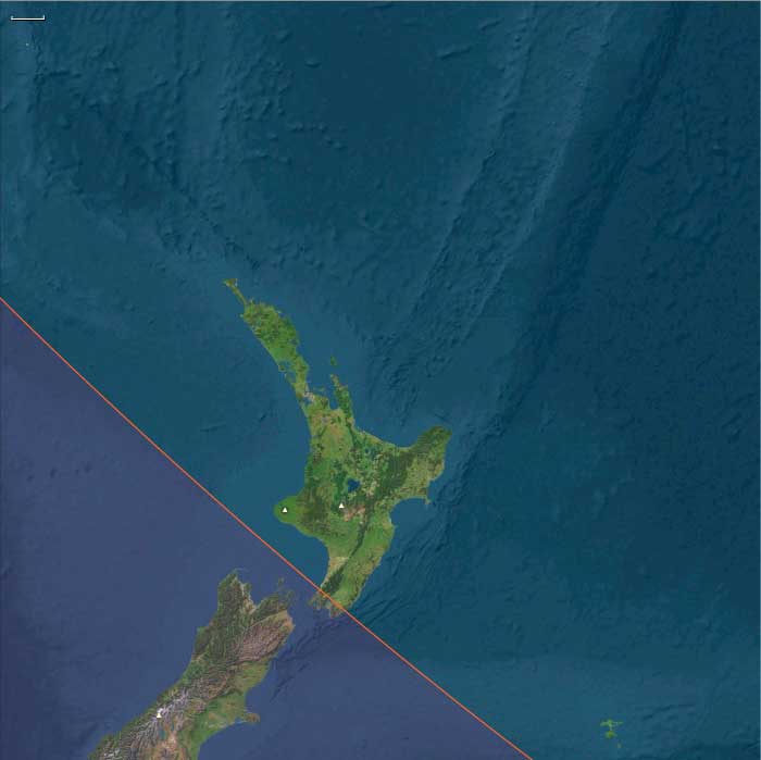
During the Late Pleistocene and early Holocene, Australasia—comprising the continental landmass of Sahul (Australia–New Guinea–Tasmania) and the surrounding islands of South Polynesia (Aotearoa North Island, the Chathams / Rēkohu, Norfolk, and the Kermadecs)—was a realm of sweeping change.
At the Last Glacial Maximum (c. 26,500 – 19,000 BCE), sea levels lay more than 100 m below present. Vast plains joined New Guinea to northern Australia across the Arafura and Carpentaria Seas, and Tasmania to the mainland via the Bassian Plain. As ice retreated, these land bridges drowned; coastlines advanced hundreds of kilometres inland; lagoons, gulfs, and barrier systems took their modern form.
By 7,800 BCE, Australia, Tasmania, and New Zealand had assumed their familiar outlines, while South Polynesia remained unpeopled but ecologically transformed by rising seas and forest renewal.
Climate & Environmental Shifts
The period opened with cold, dry glacial climates and closed in a warm, moist Holocene optimum:
-
Last Glacial Maximum: steppe and open woodland replaced most southern forests; glaciers advanced in the Southern Alps of New Zealand and the Tasmanian highlands; monsoons weakened across northern Australia.
-
Bølling–Allerød Interstadial (c. 14,700–12,900 BCE): abrupt warming strengthened rainfall; mangroves and freshwater wetlands spread along northern coasts; temperate forests began to return.
-
Younger Dryas (12,900–11,700 BCE): short-lived cooling and aridity contracted forests once more, forcing people and wildlife toward permanent water sources.
-
Early Holocene (after 11,700 BCE): temperatures rose rapidly; full-strength monsoons and westerlies re-established; rivers and lakes reached high stands; vegetation zones stabilized in patterns still recognizable today.
Subsistence & Settlement
Across Sahul, Aboriginal Australians maintained traditions of mobility and ecological engineering that stretched back tens of millennia, while the islands of South Polynesia remained uninhabited yet ecologically dynamic.
-
Northern Australia: monsoon cycles structured life. Wet-season dispersal exploited fish, turtles, waterfowl, and plant foods in flooded plains; dry-season concentration along coasts and permanent billabongs ensured continuity. Dugong, shellfish, and estuarine fish provided marine staples; yams, pandanus, and nuts formed key plant foods.
-
Southern Australia & Tasmania: people ranged between inland plains and coasts, taking kangaroos, wallabies, emus, seals, shellfish, and estuarine fish. In winter, Tasmanians depended heavily on marine mammals and shellfish when plant foods were scarce.
-
South Polynesia (Aotearoa North Island / Chathams / Norfolk / Kermadecs): still without humans, forests of podocarp–kauri–beech recolonized valleys and slopes; wetlands developed behind new barrier systems; seabird colonies fertilized emerging dunes and rocky headlands.
Settlement systems in Sahul were seasonally mobile but geographically stable—the same river bends, dune ridges, and coastal coves revisited across generations.
Technology & Material Culture
Toolkits throughout Australasia reflected continuity and regional innovation:
-
Ground-edge axes, adzes, and microlithic inserts formed multipurpose tool systems for woodworking and hunting.
-
Grinding stones processed seeds and tubers; nets, traps, and fish spears targeted aquatic resources.
-
Bark canoes and rafts enabled near-shore travel and river crossings.
-
Ochre served in art, ceremony, and body decoration.
In unpeopled South Polynesia, volcanic processes and sea-level change remained the sole “technologies,” carving gulfs, reefs, and estuaries that would one day host Polynesian settlements.
Movement & Interaction Corridors
Mobility was both ecological and social:
-
In Sahul, the Murray–Darling, Fitzroy, Victoria, and Daly rivers acted as conduits linking inland hunting grounds with coastal and estuarine fisheries.
-
During lowered sea level, the Arafura Plain connected northern Australia to New Guinea, supporting cultural and genetic exchange.
-
With post-glacial flooding, canoe and raft routes replaced terrestrial corridors, knitting new coasts into maritime landscapes.
-
In the south, the Bassian Plain allowed interchange between mainland and Tasmania until its final submergence around 11,000 BCE.
-
South Polynesia’s Kermadec–Norfolk–Chatham chain, though unpeopled, formed emerging ecological stepping-stones across the southwest Pacific.
Cultural & Symbolic Expressions
Late-Pleistocene peoples of Sahul articulated deep symbolic landscapes:
-
Rock art flourished from the Kimberley to Tasmania, depicting animals, human figures, geometric motifs, and ancestral beings—the Dreaming etched in pigment.
-
Ceremonial gatherings marked resource peaks such as fish migrations or plant harvests, renewing kin alliances and ecological law.
-
Fire-stick farming and ritual burning were not merely utilitarian but cosmological acts that maintained balance between people, plants, and animals.
In contrast, the islands of South Polynesia were silent sanctuaries of natural succession, untouched by human story yet already inscribing their own ecological mythos in reef, forest, and wind.
Environmental Adaptation & Resilience
Resilience derived from mobility, ecological mapping, and knowledge transmission:
-
Controlled fire maintained open hunting grounds and promoted edible plant regrowth.
-
Seasonal calendars tied to rainfall, flowering, and animal movement guided travel and harvest.
-
Dietary diversity—from marine to inland plant resources—buffered climatic stress.
-
In the unpeopled islands to the east, fog interception, seabird fertilization, and forest regeneration created self-sustaining ecosystems that paralleled human adaptive strategies elsewhere.
Long-Term Significance
By 7,822 BCE, Australasia had entered the Holocene as a transformed but continuous world:
-
Northern Australia enjoyed full monsoonal vigor and thriving estuaries;
-
Southern Australia and Tasmania adapted seamlessly to post-glacial coasts;
-
Sahul’s unity dissolved as rising seas isolated New Guinea and Tasmania, inaugurating new regional cultures;
-
South Polynesia, still without people, stood ecologically ready—its forests, wetlands, and lagoons stabilized in the forms that would greet the first Polynesian navigators tens of millennia later.
This epoch fixed the environmental foundations of the southern hemisphere’s enduring societies and landscapes—ancient continuity beneath a changing sea.
South Polynesia (28,577 – 7,822 BCE): Upper Pleistocene II — Deglaciation, Shelf Drowning, and Forest Recovery (No Human Presence)
Geographic & Environmental Context
South Polynesia includes New Zealand’s North Island (Aotearoa; excluding its southern coast), the Chatham Islands (Rēkohu), Norfolk Island, and the Kermadec Islands (Raoul and associated islets).
-
Anchors: Bay of Plenty embayments; Hauraki Gulf; Waikato–Taupō catchments; Raoul (Kermadec) and Norfolk uplifted margins; Chatham shelf.
Climate & Environmental Shifts
-
Deglaciation raised sea level, drowning paleo-shores and forming modern gulfs, estuaries, and sandy barrier systems.
-
Bølling–Allerød warming expanded forests; Younger Dryas snapback briefly cooled/dried; Early Holocene warmth stabilized.
Biota & Baseline Ecology
-
Podocarp–kauri and beech forests re-occupied slopes; wetlands expanded behind beach ridges.
-
Seabird nutrients (guano) fertilized dune/strand forests on Kermadec, Norfolk, Chatham; rocky reefs matured.
Long-Term Significance
Rising seas created productive estuaries and lagoons (future mātaitai food basins) and reset coastal landings that later became canoe beach-heads.
The Last Glacial Maximum (LGM) refers to the time of maximum extent of the ice sheets during the last glacial period, between twenty-six thousand five hundred and nineteen thousand to twenty thousand years ago.
The Younger Dryas will follow the Last Glacial Maximum.
Ice sheets cover the whole of Iceland and all but the southern extremity of the British Isles.
This ice extends northward to cover Svalbard and Franz Josef Land and eastward to occupy the northern half of the West Siberian Plain, ending at the Taymyr Peninsula, and damming the Ob and Yenisei rivers forming a West Siberian Glacial Lake.
Northern Europe is largely covered, the southern boundary passing through Germany and Poland, but not quite joined to the British ice sheet.
Permafrost covers Europe south of the ice sheet down to present-day Szeged and Asia down to Beijing.
The ice covers essentially all of Canada and extends roughly to the Missouri and Ohio Rivers, and eastward to New York City.
Alpine glaciers advance in addition to the large Cordilleran Ice Sheet in Canada and Montana, covering much of the Rocky Mountains in the United States.