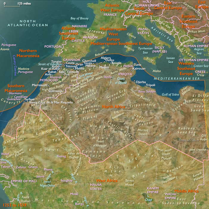
West Africa (1540–1683 CE): Gold, Slavery, and the Rising Atlantic World
Geographic & Environmental Context
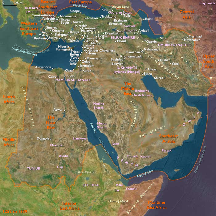
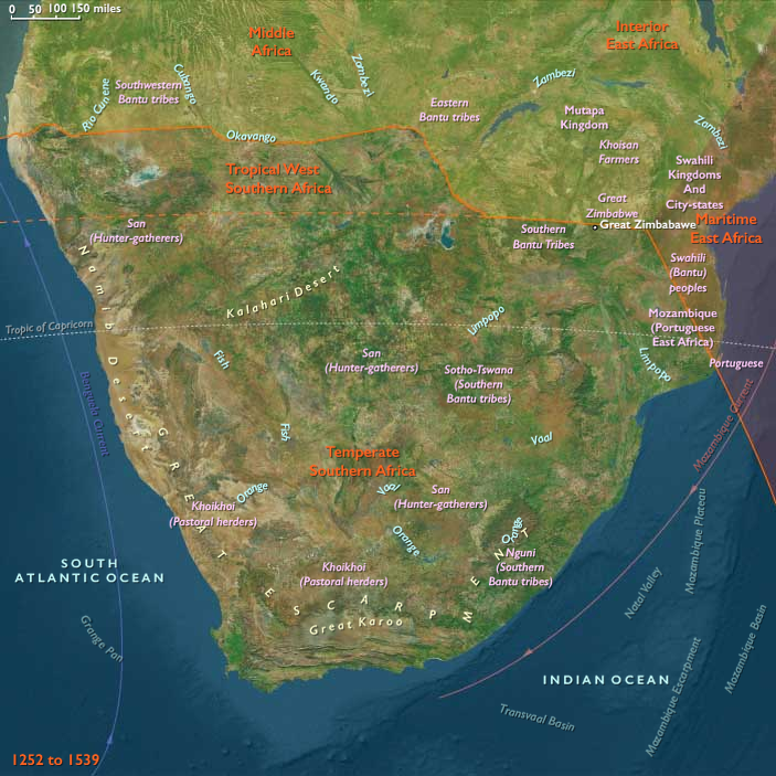
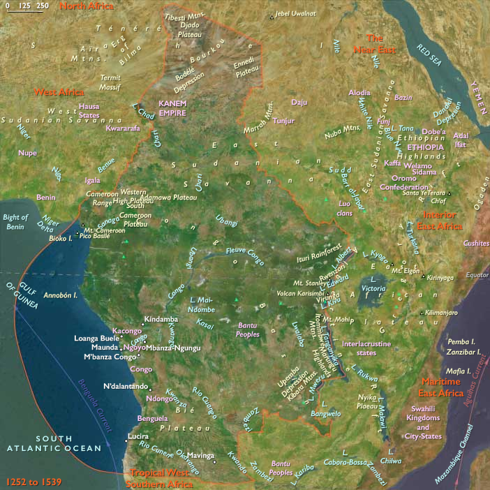
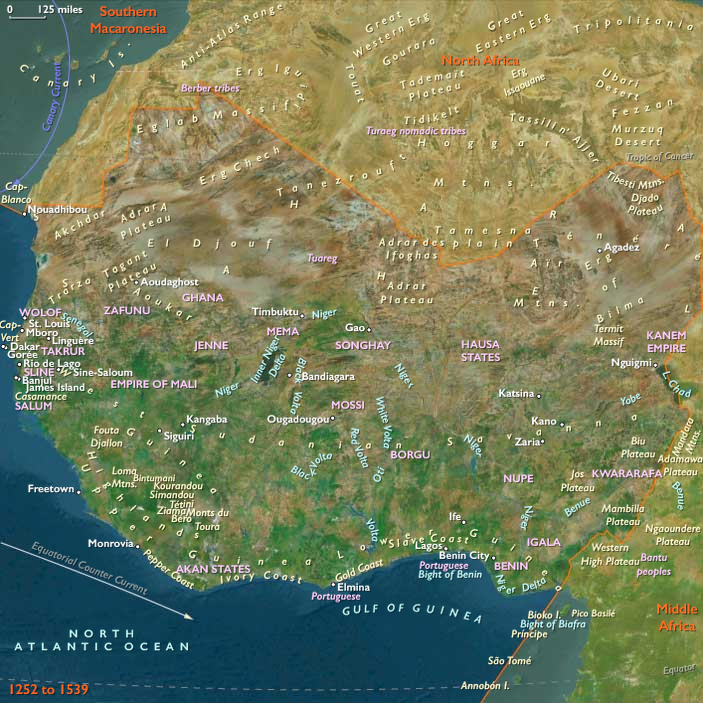
The subregion of West Africa includes the Sahelian and savanna zones stretching from the Senegal and Niger River basins across modern Mali, Burkina Faso, and Niger, as well as the forest and coastal belts of Guinea, Sierra Leone, Liberia, Côte d’Ivoire, Ghana, Togo, Benin, and Nigeria. Anchors included the Niger River’s inland delta, the savanna–forest transition zones, the Guinea coast lagoons, and the Atlantic seaboard from Senegambia to the Bight of Benin. This was a world of caravan roads, goldfields, forest polities, and increasingly, European coastal forts.
Climate & Environmental Shifts
The Little Ice Age brought variability: Sahelian droughts tightened pasture and farming margins, leading to migrations of herders and farmers. Rainfall in forest zones remained more stable, supporting yam, oil palm, and kola production. Along the coast, seasonal monsoons shaped agricultural calendars and maritime trade, while estuaries and lagoons sheltered fleets of canoes.
Subsistence & Settlement
-
Sahel and savanna: Millet, sorghum, and rice farming sustained large populations. Cattle herding remained vital to Fulani and other pastoralists.
-
Forest belt: Yams, plantains, oil palm, and kola nuts supported dense farming villages. Fishing and salt collection flourished in lagoons and mangroves.
-
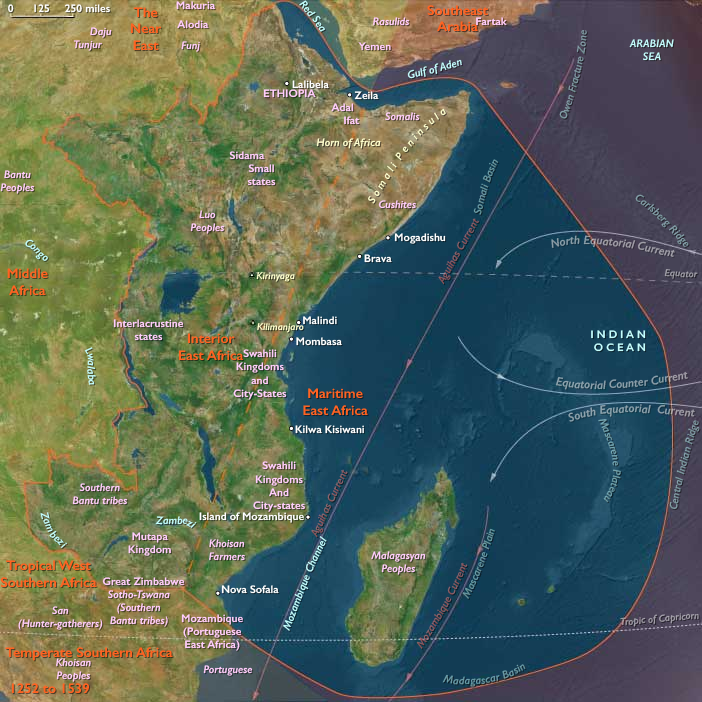
Urban centers: Timbuktu, Gao, and Jenne thrived as commercial and intellectual hubs. Coastal towns from Elmina to Lagos grew around markets and forts.
Technology & Material Culture
Iron smelting continued to produce tools and weapons. Mud-brick mosques, fortified palaces, and walled towns reflected Islamic and local traditions. Coastal states commissioned brass, ivory, and gold works—exemplified by the Benin bronzes. Manuscript culture flourished in Timbuktu, with Arabic scholarship in law, theology, and science. Europeans introduced firearms, textiles, and new shipborne technologies, altering trade balances and warfare.
Movement & Interaction Corridors
-
Trans-Saharan caravans: Still carried gold, kola, and slaves northward, though now rivaled by Atlantic trade.
-
Niger River: Remained a great artery of commerce, ferrying grain, salt, and scholars between Sahelian cities.
-
Atlantic coast: Portuguese, Dutch, English, and French traders established forts at Elmina (Portuguese, 1482; Dutch, 1637), Ouidah, and other sites. Slaves, gold, and ivory flowed outward; firearms and cloth flowed inward.
-
Internal slave routes: Raids and wars supplied captives to coastal markets, reshaping inland societies.
Cultural & Symbolic Expressions
Islam remained dominant in Sahelian cities, expressed in mosques, Qur’anic schools, and Sufi brotherhoods. In the forest belt, indigenous religions emphasized ancestor veneration, sacred groves, and ritual kingship. Oral traditions and griots preserved genealogies and epic histories. Court art in Benin and Oyo projected power with bronzes, ivories, and regalia. Music and drumming structured rituals of kingship and community life.
Environmental Adaptation & Resilience
Communities responded to drought with migration, crop diversification, and riverine farming. Trade networks redistributed surpluses during shortages. Palm oil and kola supported resilience in forest zones. Along the coast, fishing, salt, and coastal trade cushioned against inland famine. Sufi networks and communal rituals reinforced solidarity in times of stress.
Transition
By 1683 CE, West Africa had entered a new global order. The Songhai Empire had collapsed after the Moroccan invasion of 1591, fragmenting Sahelian power. Coastal states like Benin, Oyo, and Asante rose to prominence, enriched by Atlantic commerce. European forts dotted the seaboard, embedding Africa into the triangular trade system. West Africa remained vibrant and resilient, but its future was increasingly bound to the transatlantic slave trade.