Filters:
Jean-Baptiste Charle Bouvet de Lozier
French sailor, explorer, and governor of the Mascarene Islands
Years: 1705 - 1786
Jean Baptiste Charles Bouvet de Lozier (January 14, 1705 – 1786) is a French sailor, explorer, and governor of the Mascarene Islands.
Related Events
Filter results
Showing 10 events out of 12 total
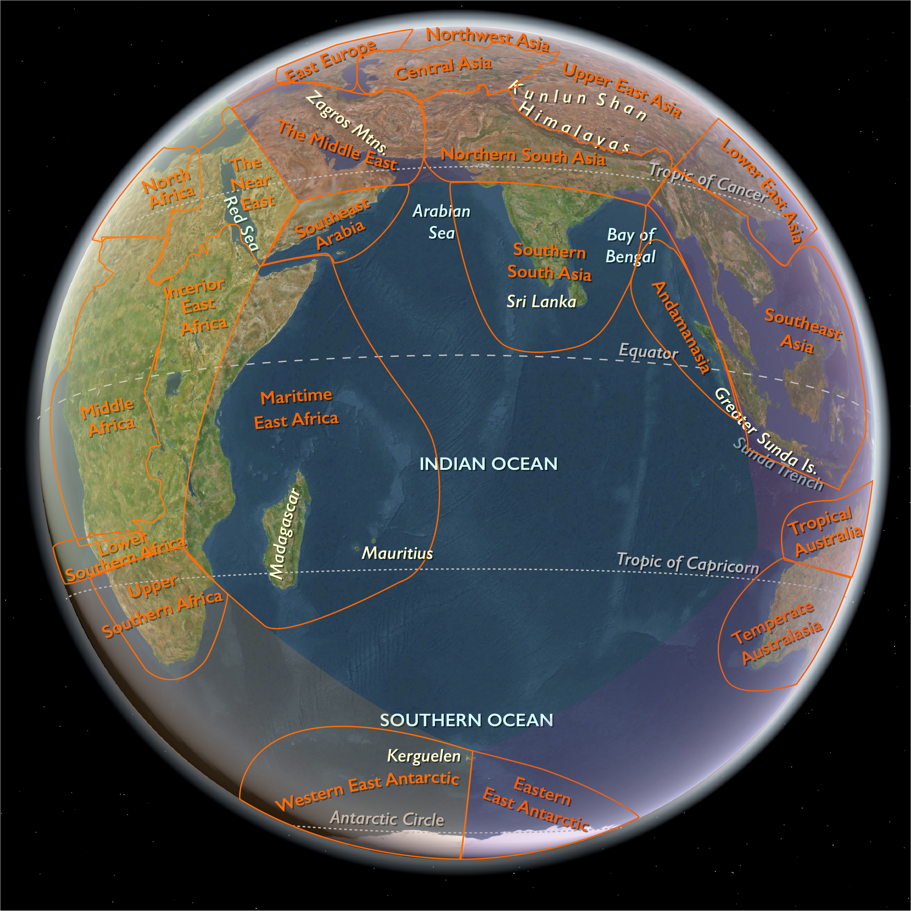
Cook's ships had left the Cape on November 22, 1772 and headed for the area of the South Atlantic where the French navigator Bouvet claimed to have spotted land that he named Cape Circumcision.
Shortly after leaving they experienced severe cold weather and early on November 23, 1772, the crew were issued with fearnaught jackets and trousers at the expense of the government.
By early December they were sailing in thick fog and seeing 'ice islands'.
Cook had not found the tiny island that Bouvet had discovered in 1739 and claimed to be in latitude 54°.
Pack ice soon surrounds the ships but in the second week in January, in the southern mid-summer, the weather abates and Cook is able to take the ships southwards through the ice to reach the Antarctic Circle on January 17.
The next day, being severely impeded by the ice, they change course and head away to the north-east.
View Event
Shortly after leaving they experienced severe cold weather and early on November 23, 1772, the crew were issued with fearnaught jackets and trousers at the expense of the government.
By early December they were sailing in thick fog and seeing 'ice islands'.
Cook had not found the tiny island that Bouvet had discovered in 1739 and claimed to be in latitude 54°.
Pack ice soon surrounds the ships but in the second week in January, in the southern mid-summer, the weather abates and Cook is able to take the ships southwards through the ice to reach the Antarctic Circle on January 17.
The next day, being severely impeded by the ice, they change course and head away to the north-east.
Cook's expedition circumnavigates the globe at an extreme southern latitude, becoming one of the first to cross the Antarctic Circle (January 17, 1773).
Resolution and Adventure become separated in the Antarctic fog on February 8.
Furneaux directs Adventure towards the prearranged meeting point of Queen Charlotte Sound (New Zealand), charted by Cook in 1770.
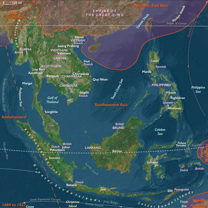
On the way to the rendezvous, Adventure surveys the southern and eastern coasts of Tasmania (then known as "Van Diemen's Land"), where Adventure Bay is named for the ship.
Furneaux makes the earliest British chart of this shore, but as he does not enter Bass Strait, he assumes Tasmania to be part of Australia.
View Event
Resolution and Adventure become separated in the Antarctic fog on February 8.
Furneaux directs Adventure towards the prearranged meeting point of Queen Charlotte Sound (New Zealand), charted by Cook in 1770.
On the way to the rendezvous, Adventure surveys the southern and eastern coasts of Tasmania (then known as "Van Diemen's Land"), where Adventure Bay is named for the ship.
Furneaux makes the earliest British chart of this shore, but as he does not enter Bass Strait, he assumes Tasmania to be part of Australia.
Adventure arrives at Queen Charlotte Sound on May 7, 1773.
Cook continues his explorations south-eastwards, reaching 61°21′s on February 24; then, in mid-March he decides to head for Dusky Bay (now Dusky Sound) in the South Island of New Zealand where the ship rests until 30 April.
The Resolution reaches the rendezvous at Queen Charlotte Sound on May 17.
View Event
Cook continues his explorations south-eastwards, reaching 61°21′s on February 24; then, in mid-March he decides to head for Dusky Bay (now Dusky Sound) in the South Island of New Zealand where the ship rests until 30 April.
The Resolution reaches the rendezvous at Queen Charlotte Sound on May 17.
Cook had almost encountered the mainland of Antarctica, but had turned towards Tahiti to resupply his ship.
The two ships of the second Cook expedition explore the southern Pacific.
Cook becomes the first European to sight Tekokota, one of the Tuamotu atolls, which he names as "Doubtful Island", on August 11.
The following day, Cook arrives at the uninhabited atoll Marutea Nord, which he names as "Furneaux Island".
The expedition reaches Tahiti on August 15, 1773.
Cook now resumes his southward course in a second fruitless attempt to find the supposed continent.
At their next stop, Mai of Ra'iatea, who had met Samuel Wallis in 1767 and James Cook in 1769 in Tahiti, embarks from Huahine on Adventure, commanded by Tobias Furneaux.
He proves to be somewhat less knowledgeable about the Pacific than Tupaia had been on the first voyage.
Mistakenly known as Omai in Britain, Mai will become the second Pacific Islander to visit Europe before returning to Tahiti with Cook in 1776.
View Event
The two ships of the second Cook expedition explore the southern Pacific.
Cook becomes the first European to sight Tekokota, one of the Tuamotu atolls, which he names as "Doubtful Island", on August 11.
The following day, Cook arrives at the uninhabited atoll Marutea Nord, which he names as "Furneaux Island".
The expedition reaches Tahiti on August 15, 1773.
Cook now resumes his southward course in a second fruitless attempt to find the supposed continent.
At their next stop, Mai of Ra'iatea, who had met Samuel Wallis in 1767 and James Cook in 1769 in Tahiti, embarks from Huahine on Adventure, commanded by Tobias Furneaux.
He proves to be somewhat less knowledgeable about the Pacific than Tupaia had been on the first voyage.
Mistakenly known as Omai in Britain, Mai will become the second Pacific Islander to visit Europe before returning to Tahiti with Cook in 1776.
Tonga becomes known in the West as the Friendly Islands because of the congenial reception accorded to Captain James Cook on his first visit in 1773.
He arrives at the time of the ʻinasi festival, the yearly donation of the First Fruits to the Tuʻi Tonga (the islands' paramount chief) and so receives an invitation to the festivities.
According to the writer William Mariner, an Englishman who will live in Tonga from late 1806 to late 1810, the chiefs wanted to kill Cook during the gathering but could not agree on a plan.
The two ships return to New Zealand after calling at Tonga in the Friendly Islands, but are separated by a storm on October 22.
This time the rendezvous at Queen Charlotte Sound is missed—Resolution departs on November 26, four days before Adventure arrives.
Cook leaves a message buried in the sand setting out his plan to explore the South Pacific and return to New Zealand.
Furneaux decides to return home and buries a reply to that effect.
View Event
This time the rendezvous at Queen Charlotte Sound is missed—Resolution departs on November 26, four days before Adventure arrives.
Cook leaves a message buried in the sand setting out his plan to explore the South Pacific and return to New Zealand.
Furneaux decides to return home and buries a reply to that effect.
Tobias Furneaux loses some of his men in New Zealand during an encounter with Maori, and eventually sails back to Britain, setting out for home on December 22, 1773, via Cape Horn; he will arrive in England on July 14, 1774.
View Event
James Cook has continued to explore the Antarctic, heading south into the summer sea ice, icebergs and fog until he reached 67°31′ South before hauling north again for fourteen hundred miles (twenty-two hundred kilometers).
The third crossing of the Antarctic Circle, on January 26, 1774, is the precursor to the most southerly penetration, reaching latitude 71°10′ South at longitude 106°54′ West on January 30 when they can go no further because of the solid sea ice.
On this occasion, Cook writes:
I who had ambition not only to go farther than anyone had been before, but as far as it was possible for man to go, was not sorry in meeting with this interruption...
The vessel is then launched north to complete a huge parabola in the Pacific Ocean, reaching latitudes just below the Equator, then New Guinea.
He will land at the Friendly Islands, Easter Island, Norfolk Island, New Caledonia, and Vanuatu before returning to Queen Charlotte Sound in New Zealand.
View Event
The third crossing of the Antarctic Circle, on January 26, 1774, is the precursor to the most southerly penetration, reaching latitude 71°10′ South at longitude 106°54′ West on January 30 when they can go no further because of the solid sea ice.
On this occasion, Cook writes:
I who had ambition not only to go farther than anyone had been before, but as far as it was possible for man to go, was not sorry in meeting with this interruption...
The vessel is then launched north to complete a huge parabola in the Pacific Ocean, reaching latitudes just below the Equator, then New Guinea.
He will land at the Friendly Islands, Easter Island, Norfolk Island, New Caledonia, and Vanuatu before returning to Queen Charlotte Sound in New Zealand.
The Cook expedition sails east over the Pacific and sights the western end of the Strait of Magellan on December 17.
They spend Christmas in a bay they name Christmas Sound on the western side of Tierra del Fuego.
View Event
They spend Christmas in a bay they name Christmas Sound on the western side of Tierra del Fuego.
Cook, in a last vain attempt to find Bouvet Island, also discovers and names Clerke Rocks and the southern eight islands of the Sandwich Islands Group in 1775, although he lumps the southernmost three together, and their status as separate islands will not be established until 1820 by Fabian Gottlieb von Bellingshausen.
Here Cook correctly predicts that:
...there is a tract of land near the Pole, which is the Source of most of the ice which is spread over this vast Southern Ocean
The northern three islands will be discovered by Bellingshausen in 1819.
The islands are tentatively named "Sandwich Land" by Cook, although he also comments that they might be a group of islands rather than a single body of land.
The name is chosen in honor of John Montagu, 4th Earl of Sandwich, First Lord of the Admiralty.
The word "South" will later be added to distinguish them from the "Sandwich Islands", now known as the Hawaiian Islands.
He now turns north to South Africa.
View Event
Here Cook correctly predicts that:
...there is a tract of land near the Pole, which is the Source of most of the ice which is spread over this vast Southern Ocean
The northern three islands will be discovered by Bellingshausen in 1819.
The islands are tentatively named "Sandwich Land" by Cook, although he also comments that they might be a group of islands rather than a single body of land.
The name is chosen in honor of John Montagu, 4th Earl of Sandwich, First Lord of the Admiralty.
The word "South" will later be added to distinguish them from the "Sandwich Islands", now known as the Hawaiian Islands.
He now turns north to South Africa.
Loading...