South Atlantic (28,577 – 6,094 BCE): Late …
Years: 28577BCE - 7822BCE
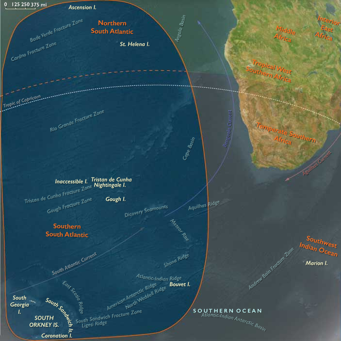
South Atlantic (28,577 – 6,094 BCE): Late Pleistocene → Early Holocene — Deglaciation, Gyre Highways, and Rising Island Ecosystems
Geographic & Oceanographic Frame
Spanning from the sub-Antarctic rim to the mid-latitude gyre, the South Atlantic comprised two linked but contrasting belts:
-
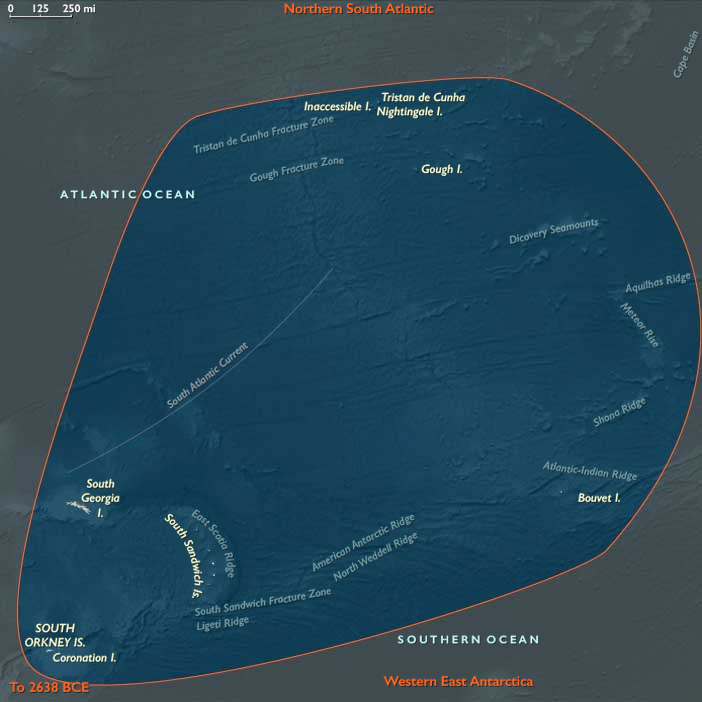
Southern South Atlantic (sub-Antarctic arc): the Tristan–Gough chain, ice-draped Bouvet, glacier-bound South Georgia and the South Sandwich arc, and the South Orkney Islands—volcanic and periglacial outposts embedded in the Antarctic Circumpolar Current (ACC) and swept by the westerlies.
-
Northern South Atlantic (gyre core and western ridge): the Ascension–St Helena segment of the Mid-Atlantic Ridge and Brazil’s offshore line of Fernando de Noronha, Rocas Atoll, São Pedro & São Paulo, and Trindade–Martim Vaz—arid, oceanic islands fringed (in places) by reefs and ring atolls, set within the South Equatorial Current and the subtropical gyre.
No permanent human presence touched either belt during this epoch; the region’s story is one of ice, wind, and water reorganizing life at planetary scale.
Climate Pulses & Sea-Level Change
The interval bridges the Last Glacial Maximum (LGM, ~26.5–19 ka) and the onset of the Holocene:
-
LGM: Global sea level stood ≈120 m lower, exposing broad coastal benches; sea ice spread far north; South Georgia and the South Orkneys lay under expanded ice caps reaching tidewater; Bouvet remained largely glaciated. Strengthened trades intensified Benguela upwelling off southwest Africa; cool, oligotrophic conditions dominated the gyre. Coral accretion at warm-water outposts (e.g., Rocas, Noronha) stalled.
-
Bølling–Allerød (~14.7–12.9 ka): Rapid warming and freshening seas shifted fronts poleward; ACC vigor persisted. Glaciers on South Georgia and the Orkneys began to retreat, unveiling new headlands and proglacial lakes. In the north, SSTs rose, trades relaxed, and reef frameworks re-animated in west-basin islands; seasonal productivity spikes intensified along gyre fronts and island wakes.
-
Younger Dryas (~12.9–11.7 ka): A brief cool relapse nudged productivity back toward wind-driven margins; reef growth slowed but persisted in sheltered lagoons; sub-Antarctic snowfall ticked up and outlet glaciers pulsed.
-
Early Holocene (post-11.7 ka): Sea level climbed by tens of meters toward modern stands, drowning LGM terraces and fixing contemporary shorelines. Sub-Antarctic climates stabilized—cold, windy, moist—with peat initiation in leeward basins on Kerguelen-like platforms mirrored at South Georgia and parts of the Orkneys. In the north, warm, stratified SSTs expanded reef habitat (notably at Rocas, the South Atlantic’s classic atoll) and widened turtle-nesting beaches on new sand cays.
Ecosystem Assembly & Expansion (No Human Presence)
With ice in retreat and coastlines reworked, life spread rapidly:
-
Sub-Antarctic belt: Tussock grasses, mosses, lichens, and cushion plants colonized freshly deglaciated slopes and moraines; peat began to accumulate in saturated hollows. Penguin (king, macaroni, gentoo) rookeries multiplied on new shingle terraces; albatross and petrel colonies rimmed cliffs; fur and elephant seals reoccupied emerging beaches. Offshore, the ACC’s krill-rich conveyor fueled surging baleen whale populations and dense pelagic food webs.
-
Gyre islands: On Ascension and St Helena, basaltic cones with scant freshwater supported sparse xeric flora; island-wake eddies (“island mass effect”) concentrated plankton and small pelagics, drawing boobies, terns, and tuna. Along Brazil’s offshore arc, Rocas’ ring-reef lagoons flourished as coral accretion resumed; Noronha and Trindade hosted mixed rocky reefs and pocket corals, while São Pedro & São Paulo sustained remarkable seabird and fish aggregations. Green and hawksbill turtles nested on expanding beaches; pelagic predatorscruised gyre fronts.
Movement & Interaction Corridors
Oceanic and atmospheric circulation knit the belts into one system:
-
The ACC and westerlies linked Tristan–Gough–Bouvet–South Georgia–Orkneys, transporting nutrients, ice, and biota around the hemisphere.
-
The South Equatorial Current and subtropical gyre connected Noronha–Rocas–Trindade–St Helena–Ascension, while Benguela upwelling along Africa’s margin and island wakes created predictable feeding hotspots.
-
Whale migrations bridged north–south belts seasonally; seabirds stitched the oceanic mosaic, moving marine nutrients ashore as guano and back to sea, reinforcing cross-realm productivity.
Symbolic & Cultural Dimensions
Human symbolic activity is absent; the islands lay beyond the range of late Pleistocene seafaring. The only “rituals” inscribed were ecological: annual penguin returns, seal pupping cycles, whale passage, and glacial advance–retreat—a natural chronicle of recurrence written in ice and surf.
Environmental Resilience & Feedbacks
Sub-Antarctic and gyre ecosystems displayed robust adjustment to large climate swings:
-
Relocation and recolonization: Penguins and seals shifted rookeries/haul-outs with retreating ice and changing surf exposure; pioneer plants rapidly stabilized new substrates.
-
Biogeochemical coupling: Guano-driven nutrient pumps enriched thin island soils and nearshore waters; krill dynamics tracked sea-ice phenology, buffering higher trophic levels.
-
Physical buffers: Peatlands and kelp forests moderated hydrologic and wave energy extremes; volcanic ash inputs periodically reset and fertilized soils.
Long-Term Significance
By 6,094 BCE, the South Atlantic’s dual identity was established: a thriving sub-Antarctic archipelago of peat-forming, bird-and-seal–rich islands to the south, and a string of oligotrophic mid-ocean oases to the north. Though unvisited by humans, these belts had reached a Holocene steady state—a biologically powerful, interconnected seascape that would later frame the first episodic human sightings and, much later, sustained voyages across the Atlantic’s southern reaches.
Topics
Subjects
Regions
Subregions
Years: 28577BCE - 7822BCE
Topics
Subjects
Regions
Subregions