Middle America (28,577 – 7,822 BCE): Upper …
Years: 28577BCE - 7822BCE
Middle America (28,577 – 7,822 BCE): Upper Pleistocene II → Early Holocene — Deglaciation, Lagoons, and the First Garden–Sea Networks
Geographic & Environmental Context
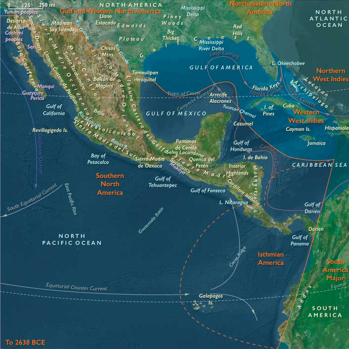
Middle America—bridging Southern North America and Isthmian America—formed a dynamic, interlocking world of mountains, lakes, rainforests, and coastal lagoons extending from Mexico to Panama.
-
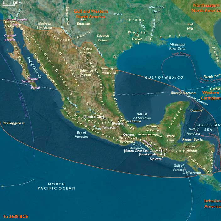
Southern North America encompassed the highland basins and coasts of Mexico, Guatemala, Belize, Honduras, El Salvador, and Nicaragua: the Basin of Mexico, Balsas–Tehuacán and Oaxaca valleys, Usumacinta–Grijalva and Motagua rivers, Yucatán karst plains, and Pacific and Caribbean lagoons.
-
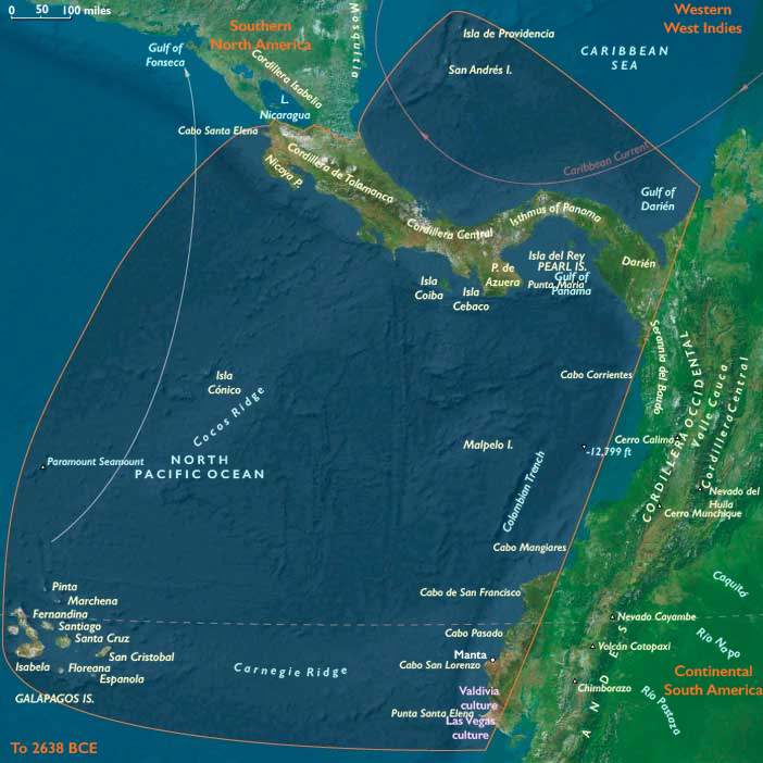
Isthmian America included Costa Rica, Panama, Darién–Chocó, the San Andrés archipelago, and the Ecuadorian Capes (Manta–Santa Elena)—a narrow, humid bridge between the continents lined with mangroves, lagoons, and volcanic capes.
As glaciers retreated worldwide, sea level rose 60–80 m, drowning continental shelves and transforming river mouths into estuaries and back-reef lagoons. Inland, highland lakes stabilized, and rainforests rebounded, reconnecting once-fragmented refugia.
Climate & Environmental Shifts
-
Bølling–Allerød (c. 14.7–12.9 ka): Warming and moisture recovery filled lakes, lagoons, and aquifers; forests returned to valleys and coasts; productive coral and kelp systems matured along both Pacific and Caribbean margins.
-
Younger Dryas (c. 12.9–11.7 ka): A cool–dry relapse tightened rainfall belts; many basins lowered; coastal foragers pivoted toward reefs, mangroves, and shellfish “fallback foods.”
-
Early Holocene (after 11.7 ka): Stabilizing warmth and rainfall restored monsoon regularity; estuaries and freshwater systems reached near-modern configurations.
This environmental rhythm produced predictable seasonality—a foundation for the mixed terrestrial–aquatic economies that followed.
Subsistence & Settlement
Across Middle America, foragers developed broad-spectrum and water-anchored economies with early plant tending, semi-sedentary rounds, and localized intensification:
-
Highlands and valleys:
Seasonal camps in Tehuacán, Oaxaca, Balsas, and Puebla–Tlaxcala valleys combined hunting (deer, peccary) with gathering of wild tubers, seeds, and fruits. By 10–9 ka, foragers were managing teosinte, squash, amaranth, chile, and avocado near springs and rock shelters—proto-horticultural systems that foreshadowed agriculture.
Grinding stones and manos–metates spread through uplands, signaling increased seed and tuber processing. -
Lakes and wetlands:
Basin of Mexico and Chalco–Xochimilco-like wetlands supported fish, waterfowl, turtles, reeds, and rushes. Seasonal return to these resource-rich zones led to place memory and early social anchoring. -
Karst plains (Yucatán–Belize):
Foragers clustered around cenotes and bajos, where water and game remained dependable; fruit, palm, and root foraging merged with early tree management. -
Pacific and Gulf coasts:
Lagoon and estuary camps—from Soconusco and Guerrero to Papaloapan and Tabasco—focused on shellfish, fish, turtle, and mangrove crab.
Darién–Chocó, Nicoya–Azuero, and Manta–Santa Elena formed a continuum of littoral economies, where reef, estuary, and upland game overlapped.
Shell-midden villages emerged along tidal flats and springheads; canoes or rafts enabled short-hop movement between lagoons and coves. -
Islands:
San Andrés and other banks served as occasional fishing or foraging stops; Galápagos remained unpeopled.
Across the region, semi-recurrent encampments at coves, lagoons, springs, and lake terraces formed enduring ritual and ancestral landscapes.
Technology & Material Culture
-
Microlithic flake–blade industries: backed bladelets, trapezes, and triangular points for bows and atlatls.
-
Aquatic toolkits: bone and shell gorges, harpoons, and net weights; basketry and weir elements in placid rivers.
-
Grinding technology: manos, metates, and mortars for seeds, roots, and pigments.
-
Watercraft: rafts and early dugouts supported lagoon and short coastal travel.
-
Adornment: shell and seed beads, teeth pendants, ochre body paints; occasional carved stones and incised pebbles.
Movement & Interaction Corridors
Braided corridors of movement and exchange stitched the highlands to the seas:
-
Pacific coast: Manta–Santa Elena ⇄ Nicoya/Azuero ⇄ Darién canoe circuits connected fishing communities across the isthmus; a precursor to later maritime networks.
-
Gulf and Caribbean side: Papaloapan–Pánuco–Campeche–Tabasco mangrove belts offered long-range lagoon navigation.
-
Riverine interior: Usumacinta–Grijalva–Motagua and Balsas–Tehuacán–Oaxaca channels tied interior valleys to coastal nodes.
-
Isthmus of Tehuantepec and Central American saddles: allowed rapid cross-coast exchange of stone, pigment, fiber, and dried fish.
-
Mountain corridors: trans-volcanic and Chiapan passes linked Basin of Mexico, Oaxaca, and Soconusco spheres.
These networks carried not only materials but shared ritual knowledge—seasonal timing, water control, and navigation cues.
Cultural & Symbolic Expressions
-
Caves and springs functioned as ritual thresholds—painted, replastered, and revisited through generations.
-
Shell middens doubled as feast archives and ancestral monuments, marking rights to fisheries or freshwater outlets.
-
Bead strings, pigment caches, and curated hearths signal identity continuity and kin-line memory.
-
Early clearing and fire rites in garden zones connected planting to rainfall and renewal, blending subsistence and cosmology.
Environmental Adaptation & Resilience
Resilience derived from ecological layering and scheduling:
-
Coast–upland mobility synchronized with wet–dry cycles and resource peaks.
-
Storage and preservation—smoked fish, roasted seeds, dried roots—bridged climatic downturns like the Younger Dryas.
-
Water–land redundancy: lagoons, cenotes, and spring-fed basins hedged against drought or flood.
-
Early niche engineering: plant tending, fire use, and patch management increased stability in fluctuating climates.
Long-Term Significance
By 7,822 BCE, Middle America had become a lattice of semi-sedentary, water-centered forager communities—anchored by lagoon villages, spring gardens, and lake terraces, yet bound together by canoe routes and mountain passes.
This was the proto-Mesoamerican world in embryo:
broad-spectrum subsistence, incipient horticulture, food storage, ritualized water and land use, and dense ecological knowledge spanning coast to highland.
As seas and forests stabilized, these systems evolved seamlessly into the Holocene heartlands that would nurture the world’s earliest tropical agricultural traditions.
Groups
Commodoties
Subjects
Regions
Subregions
Years: 28577BCE - 7822BCE
Groups
Commodoties
Subjects
Regions
Subregions