East Polynesia (2637 – 910 BCE): The …
Years: 2637BCE - 910BCE
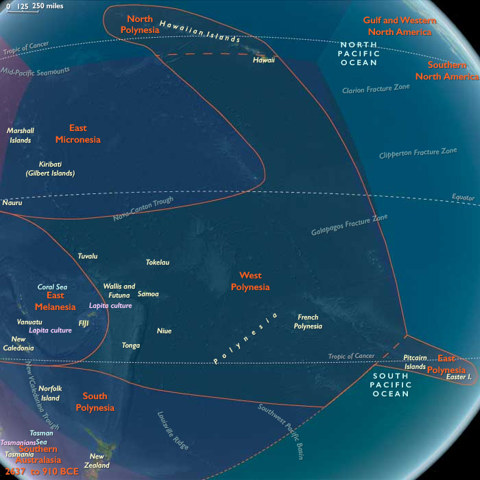
East Polynesia (2637 – 910 BCE): The Remote Eastern Apex
Geographic and Environmental Context
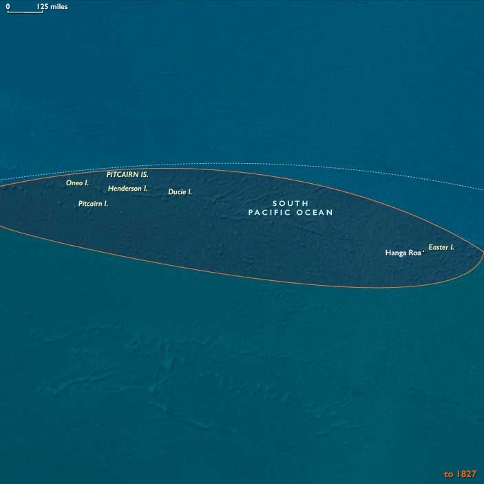
East Polynesia—including Easter Island (Rapa Nui) and the Pitcairn Islands—formed the far southeastern point of the Polynesian Triangle. Both were volcanic in origin, with Rapa Nui characterized by rolling volcanic hills, freshwater crater lakes, and arable soils, while the Pitcairn Islands presented rugged coastlines, forested slopes, and limited lowland plains. The surrounding South Pacific waters were warm but relatively nutrient-poor, with marine life concentrated in reef and nearshore environments.
Subsistence and Settlement
There is no evidence of permanent human settlement in East Polynesia during this epoch. However, the islands’ resources made them potentially valuable to exploratory voyagers:
-
Rapa Nui had fertile soils and enclosed freshwater sources in volcanic craters.
-
Pitcairn had forest resources, nesting seabirds, and freshwater springs.
Any landfall during this period would likely have been short-term, focused on fishing, gathering seabirds and eggs, and collecting fresh water before departing.
Technological and Navigational Context
Reaching East Polynesia from West or Central Polynesia required some of the longest open-ocean voyages in prehistory, often over 2,000 km with no intermediate landfalls. Voyaging demanded double-hulled canoes capable of carrying ample provisions, navigators skilled in star compasses, ocean swell interpretation, and avian flight tracking, and coordinated crew expertise for prolonged sea passages.
Environmental Characteristics and Resource Use
-
Rapa Nui: Volcanic soils capable of supporting root crops like taro and yam; freshwater in crater lakes; rocky coasts for fishing and shellfish gathering.
-
Pitcairn Islands: Forest cover for timber; limited arable land; rich seabird rookeries and inshore fisheries.
Both locations lacked land mammals but offered abundant marine and avian protein.
Cultural and Symbolic Role
Even if not visited, these islands may have existed in the conceptual horizon of Polynesian navigators as the ultimate eastern limit—places of challenge, achievement, and perhaps spiritual significance in oral tradition. In later centuries, such distant lands often featured in migration stories and cosmological maps.
Environmental Adaptation and Resilience
Exploratory crews would have needed to maximize fresh water collection, preserve fish and other foods, and time voyages to seasonal wind shifts for safe return. The capacity to survive and navigate in such remote seas reflects the apex of Polynesian wayfinding skill.
Transition to the Early First Millennium BCE
By 910 BCE, East Polynesia remained beyond the frontier of regular Polynesian voyaging, awaiting the later period of long-range expansion. Its eventual settlement would mark one of the greatest achievements in human navigation, completing the settlement of the world’s largest oceanic expanse.
Topics
Commodoties
Subjects
Regions
Subregions
Years: 2637BCE - 910BCE
Topics
Commodoties
Subjects
Regions
Subregions