Prehistory of the Netherlands: A Landscape Shaped …
Years: 256653BCE - 235918BCE
Prehistory of the Netherlands: A Landscape Shaped by Water
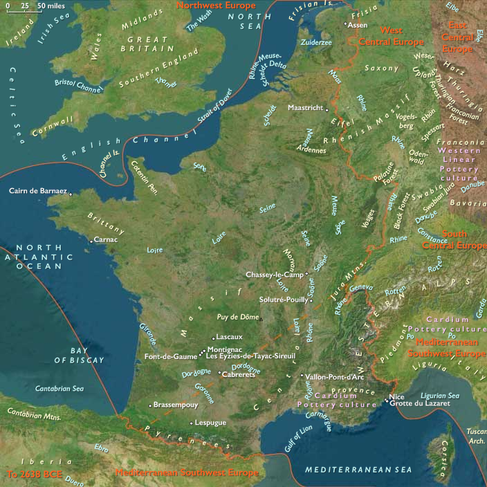
The prehistory of the region that is now the Netherlands was largely shaped by the sea and rivers, which continuously shifted the low-lying geography over millennia. The dynamic interplay of water and land influenced human settlement patterns, with early inhabitants gravitating toward higher ground as the landscape evolved.
Early Human Presence: Neanderthal Traces near Maastricht
- The oldest known human traces in the region belong to Neanderthals, whose presence dates back approximately 250,000 years.
- These remains have been discovered in higher, more stable soils near Maastricht, an area less affected by the flood-prone terrain of the lowlands.
- The Neanderthals likely adapted to a changing environment, utilizing the resources of rivers and forests for survival.
A Landscape in Constant Flux
Throughout prehistory, the region’s geological and climatic changes played a crucial role in shaping early habitation:
- Glacial and interglacial periods altered sea levels, periodically expanding and contracting habitable land.
- The Rhine, Meuse, and Scheldt rivers created fertile but unstable floodplains, influencing settlement choices.
- Rising sea levels and sediment deposits led to the formation of peat bogs and coastal dunes, features that would later define the Dutch landscape.
These early environmental factors set the stage for the later development of prehistoric cultures, as humans adapted to a land in flux, balancing the challenges of water management with the rich resources provided by the rivers and coastlines.
Locations
Groups
Topics
Subjects
Regions
Subregions
Related Events
Showing 10 events out of 69751 total
Years: 256653BCE - 235918BCE
Locations
Groups
Topics
Subjects
Regions
Subregions