West Indies (7,821 – 6,094 BCE): Early …
Years: 7821BCE - 6094BCE
West Indies (7,821 – 6,094 BCE): Early Holocene — Reef Corridors, River Mouth Villages, and Shell-Midden Memory
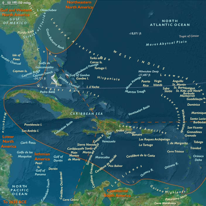
Geographic & Environmental Context
During the Early Holocene, the West Indies coalesced into a three-part maritime world:
-
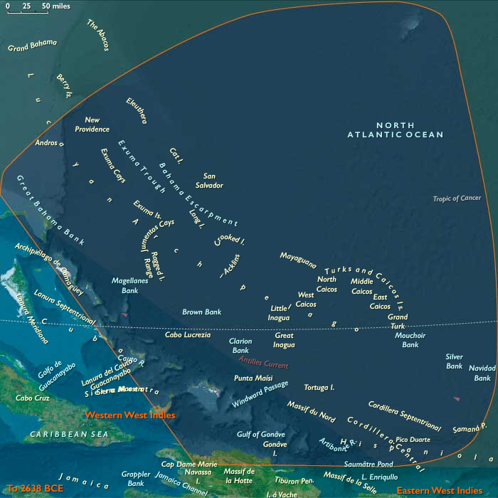
Northern arc—the Outer Bahamas–Turks & Caicos banks and northern Hispaniola (Cibao–Puerto Plata–Cap-Haïtien), where broad carbonate shelves, perched freshwater lenses, and stable river fans framed reef-rich shorelines.
-
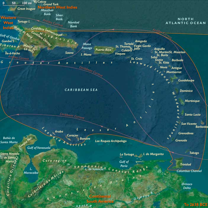
Eastern arc—Puerto Rico, the Virgin Islands, and the Lesser Antilles to Trinidad & Tobago, a necklace of volcanic and limestone isles with reef-protected bays and short inter-island channels.
-
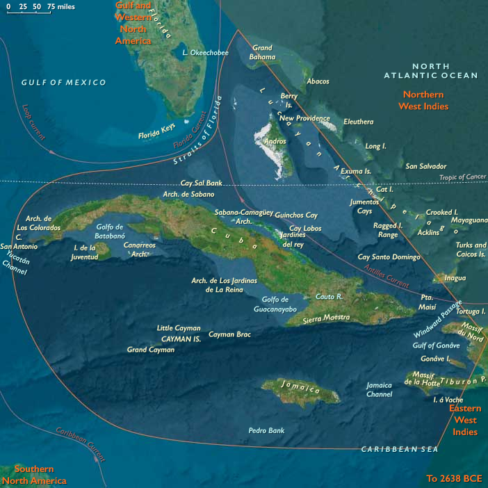
Western arc—Cuba, Jamaica, Cayman, and west Hispaniola (Gonâve Gulf, Tiburon), a littoral of wide shelves, tidal embayments, and straits (Windward Passage, Jamaica Channel).
Rising seas neared modern levels, converting drowned valleys to embayments and tightening the pass-and-channel geometry that would guide canoe movement for millennia.
Climate & Environmental Shifts
The Holocene thermal optimum delivered warm, humid stability with episodic but seasonally predictable storms.
River discharges on northern Hispaniola sustained fertile deltas; reef flats and seagrass meadows diversified across all arcs; freshwater lenses on the Bahama–Caicos banks matured, creating dependable (if limited) water stores.
Subsistence & Settlement
A semi-sedentary, coastal-forager mosaic spanned the archipelago, with mobility keyed to storms and spawning runs:
-
Northern arc: river–reef coupling on Hispaniola underwrote camps at river mouths and beach ridges—shellfish, reef fish, turtle, manatee, with deer/hutía inland. On the Bahamas–Caicos banks, visits were brief and seasonal—fishing, rookery harvests—but no durable villages formed.
-
Eastern arc: seasonal hamlets clustered in reef-protected bays of Puerto Rico, the Virgin Islands, and the Leewards/Windwards; diets blended turtle, fish, and shellfish with inland fruit–root rounds. Trinidad & Tobago functioned as the Orinoco gate, mediating mainland contacts.
-
Western arc: strand camps dotted north Cuba and Gonâve Gulf/Tiburon margins, mixing shellfish, fish, turtle, manatee with deer/hutía where present; settlement was nodal but repeatedly reoccupied.
Across all arcs, households returned to the same coves, levees, and dune bars, building shell-midden villages that doubled as waypoints and memory sites.
Technology & Material Culture
A shared maritime toolkit matured: bone gorges and barbed hooks, shell adzes, nets and basket traps, and dugout canoes for near-shore runs and calm-season channel crossings. Early net floats/weights and smoking racks supported storage; ornaments in shell and bone accompanied everyday dress and burial.
Movement & Interaction Corridors
Short-hop canoeing defined the region’s reef-and-pass logistics:
-
Northern coast lanes tied Cibao estuaries and allowed calm-season jumps onto the Caicos banks.
-
Eastern passages (Virgin–Anegada–Leeward straits) stitched island hamlets; Trinidad relayed goods and news from the Orinoco.
-
Western straits (Windward Passage, Jamaica Channel) enabled near-shore corridors among Cuba–Hispaniola–Jamaica–Cayman.
These braided routes created redundancy—if a reef failed or storms reshaped a cove, another bay or bank supplied protein and salt.
Cultural & Symbolic Expressions
Middens became monuments: curated shell terraces and ridge-top burial zones anchored ancestor veneration at landing places. Patterned discard around first-catch feasts hints at ritual season openers; storm-season departures and returns likely carried narratives of guardianship over passes, rookeries, and river mouths.
Environmental Adaptation & Resilience
Security rested on storage + mobility + multi-habitat scheduling:
Smoked/dried fish and turtle, oil-rich meats, and shellfish stores bridged lean spells; storm mobility shifted camps to lee shores; river–reef alternation diversified risk. Access to freshwater lenses on banks and springs at headlands governed camp viability and route choice.
Long-Term Significance
By 6,094 BCE, the West Indies had consolidated into a canoe-linked, semi-sedentary seascape: stable Archaic lifeways on Hispaniola and the larger isles, a densifying forager lattice across the eastern chain, and lightly used blue larders on the Bahama–Caicos banks. The operating code—reef logistics, shell-midden ancestry, short-hop corridors, and storm-season choreography—set the template that later ceramic horticulturalists would inherit and extend across the Caribbean.
Topics
Commodoties
Subjects
Regions
Subregions
Related Events
Showing 10 events out of 69350 total
Years: 7821BCE - 6094BCE
Topics
Commodoties
Subjects
Regions
Subregions