Northeastern North America (49,293–28,578 BCE) Upper …
Years: 49293BCE - 28578BCE
Northeastern North America (49,293–28,578 BCE) Upper Pleistocene I — Paleoindian Arrival, Fluted Horizons, and River Terraces
Geographic and Environmental Context
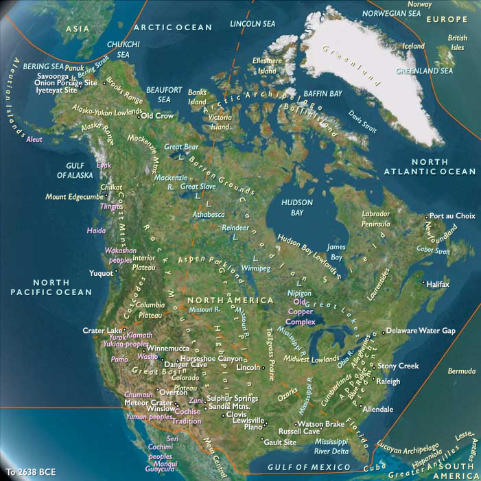
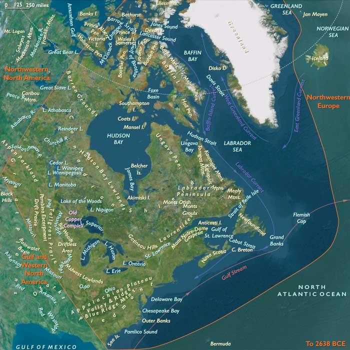
Northeastern North America includes the Atlantic coast from Jacksonville, FL to St. John’s, NL; Greenland; the Canadian Arctic; all Canadian provinces east to the Saskatchewan–Alberta border; and, within the U.S., the Old South, the Appalachian Plateau, Midwest & Great Lakes (including Driftless Area, Midwest Lowlands, Tallgrass Prairie, Big Woods, Drift Prairie, Aspen Parkland).
Anchors: Chesapeake–Delaware–Hudson–Gulf of Maine coasts; St. Lawrence–Quebec–Montreal; Great Lakes & Ohio–Illinois–Mississippi valleys; Appalachian Plateau (Pittsburgh–Knoxville); Hudson Bay rim; Arctic (Baffin, Foxe, Labrador); Greenland (future Norse Eastern/Western Settlements).
-
Laurentide ice lobes retreated unevenly; proglacial Lake Iroquois/Algonquin ancestors formed; coastal outwash plains expanded.
Climate & Environmental Shifts
-
Cold, dry; abrupt Dansgaard–Oeschger oscillations; productive river–lake ecotones as ice withdrew.
Subsistence & Settlement
-
Paleoindian big-game foragers (fluted points) hunted mammoth/mastodon (earlier), caribou, then elk/deer; camps on terraces and kame plains.
Technology & Material Culture
-
Clovis–Folsom-like fluted points → regional fluted series; prismatic blades, end-scrapers; bone/antler tools.
Movement & Interaction Corridors
-
Champlain–Hudson, St. Lawrence, Ohio–Tennessee, Great Lakes strandlines; Atlantic forelands.
Cultural & Symbolic Expressions
-
Red-ochre treatment; curated toolkits; long-distance raw material transport (cherts, obsidian rare).
Environmental Adaptation & Resilience
-
High mobility across deglaciating mosaics buffered risk.
Transition
By 28,578 BCE, mobile foragers had mapped post-glacial corridors.
Groups
Topics
Commodoties
Subjects
Regions
Subregions
Years: 49293BCE - 28578BCE
Groups
Topics
Commodoties
Subjects
Regions
Subregions