North Europe (28,577 – 7,822 BCE): Late …
Years: 28577BCE - 7822BCE
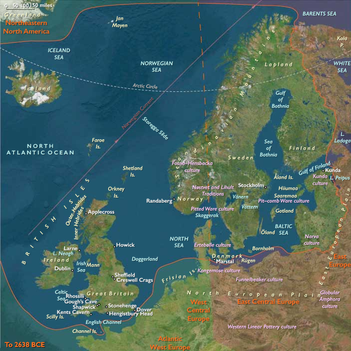
North Europe (28,577 – 7,822 BCE): Late Pleistocene–Early Holocene — Deglaciation, Doggerland, and the Rise of the Baltic Seas
Geographic & Environmental Context
During the final millennia of the Ice Age, North Europe was a landscape of retreating glaciers, rising seas, and advancing forests.
Two interdependent subregions defined this transformation:
-
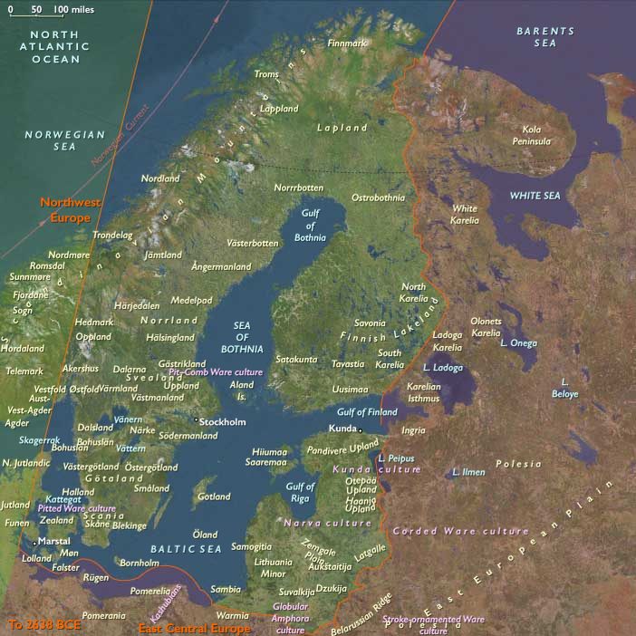
Northeast Europe — the Baltic–Fennoscandian zone, including southern Sweden, Finland, the Baltic States (Estonia, Latvia, Lithuania), eastern Denmark, eastern Norway, and the Ladoga–Karelia–Kaliningrad corridor. Deglaciation sculpted a system of proglacial lakes, notably the Baltic Ice Lake and later the Ancylus Lake, which filled the basins left by retreating ice sheets. Meltwater rivers like the Daugava–Nemunas served as northward corridors for people and animals.
-
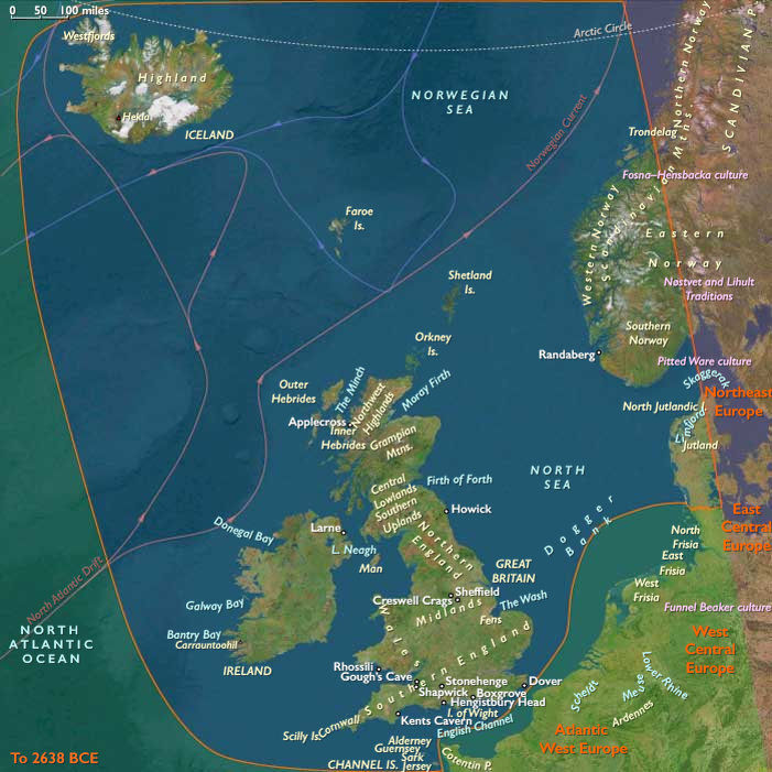
Northwest Europe — comprising the British Isles, western Norway, western Denmark, and the exposed North Sea plains known as Doggerland. These connected Britain to the European mainland until sea-level rise in the early Holocene submerged them. River valleys such as the Rhine–Thames–Elbe drained the plains, while the deepening fjords of Norway became centers of emerging coastal productivity.
Together these regions formed a vast transitional world—part tundra, part forest, part floodplain—bridging the glacial and postglacial epochs.
Climate & Environmental Shifts
-
Last Glacial Maximum (26,500–19,000 BCE): Thick ice sheets blanketed Scandinavia and the Baltic basin; tundra–steppe dominated the North Sea lowlands; strong westerlies and low precipitation produced cold, arid conditions.
-
Bølling–Allerød (14,700–12,900 BCE): Rapid warming melted ice and flooded valleys; birch and pine colonized newly deglaciated terrain; reindeer and horse herds moved north.
-
Younger Dryas (12,900–11,700 BCE): A sharp cold relapse restored steppe–tundra in lowlands and slowed forest spread; foragers retreated to coastal and riverine refugia.
-
Early Holocene (after 11,700 BCE): Long-term climatic stability allowed oak, hazel, and elm forests to spread across lowlands; the Baltic Ice Lake evolved into the Ancylus Lake and later the brackish Littorina Sea; Doggerland slowly disappeared beneath rising seas.
Subsistence & Settlement
As the ice withdrew, pioneer foragers followed the meltwater front northward:
-
Northeast Europe: Early camps formed along proglacial lakes and meltwater valleys, initially focused on reindeer hunting. By the Early Holocene, diets diversified to include elk, beaver, fish, and waterfowl, signaling a shift toward broad-spectrum economies. Lakeside and riverside camps became increasingly permanent, especially around Karelia, Lake Ladoga, and the Baltic shore.
-
Northwest Europe: The Doggerland plains supported reindeer, horse, and aurochs hunters during the Late Glacial, who later adapted to riverine and coastal resources as the plains flooded. Norwegian fjord communities developed early specializations in seal, fish, and seabird harvesting, while groups along the Channel and North Sea coasts gathered shellfish and netted migratory fish.
These mobile but regionally anchored foragers balanced inland game rounds with predictable aquatic resources.
Technology & Material Culture
-
Lithic industries: Late Magdalenian and Hamburgian–Ahrensburgian complexes in the west, and Swiderian and Kunda traditions in the east, employed microblades, tanged points, and backed tools suited for reindeer and elk hunting.
-
Fishing and woodworking: Bone and antler harpoons, gorges, and fish weirs show intensified aquatic specialization; woodworking tools like adzes and chisels appear with forest expansion.
-
Early pottery arose by the end of this epoch in the Upper Volga–Karelia region, spreading westward as one of Eurasia’s earliest ceramic traditions.
-
Adornment and art: Amber, tooth, and bone pendants, engraved plaquettes, and ochre burials continued the symbolic practices of Upper Paleolithic Europe.
Movement & Interaction Corridors
-
Daugava–Nemunas–Pregolya waterways connected the Baltic basin to the eastern European plains.
-
The Ladoga–Onega–Karelia–Finnmark chain served as a migration route for both humans and fauna into postglacial Finland and Sweden.
-
The Doggerland river system linked the Rhine, Thames, and Elbe, creating a shared cultural landscape before submergence.
-
Norwegian fjords and North Sea coasts enabled early maritime foraging and the first use of small watercraft.
-
Western Denmark and eastern England served as cross-channel contact zones until the sea finally severed them around 8,000–7,500 BCE.
These routes knitted together a continent of thawing valleys and emergent coasts into a single interactive frontier.
Cultural & Symbolic Expressions
-
Rock engravings on glacial outcrops in Karelia and northern Norway depicted reindeer, elk, fish, and boats, recording both ecological dependence and spiritual continuity.
-
Ochre burials with antler and tooth ornaments across Denmark, Doggerland, and the Baltic reveal shared ritual traditions.
-
Lakeside offerings—antlers, fish bones, ochre, and carved figurines—point to ceremonies honoring water spirits or ancestors tied to place.
-
Portable ornamentation and engraved tools reinforced social identity and long-distance connection across forager bands.
Environmental Adaptation & Resilience
-
Seasonal mobility tracked reindeer herds north in spring and followed fish and waterfowl south in fall.
-
Mixed terrestrial–aquatic diets provided stability as ecosystems transformed.
-
Flexible dwellings, clothing, and watercraft enabled survival in both tundra and forest.
-
Storage and preservation of fish, meat, and nuts reduced risk during winter scarcity.
-
Persistent symbolic marking of key foraging grounds reinforced social memory in shifting environments.
Long-Term Significance
By 7,822 BCE, North Europe had fully transitioned from glacial tundra to a world of forests, rivers, and rising seas:
-
In the northeast, the Baltic basin had become a vast freshwater landscape supporting semi-sedentary fishers and elk hunters.
-
In the northwest, Doggerland was vanishing beneath the sea as its inhabitants migrated to the British Isles and Norwegian fjords, where maritime traditions took root.
These centuries of adaptation forged the ecological intelligence and technological foundations of the European north—mobility paired with memory, foraging fused with water mastery, and landscapes rendered sacred through continuity of use—that would define the Mesolithic and set the stage for later Neolithic expansions.
Topics
Commodoties
Subjects
Regions
Subregions
Related Events
Showing 10 events out of 69584 total
Years: 28577BCE - 7822BCE
Topics
Commodoties
Subjects
Regions
Subregions