The Near and Middle East (6,093 – …
Years: 6093BCE - 4366BCE
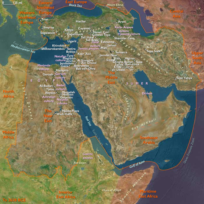
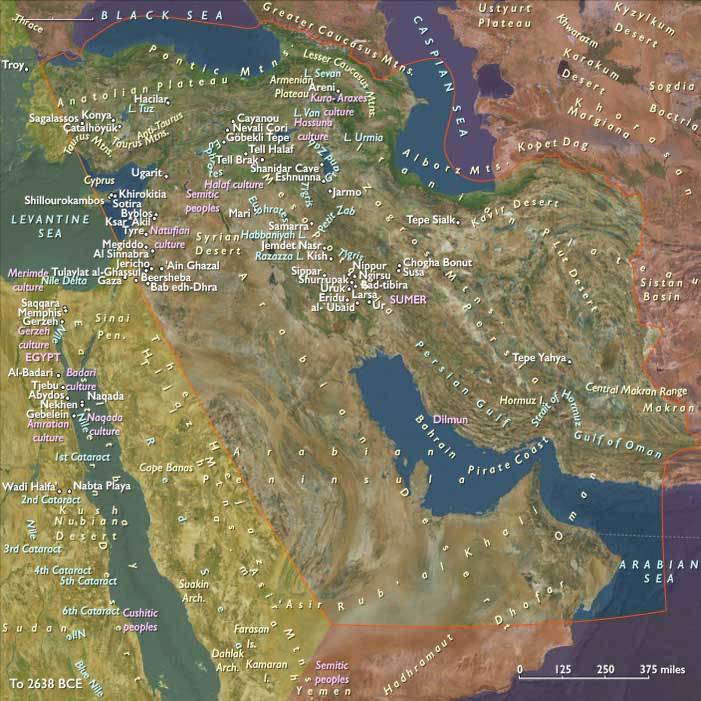
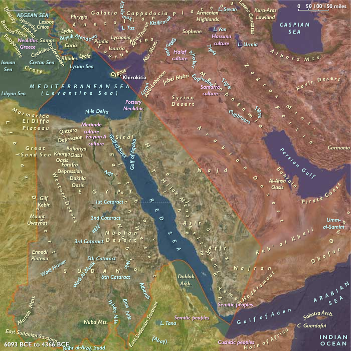
The Near and Middle East (6,093 – 4,366 BCE): Middle Holocene — Hearths of Cultivation and the First Webs of Exchange
Geographic & Environmental Context
During the Middle Holocene, the Near and Middle East—stretching from the Nile Valley and Aegean coasts across Mesopotamia, Iran, and Arabia to the Persian Gulf and Caucasus foothills—stood as the primary heartland of the global Neolithic.
This vast zone combined riverine alluvia, fertile uplands, oasis basins, and seasonal monsoon margins, all benefiting from the climatic stability of the Hypsithermal Optimum.
-
In the Middle East proper, the Tigris–Euphrates plains, the Zagros foothills, and the Caucasus formed a continuous belt of early farming, herding, and craft innovation.
-
The Near Eastern sphere—the Nile Delta, Red Sea highlands, and Aegean–Anatolian littoral—blended floodplain and coastal economies tied to the first maritime exploration.
-
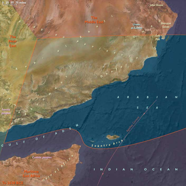
Along the southern frontier, Southeast Arabia and Yemen’s uplands linked oasis horticulture, early pastoralism, and maritime gathering in one adaptive system.
This region was, in essence, the ecological and technological axis of the Middle Holocene world: the meeting ground of the river, the steppe, and the sea.
Climate & Environmental Shifts
The epoch coincided with the Hypsithermal climatic maximum, when temperatures and rainfall across Southwest Asia were higher and more consistent than at any time before or since.
-
The Nile experienced regular, strong floods, nourishing fertile alluvium from Nubia to the Delta.
-
The Tigris–Euphrates lowlands oscillated between flood and marsh, while the Zagros and Caucasus enjoyed dense woodland and ample springs.
-
Arabia’s southern and eastern uplands received reliable monsoon rains, creating “green corridors” across Dhofar, Hadhramaut, and Oman.
-
Western Anatolia and the Aegean coasts prospered under mild, humid conditions ideal for cereals and olives.
This convergence of warmth, moisture, and sediment productivity underwrote a massive expansion of farming frontiers and the first sustained population growth in the Old World.
Subsistence & Settlement
By this period, fully developed Neolithic lifeways had spread across nearly every subregion:
-
In Upper and Lower Mesopotamia, villages cultivated wheat, barley, pulses, and flax, while herding sheep, goats, and cattle. Canals and ditches appeared in Khuzestan and the Lower Tigris–Euphrates, marking the birth of irrigation agriculture.
-
The Zagros and Iranian plateaus supported terraced gardens and orchards near permanent springs, with transhumant herding along mountain flanks.
-
In the Caucasus foothills, mixed farming–herding hamlets developed into the precursors of the Shulaveri–Shomu and Kura–Araxes horizons.
-
Across the Nile floodplain, grain cultivation and cattle management became staples; oasis gardening flourished in the Fayum and Western Desert depressions.
-
In the Aegean and Anatolian coasts, farmers combined fields, orchards, and fishing, creating hybrid economies of land and sea.
-
In Southeast Arabia, proto-horticultural villages in Dhofar and Hadhramaut tended millets, tubers, and fruit trees, while coastal groups practiced net fishing and shell gathering.
The overall pattern was one of ecological specialization and integration—communities adapted their subsistence to every available niche, from marsh reedbeds to desert wadis.
Technology & Material Culture
This epoch marked the technological threshold of the Chalcolithic:
-
Pottery reached universal adoption, with distinct regional styles—painted, burnished, or impressed—signifying cultural networks.
-
Mudbrick and plaster construction, lime floors, and storage granaries appeared in major settlements.
-
Sickle blades, loom weights, spindle whorls, and grinding stones defined the domestic economy.
-
Copper ornaments and small tools emerged in the Zagros, Caucasus, and Anatolia, heralding early metallurgy.
-
In Southeast Arabia, the first terrace-bund systems and stone alignments prefigured later oasis agriculture.
-
Weirs, fish traps, and early sails on the Nile and Gulf coasts hint at growing control of water and wind power.
Together these innovations formed a technological constellation—the first integrated toolkit of sedentary civilization.
Movement & Interaction Corridors
The Middle Holocene Near and Middle East was bound by interlocking networks of exchange:
-
The Zagros–Khuzestan–Lower Mesopotamia route linked grain, livestock, and metal between mountain and plain.
-
The Kura–Araxes corridor connected the Caucasus to northern Iran and Anatolia, transmitting both obsidian and copper.
-
The Euphrates and Nile served as inland highways, carrying goods and ideas between villages, oases, and early towns.
-
Aegean coastal cabotage moved obsidian, shell, and pigment across western Anatolia, Cyprus, and the Levant.
-
Red Sea and Arabian Sea navigation—still short-range—linked Yemen and Dhofar to coastal Oman and the Horn of Africa.
These corridors laid the foundations for the world’s earliest long-distance trade system, one that would, within millennia, stretch from the Indus to the Mediterranean.
Cultural & Symbolic Expressions
Religious and symbolic life deepened around ancestry, fertility, and the household shrine.
-
Across the Fertile Crescent, clay figurines—often female—represented fertility and domestic prosperity.
-
House shrines and ritual pits served as loci of ancestor veneration and community feasting.
-
In the Aegean, cape sanctuaries and communal burials expressed a growing sense of shared identity.
-
Rock art in Dhofar and the Iranian highlands depicted hunters, ibex, and herders, blending daily life with mythic imagery.
-
Feasting rituals—often at house compounds or communal courtyards—symbolized renewal and alliance.
The sacred was both intimate and practical: it infused agriculture, herding, and domestic space rather than standing apart from them.
Environmental Adaptation & Resilience
Across these varied landscapes, societies perfected adaptive strategies for climatic and environmental variability:
-
Irrigation canals and flood management in Mesopotamia stabilized crop yields.
-
Pastoral mobility in the Zagros and Arabian fringes allowed herders to exploit shifting rainfall zones.
-
Oasis horticulture in Arabia and Egypt buffered against drought.
-
Storage systems and inter-village exchange distributed risk and secured food during lean years.
-
Arboriculture and mixed farming ensured ecological sustainability, preserving soil fertility and hydrological balance.
Resilience was achieved through diversity—agriculture, herding, and trade worked in symbiosis, forming an enduring environmental equilibrium.
Long-Term Significance
By 4,366 BCE, the Near and Middle East had fully matured into a network of interconnected Neolithic civilizations.
The seeds of urbanism, metallurgy, and written administration were already germinating in Mesopotamia and the Nile Valley; the oasis and terrace cultures of Arabia and the Aegean coastal communities would soon join the same orbit.
This epoch cemented the region’s role as the world’s first agricultural and cultural nexus—where field, flock, and faith combined to generate sustained human complexity.
In these centuries, the land between the Nile, the Tigris, and the Indus became the blueprint for civilization itself:
rivers as lifelines, mountains as corridors, and the sea as a bridge rather than a boundary.
Groups
Topics
- Older Peron Transgression during the Neolithic Subpluvial
- Younger Peron Transgression during the Neolithic Subpluvial
- 5.9 kiloyear event during the Neolithic Subpluvial
- Subboreal Period during the Neolithic Subpluvial
- Early Bronze Age I (Near and Middle East)
- Piora Oscillation ending the Neolithic Subpluvial
- Early Bronze Age II (Near and Middle East)
Commodoties
- Weapons
- Hides and feathers
- Glass
- Domestic animals
- Grains and produce
- Textiles
- Ceramics
- Strategic metals
- Beer, wine, and spirits
Subjects
- Commerce
- Architecture
- Painting and Drawing
- Environment
- Decorative arts
- Faith
- Government
- Custom and Law
- Technology
- Metallurgy
- Astronomy
Regions
Subregions
Years: 6093BCE - 4366BCE
Groups
Topics
- Older Peron Transgression during the Neolithic Subpluvial
- Younger Peron Transgression during the Neolithic Subpluvial
- 5.9 kiloyear event during the Neolithic Subpluvial
- Subboreal Period during the Neolithic Subpluvial
- Early Bronze Age I (Near and Middle East)
- Piora Oscillation ending the Neolithic Subpluvial
- Early Bronze Age II (Near and Middle East)
Commodoties
- Weapons
- Hides and feathers
- Glass
- Domestic animals
- Grains and produce
- Textiles
- Ceramics
- Strategic metals
- Beer, wine, and spirits
Subjects
- Commerce
- Architecture
- Painting and Drawing
- Environment
- Decorative arts
- Faith
- Government
- Custom and Law
- Technology
- Metallurgy
- Astronomy
Regions
Subregions