The Near and Middle East (49,293 – …
Years: 49293BCE - 28578BCE
The Near and Middle East (49,293 – 28,578 BCE): Upper Pleistocene I — Glacial Corridors, Desert Shelves, and the First Interlinked Worlds
Geographic and Environmental Context
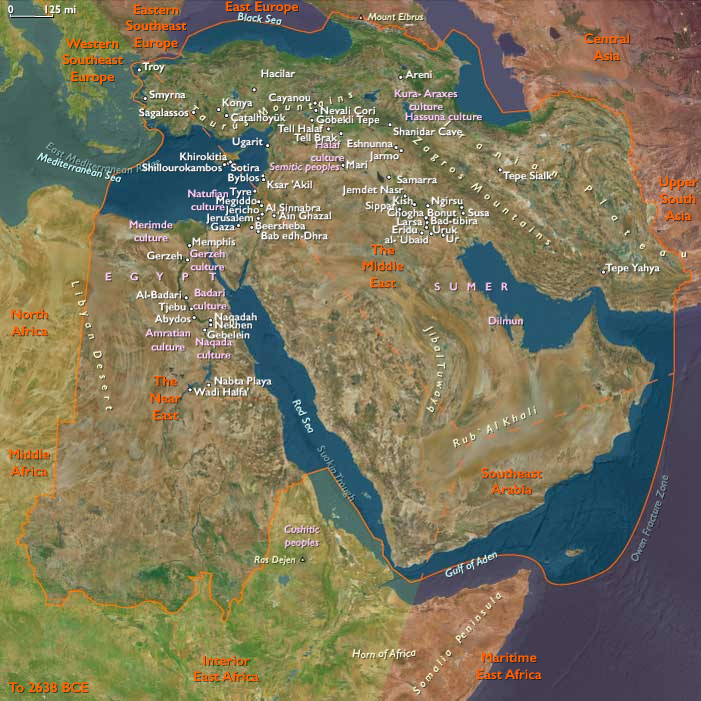
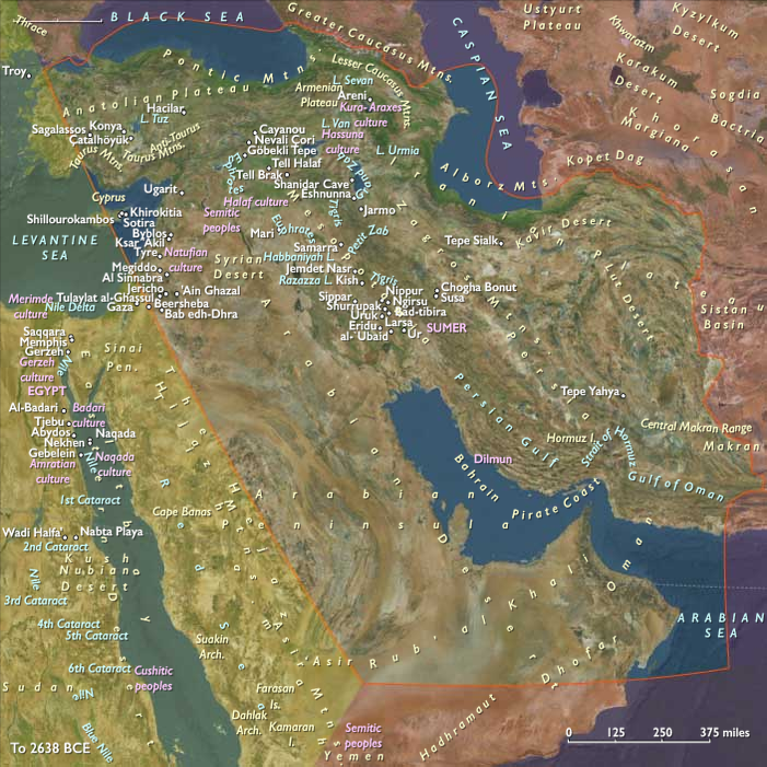
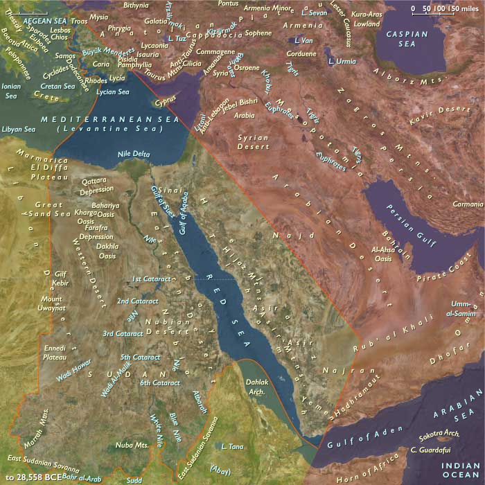
The Near and Middle East during the late Pleistocene formed a continental hinge between Africa, Eurasia, and the Indian Ocean—a convergence of deserts, mountains, and river valleys where small human bands navigated extreme environmental contrasts.
Yet this “region” was, in reality, three adjacent worlds with distinct climatic engines and survival logics:
-
The Near East, anchored by the Nile corridor, Sinai, and Levant, where riverine and coastal refugia offered year-round resources amid surrounding aridity.
-
The Middle East, stretching from Mesopotamia and the Zagros to the Caucasus uplands and the dry Gulf plain, where loess steppes and cave systems sheltered mobile big-game hunters.
-
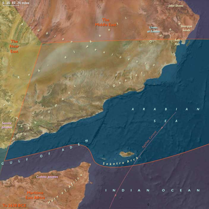
The Southeast Arabian and South-Arabian world, dominated by desert basins, fog-fed highlands, and episodic monsoon corridors, where human presence ebbed and returned with the pulse of the Indian Ocean climate.
Across these adjoining zones, people were linked less by proximity than by movement—through rivers, wadis, and coastal shelves that alternately connected and isolated them as the ice advanced and retreated.
Climate and Environmental Shifts
Throughout this epoch, the region oscillated between bitter glacial aridity and brief interstadial moistening.
-
In the Near East, the Sahara and Sinai desiccated, but the Nile remained a green thread nourished by equatorial rains.
During wetter pulses, the Levantine corridor sprouted steppe grasses and gazelle herds; during dry phases, settlement contracted to springs and caves. -
In the Middle East, loess steppes spread across the Zagros piedmont and northern Mesopotamia, with snowfields mantling the Caucasus and Alborz.
The Arabian Gulf stood as a vast inland plain—its rivers and marshes forming a new ecosystem connecting Iran, Mesopotamia, and Arabia. -
In Southeast Arabia, Heinrich-type dry pulses brought dune advance and near-desertion, while interstadials revived fog-belts along Dhofar and Hadhramaut, producing grass and browse for gazelle and ibex.
Overall, a cooler, windier, and more unpredictable climate forced human groups to become specialists in mobility and memory, knowing where water might reappear when the rains returned.
Lifeways and Settlement Patterns
Population density remained low, but continuity endured across shifting ecotones.
Small, kin-based forager bands ranged between upland caves, river terraces, and desert wadis, often revisiting the same localities through generations.
-
Along the Nile and Levant, fish, mollusks, and migratory birds supplemented gazelle, wild cattle, and onager hunting.
Seasonal camps lined ancient channels, with longer stays at delta lagoons and spring oases. -
In the Zagros and Caucasus, hunters followed red deer, goat, and wild sheep along snowline meadows, while lowland groups pursued equids and aurochs across the Euphrates terraces.
Caves such as those of the Zagros foothills show repeated winter occupation and hearth reuse. -
On the Arabian and Oman coasts, transient groups exploited shellfish and turtles; inland foragers converged on perennial springs in Dhofar and Hadhramaut during wet cycles.
Most of the peninsula, however, was uninhabitable during glacial peaks.
Each subregion’s rhythm differed: the Nile anchored, the Zagros alternated, the Arabian deserts blinked in and out of habitability. Together, they embodied the pattern that defines this greater world—a mosaic of refugia and corridors, never a uniform whole.
Technology and Material Culture
A shared Upper Pleistocene adaptive toolkit extended from Africa to Iran but took distinct regional forms:
-
In the Levant and Nile corridor, blade and microlithic industries refined hunting efficiency; bone and antler points, grinding stones, and ochre use signaled complex daily life.
-
Across Mesopotamia and the Zagros, chert microblade and burin technologies flourished, suited to composite hafted tools; cave sites show early use of resins and sinew for binding.
-
In Southeast Arabia, simpler flake industries persisted during dry phases, with bursts of innovation in wetter intervals—evidence of intermittent occupation rather than decline.
Throughout the region, personal ornaments—pierced teeth, shell beads, carved bone—reveal exchange and communication across wide distances. Their presence even in the harshest zones implies networks of symbolic kinship spanning deserts and rivers alike.
Movement and Interaction Corridors
Despite their contrasting ecologies, the three worlds were knitted by movement rather than settlement.
-
The Nile–Sinai–Levant corridor remained the principal conduit between Africa and Eurasia, funneling both genes and ideas northward.
-
The Tigris–Euphrates–Zagros axis linked Anatolia and the Caucasus to the Gulf plain and onward to the Iranian plateau.
-
The Arabian coastal rim—especially during wetter interstadials—offered a tenuous maritime pathway from the Red Sea to the Persian Gulf, bridging African and Asian populations.
At times of extreme aridity, these corridors constricted into isolated refugia; during humid pulses, they reopened, forming vast “cultural floodplains” where foragers re-encountered each other after centuries apart.
Cultural and Symbolic Life
Across all three subregions, symbolic behaviors deepened as adaptive anchors in unstable climates.
Ochre burials, engraved bone fragments, and hearth renewals reflect an expanding sense of continuity and belonging to place.
On the Zagros slopes, patterned bone carvings echo those from the Levant and Caucasus, implying shared mythic language across enormous distances.
Coastal shell beads—some traded hundreds of kilometers inland—testify to communication networks that prefigured the long exchange chains of the early Holocene.
Ritual gatherings likely coincided with resource peaks: Nile flood feasts, gazelle drives on the Levantine steppes, or ibex hunts in Dhofar’s fog forests. These periodic convergences maintained social coherence across landscapes that were otherwise scattered and marginal.
Environmental Adaptation and Resilience
The defining trait of the Near and Middle Eastern worlds in this epoch was ecological intelligence—the capacity to read changing water, wind, and animal patterns and adjust routes accordingly.
People mastered the art of seasonal oscillation:
-
shifting between upland and lowland zones with temperature and rainfall;
-
alternating between riverine anchorage and desert passage;
-
relying on both terrestrial game and aquatic protein to stabilize diets.
Through these habits, they transformed one of the planet’s most unstable climatic mosaics into a livable, remembered geography—an early rehearsal of the human resilience that would later sustain agriculture and urbanism here.
Transition Toward the Last Glacial Maximum
By 28,578 BCE, the Near and Middle East had become a web of refugia and corridors whose diversity belied their geographic continuity.
The Nile, Zagros, and Dhofar realms each operated as semi-independent ecological systems—distinct worlds sharing little but the persistence of life itself.
Yet between them flowed knowledge, pigments, and memory: traces of an expanding human presence that connected Africa’s heart to the heart of Asia.
As the ice advanced elsewhere, this region remained humanity’s crucial bridge—a lattice of shifting coasts, mountains, and deserts that would, in the millennia ahead, seed some of the world’s first enduring civilizations.
Topics
Commodoties
Subjects
Regions
Subregions
Related Events
Showing 2 events out of 2 total
Years: 49293BCE - 28578BCE
Topics
Commodoties
Subjects
Regions
Subregions