Southeast Arabia (49,293 – 28,578 BCE) …
Years: 49293BCE - 28578BCE
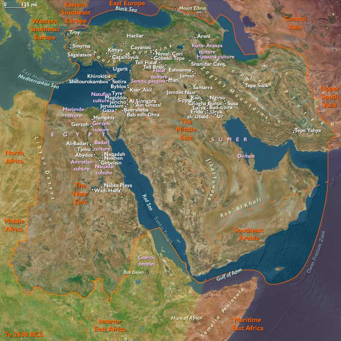
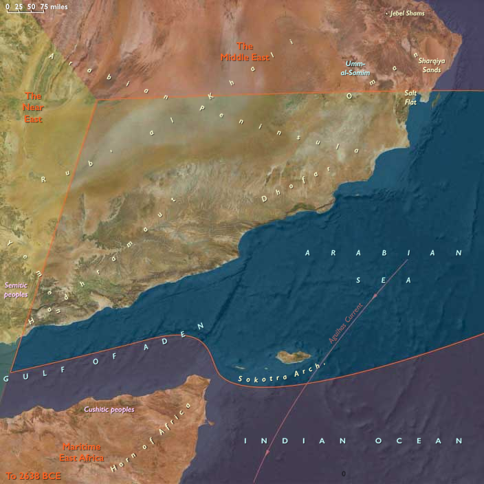
Southeast Arabia (49,293 – 28,578 BCE) Upper Pleistocene I — Monsoon Margins, Highland Refugia, and Desert Shelves
Geographic and Environmental Context
Southeast Arabia covers the southern and eastern margins of the Arabian Peninsula:-
Eastern Yemen (Hadhramaut, eastern Aden interior, al-Mahra).
-
Southern Oman (Dhofar Highlands with the khareef monsoon, al-Wusta gravel plains, Sharqiyah Desert fringes).
-
The Empty Quarter (Rubʿ al-Khālī) margins in adjoining Saudi territory.
-
The offshore island of Socotra in the Arabian Sea.
-
Anchors: Wādī Ḥaḍramawt–Shibam–Tarim, Dhofar escarpments (Ẓafār/Al-Balīd, Mirbat), al-Mahra dunes, al-Wusta plains, Sharqiyah sands, Socotra’s Hagghier Mountains and dragon’s-blood groves.
-
Coastal plains alternated with limestone scarps and gravel plains; the Dhofar escarpments trapped Indian Ocean moisture, creating fog-fed uplands.
-
Socotra lay isolated offshore, its endemic flora (dragon’s-blood trees, frankincense relatives) forming a unique biotic world, probably still uninhabited.
Climate & Environmental Shifts
-
Dansgaard–Oeschger warm interstadials: monsoon strengthened, rains reached inland wadis; ephemeral streams and pasture belts expanded.
-
Heinrich dry stadials: aridity dominated; dunes advanced; only perennial springs in highlands persisted; coastal productivity declined as upwelling weakened.
Subsistence & Settlement
-
Highlands & wadis: Foragers hunted gazelle, ibex, and small game; gathered roots, fruits, and nuts in seasonal flushes.
-
Coastal zones: Shellfish, turtle eggs, mullet, and crabs provided fallback protein in dry seasons.
-
Dry-phase strategy: Mobility focused on spring-fed uplands and the richest coastal embayments.
-
Socotra: no firm evidence for human presence, though transient visits in wet pulses cannot be excluded.
Technology & Material Culture
-
Late Middle Paleolithic flake industries dominated, with emerging microlithic elements in wetter episodes.
-
Chert/quartzite used for points and scrapers; expedient coral limestone tools along the coast.
-
Organic tools (digging sticks, nets, fish traps) likely, but preservation poor.
-
Use of ochre and shell beads attested regionally (Levant, Red Sea), suggesting shared symbolism.
Movement & Interaction Corridors
-
Coastal corridor tied southeastern Arabia to central/eastern Arabia, passable in wetter pulses.
-
Wadis linked coasts to uplands; critical routes to highland pastures.
-
Maritime: Dhofar–Mahra strip may have linked by canoe to the southern Red Sea in interstadials.
Cultural & Symbolic Expressions
-
Symbolism inferred from ochre and ornaments in adjacent regions.
-
Seasonal aggregation likely at highland springs and productive coves.
Environmental Adaptation & Resilience
-
Dual mobility (upland springs + coast) buffered variability.
-
Broad-spectrum diets combining marine and terrestrial foods ensured survival.
Transition
By 28,578 BCE, Southeast Arabian groups had stabilized a coastal–highland adaptive cycle, enabling persistence in one of the world’s driest inhabited frontiers.
Topics
Commodoties
Subjects
Regions
Subregions
Related Events
Showing 10 events out of 69706 total
Years: 49293BCE - 28578BCE
Topics
Commodoties
Subjects
Regions
Subregions