The Near and Middle …
Years: 2637BCE - 910BCE
-
The Near and Middle East (2637 – 910 BCE): Bronze and Early Iron — Empires, Incense, and the First Great Corridors
Regional Overview
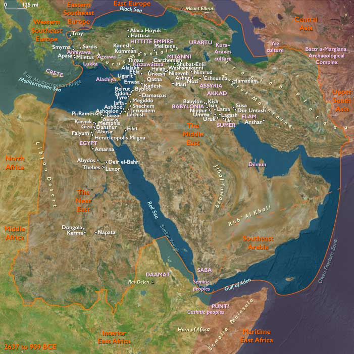
During the Bronze and Early Iron Ages, the Near and Middle East stood at the center of Afro-Eurasian innovation.
From the Tigris–Euphrates to the Nile, from the Caucasus uplands to the Arabian Sea, irrigation, metallurgy, and overland and maritime trade linked highlands, deserts, and fertile deltas into a single interdependent world.
By the close of this epoch, the region had evolved into a mosaic of palace-states, caravan polities, and incense ports that prefigured the classical empires of the first millennium BCE.
Geography and Environment
The region spanned three great ecological belts:
-
the alluvial lowlands of Mesopotamia and Egypt,
-
the mountain and plateau arcs of Iran, Armenia, and Anatolia, and
-
the arid steppe and coastal deserts of Arabia and the Levant.
Rivers such as the Tigris, Euphrates, Nile, and Jordan supplied irrigation, while the Zagros and Caucasus offered pastures and metals.
The Red Sea, Persian Gulf, and eastern Mediterranean served as maritime corridors binding these lands into one economic sphere.
Climate and Environmental Shifts
Late-Holocene arid pulses intensified after 2000 BCE.
Mesopotamian salinization and river avulsion forced canal redirection and crop rotation, while the Caucasus and Zagros pastures remained comparatively stable.
Along the Red Sea and Arabian coasts, fog oases and mountain terraces mitigated drought.
This interplay of aridity and adaptation produced the region’s hallmark—hydraulic ingenuity.
Societies and Political Developments
In the Mesopotamian and Iranian highlands, Elamite, Susian, and Zagros polities balanced urban irrigation systems with pastoral hinterlands.
Metal-rich Transcaucasia (Trialeti, Kura–Araxes legacies) supplied arsenical bronzes and stimulated north-south trade.
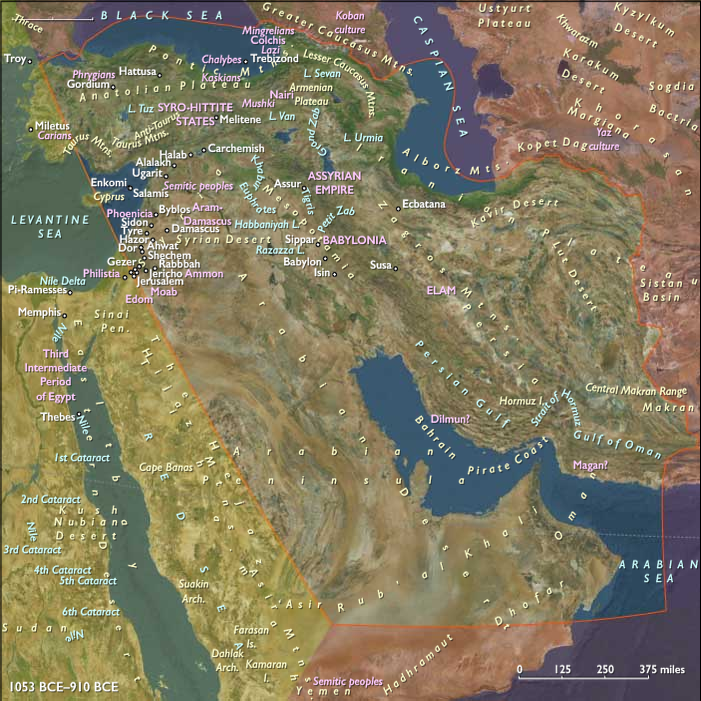
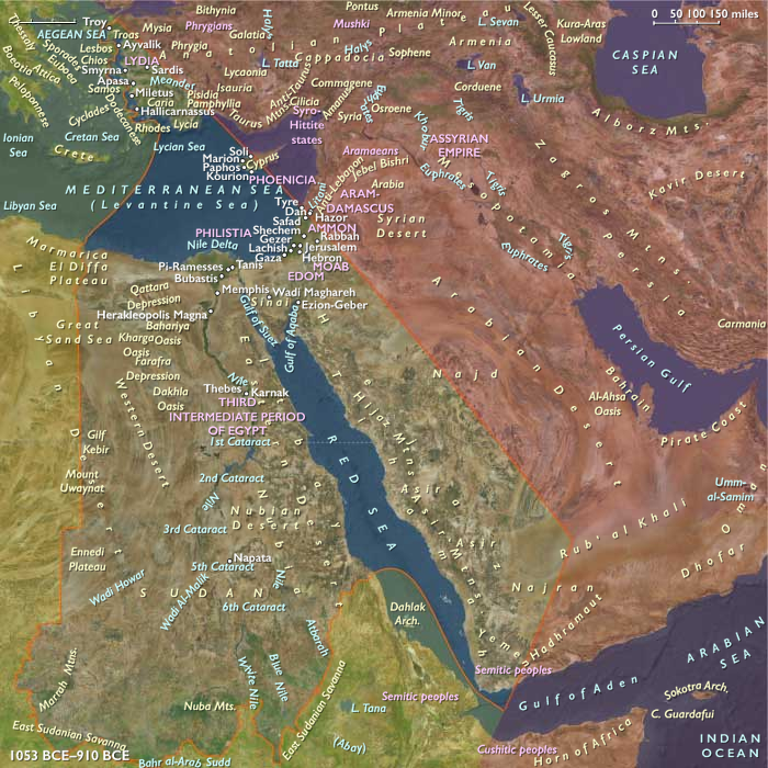
By the late second millennium BCE, the foundations of Assyria, Urartu, and Syro-Anatolian kingdoms were emerging.
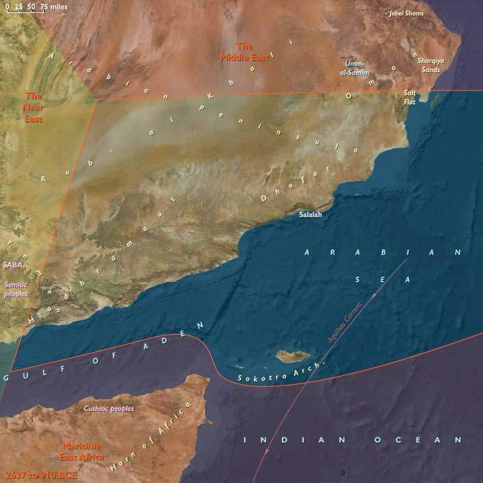
To the south and east, Southeast Arabia developed terraced oases in Hadhramaut and Dhofar, expanding goat-camel herding and pioneering the frankincense and myrrh trades.
Socotra’s resins and dried fish entered long-range exchange networks that reached the Gulf and the Red Sea.
In the Near East proper, the Nile and Aegean worlds intertwined.
Egypt’s New Kingdom power extended into the Levant, while Aegean mariners and Anatolian city-states (Minoan–Mycenaean, later Aeolian and Ionian) connected the Mediterranean coasts.
Tyre, within this subregion, grew into a Phoenician entrepôt, while western Arabia’s oases and Yemeni highlands cultivated incense gardens and terraced cereals—the first outlines of the later incense road.
Economy and Technology
Across the region, Bronze-Age craft economies reached maturity.
-
Bronze metallurgy dominated tools, weapons, and luxury goods; iron-smelting appeared near the end of the period in Anatolia and Iran.
-
Wheeled transport and pack-camels widened caravan trade.
-
Canal agriculture, terrace farming, and oasis irrigation supported dense populations.
-
Sewn-plank dhows and sail-rigged ships carried pearls, dates, metals, and incense along the Gulf and Red Sea.
The interplay of highland ores, lowland crops, and coastal markets created a vertically integrated economic web unmatched elsewhere in the ancient world.
Belief and Symbolism
Ritual and kingship centered on divine mediation of fertility and order.
Highland peoples carved rock reliefs and tended fire altars; Mesopotamian and Levantine cities built temple precinctsaligned with stars and rivers.
In Egypt, solar and funerary cults radiated outward; in Aegean Anatolia, maritime sanctuaries honored capes and storms; in Arabia, ancestor tombs and incense offerings sacralized the desert routes.
The region’s mythic imagination—of gods ruling sky, sun, and flood—underpinned later Zoroastrian, Hebrew, and Hellenic traditions.
Movement and Interaction Corridors
Trade and migration moved through a network of interlocking routes:
-
Overland Zagros–Tigris and Caucasus–Ararat–Urmia corridors moved metals and livestock.
-
The Royal Road precursors tied Susiana to Anatolia.
-
The Gulf and Red Sea coasts hosted pearl fishers, incense ports, and ferry routes linking Arabia, Egypt, and the Levant.
-
Nile–Aegean maritime lanes ferried copper, tin, and luxury goods.
Together these paths created the first durable framework of continental-scale commerce.
Environmental Adaptation and Resilience
Societies balanced extremes through ecological complementarity:
mountain pastures fed lowland markets; oases and terraces offset desert risk; multi-crop rotations and canal maintenance curbed salinity.
Pastoral mobility and diversified trade insulated economies from drought and political upheaval.
By coupling agriculture, herding, and commerce, the region sustained continuity through climatic and dynastic flux.
Regional Synthesis and Long-Term Significance
By 910 BCE, the Near and Middle East had matured into a highly interconnected world system.
Its urban irrigation states, steppe-oasis alliances, and maritime incense routes linked Africa, Asia, and Europe.
The technological and cultural legacies of this era—bronze metallurgy, writing, monumental architecture, and long-distance exchange—formed the enduring template for the imperial and religious civilizations that would dominate the first millennium BCE and beyond.
People
Groups
- Mesopotamia
- Ur, city-state of
- Uruk, city-state of
- Dilmun (Bahrain?)
- Magan (civilization)
- Cyprus, Archaic
- Canaanite culture, ancient
- Harrapan civilization, Mature (Indus Valley Civilization)
- Akkadian Empire
- Gutians
- Hittites
- Ur, Third Dynasty of (Neo-Sumerian Empire)
- Ugarit, Kingdom of
- Kassites
- Babylonia
- Babylonian Empire
- Phoenicia
- Hittites, (Old) Kingdom of the
- Aramaeans
- Babylonian Kingdom of the Kassites
- Mitanni (Hanigalbat), Kingdom of
- Hittites (Middle) Kingdom of the
- Phoenicians
- Hittites (Hittite Empire), (New) Kingdom of the
- Tyre, Kingdom of (Phoenicia)
- Sea Peoples
- Syro-Hittite states
- Babylon, Kingdom of
- Elam, (New) Kingdom of
- Assyria, (New) Kingdom of (Neo-Assyrian Empire)
Topics
- Early Bronze Age III (Near and Middle East)
- Early Bronze Age IV (Near and Middle East)
- Middle Bronze Age I (Near and Middle East)
- Middle Bronze Age II A (Near and Middle East)
- Middle Bronze Age II B (Near and Middle East)
- Middle Bronze Age II C (Near and Middle East)
- Late Bronze Age I and II A (Near and Middle East)
- Late Bronze Age III (Near and Middle East
- Bronze Age collapse
- Iron Age, Near and Middle East
Commodoties
Subjects
- Commerce
- Writing
- Architecture
- Watercraft
- Environment
- Decorative arts
- Conflict
- Government
- Custom and Law
- Metallurgy
- Mythology
Regions
Subregions
Years: 2637BCE - 910BCE
People
Groups
- Mesopotamia
- Ur, city-state of
- Uruk, city-state of
- Dilmun (Bahrain?)
- Magan (civilization)
- Cyprus, Archaic
- Canaanite culture, ancient
- Harrapan civilization, Mature (Indus Valley Civilization)
- Akkadian Empire
- Gutians
- Hittites
- Ur, Third Dynasty of (Neo-Sumerian Empire)
- Ugarit, Kingdom of
- Kassites
- Babylonia
- Babylonian Empire
- Phoenicia
- Hittites, (Old) Kingdom of the
- Aramaeans
- Babylonian Kingdom of the Kassites
- Mitanni (Hanigalbat), Kingdom of
- Hittites (Middle) Kingdom of the
- Phoenicians
- Hittites (Hittite Empire), (New) Kingdom of the
- Tyre, Kingdom of (Phoenicia)
- Sea Peoples
- Syro-Hittite states
- Babylon, Kingdom of
- Elam, (New) Kingdom of
- Assyria, (New) Kingdom of (Neo-Assyrian Empire)
Topics
- Early Bronze Age III (Near and Middle East)
- Early Bronze Age IV (Near and Middle East)
- Middle Bronze Age I (Near and Middle East)
- Middle Bronze Age II A (Near and Middle East)
- Middle Bronze Age II B (Near and Middle East)
- Middle Bronze Age II C (Near and Middle East)
- Late Bronze Age I and II A (Near and Middle East)
- Late Bronze Age III (Near and Middle East
- Bronze Age collapse
- Iron Age, Near and Middle East
Commodoties
Subjects
- Commerce
- Writing
- Architecture
- Watercraft
- Environment
- Decorative arts
- Conflict
- Government
- Custom and Law
- Metallurgy
- Mythology
Regions
Subregions