Maritime East Africa (28,577–7,822 BCE) Upper …
Years: 28577BCE - 7822BCE
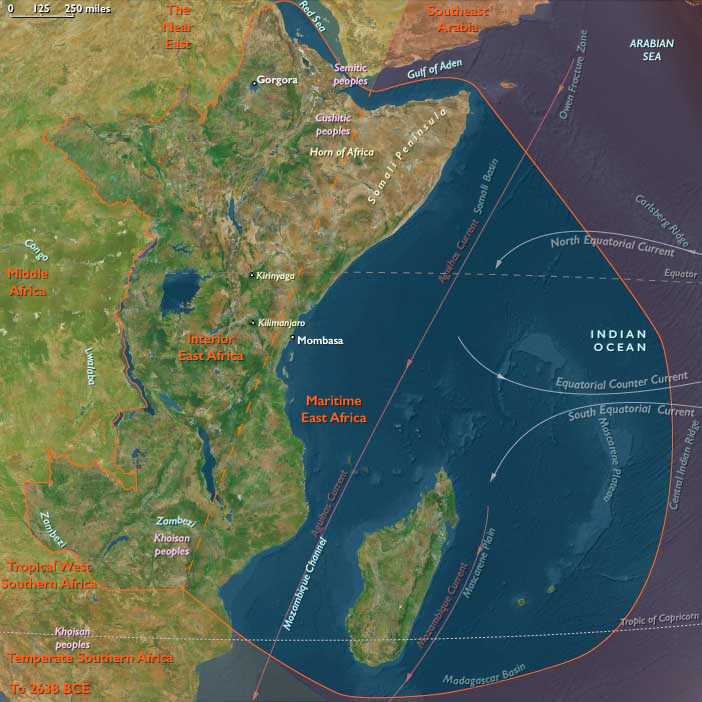
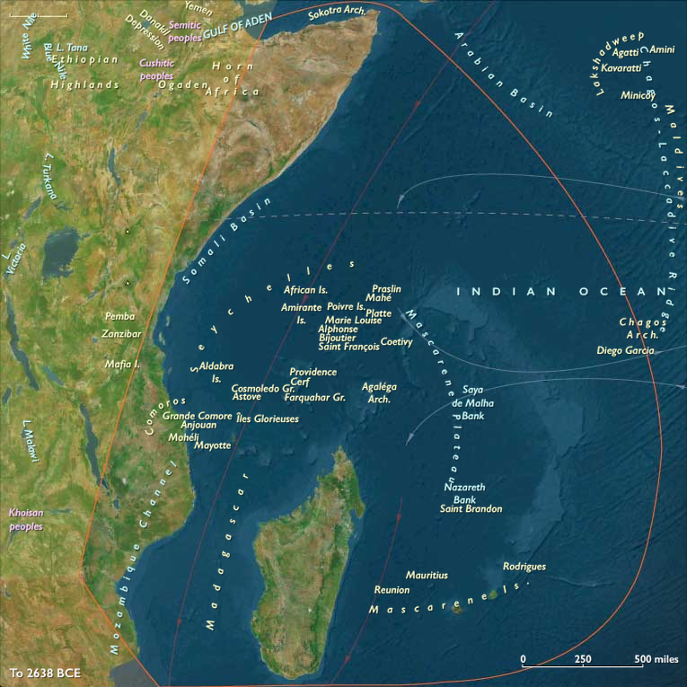
Maritime East Africa (28,577–7,822 BCE) Upper Pleistocene II — Deglaciation, Rising Seas, and Lagoon Productivity
Geographic and Environmental Context
Maritime East Africa includes littoral and nearshore islands from Somalia through Kenya and Tanzania to northern/central Mozambique and southern Malawi, plus Lamu–Pate–Mombasa, Zanzibar–Pemba–Mafia, Kilwa Kisiwani–Songo Mnara, the Comoros, Madagascar, Seychelles, and the Mascarene Islands.
-
Anchors: Lamu archipelago, Mombasa–Kilifi, Zanzibar–Pemba–Mafia, Kilwa Kisiwani–Songo Mnara, Comoros (Ngazidja, Nzwani, Mwali), Madagascar highlands/coasts, Seychelles/Mascarene atolls.Sea level ~100 m lower, exposing broad Somali–Kenyan–Tanzanian shelves
-
Rapid sea rise drowned terraces, creating estuaries and mangroves.
-
Offshore islands remained unpeopled.
Climate & Environmental Shifts
-
Bølling–Allerød: wetter, mangroves expanded.
-
Younger Dryas: aridity; reefs exposed.
-
Early Holocene: warm/moist stability.
Subsistence & Settlement
-
Broad diets: shellfish, fish, dugong, estuarine mollusks, turtle.
-
Coastal settlements became more fixed around lagoons.
Technology & Material Culture
-
Microlithic industries; fish gorges, harpoons.
-
Net weights suggest weirs.
Movement & Interaction Corridors
-
Coastal canoe traffic stitched lagoons; seasonal movement along Horn → Kenya.
Cultural & Symbolic Expressions
-
Shell middens served as ancestral markers.
-
Ritual feasts around fish runs.
Adaptation & Resilience
-
Dual estuary–reef strategy maintained resilience.
Transition
By 7,822 BCE, estuarine foragers built semi-sedentary shell-midden villages.
Topics
Commodoties
Subjects
Regions
Subregions
Related Events
Showing 10 events out of 186 total
Years: 28577BCE - 7822BCE
Topics
Commodoties
Subjects
Regions
Subregions