Tropical West Southern Africa (49,293 – …
Years: 49293BCE - 28578BCE
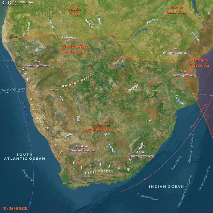
Tropical West Southern Africa (49,293 – 28,578 BCE) Upper Pleistocene I — Wetland Lifelines, Pan Edges, and Desert-Fog Shores
Geographic and Environmental Context:
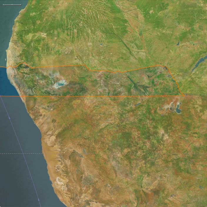
Tropical West Southern Africa includes the far-northern zones of Botswana and Namibia, including the Okavango Delta, the Zambezi–Chobe–Caprivi Strip wetlands, the Etosha Pan basin and surrounding thornveld, and the Namib’s Skeleton Coast fringe.
Anchors: Okavango Delta (Boro–Thamalakane–Khwai distributaries), Zambezi–Chobe–Cuando/ Kwando–Linyanti–Caprivi channels and floodplains, Etosha Pan (Oshigambo–Oshivelo margins, Ekuma–Omuramba inlets), Owambo/ Cuvelai seasonal rivers, and the Skeleton Coast (surf-battered gravel plains, fog-fed lichen fields, seal rookeries).
-
Okavango received attenuated headwaters from the Angolan highlands, spreading into seasonal marshes and islands;
-
Etosha Pan alternated between shallow saline lake and wind-bared playa, with woodland belts on its margins;
-
Caprivi housed distributary floodplains and gallery forests along Zambezi–Chobe–Cuando;
-
Skeleton Coast offered fog-fed strandlines rich in beached carrion and seabird rookeries.
Climate & Environmental Shifts
-
Last Glacial Maximum (LGM): cooler, drier interior; rain belts contracted north; Okavango floods smaller and more variable; Etosha more frequently dry; persistent coastal fogs on the Skeleton Coast.
Subsistence & Settlement
-
Forager bands shuttled between wetland refugia (Okavango/Caprivi channels) and pan edges (Etosha margin springs), hunting antelope and small game, gathering bulbs, fruits, and nuts;
-
Coastal foragers exploited strandings (whale, seal), shellfish pockets, and beach birds along the Skeleton Coast, with brief seasonal stays.
-
Camps clustered near perennial springs, island thickets, and pan-edge seeps.
Technology & Material Culture
-
Flake/core stone industries (quartz, chert, calcrete); backed pieces emerge late; bone points; digging sticks weighted with stone rings; ostrich eggshell (OES) water flasks and beads.
Movement & Interaction Corridors
-
Floodplain ridges and palm-island chains guided movements through the Okavango;
-
Omiramba (fossil river) corridors led into Etosha margins;
-
Zambezi–Chobe–Cuando levees enabled seasonal traversal;
-
Fog-shorelines served as linear routes along the Skeleton Coast.
Cultural & Symbolic Expressions
-
OES bead kits; pigment use (red/ yellow ochres) at island and pan-edge shelters; ritual hearth renewal at spring camps.
Environmental Adaptation & Resilience
-
Wetland–pan–coast switching hedged risks; eggshell flasks and knowledge of spring timing critical for LGM survival.
Transition
By 28,578 BCE, foragers had mapped a tri-zonal safety net — Okavango, Etosha margins, Caprivi channels — with episodic forays to the Skeleton Coast.
Topics
Subjects
Regions
Subregions
Years: 49293BCE - 28578BCE
Topics
Subjects
Regions
Subregions