Filters:
The Decline of …
Years: 892 - 903
Subjects
Regions
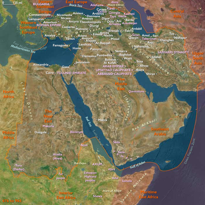
- The Near and Middle East
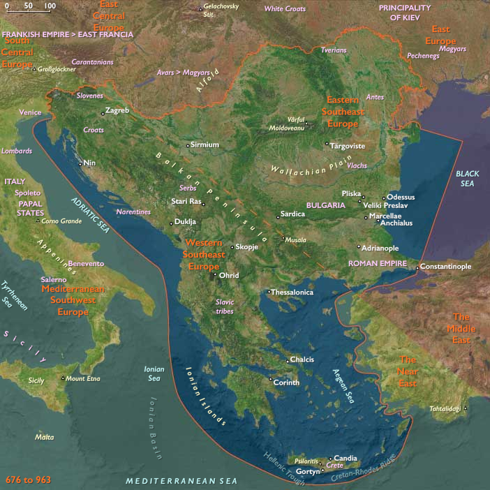
- Southeast Europe
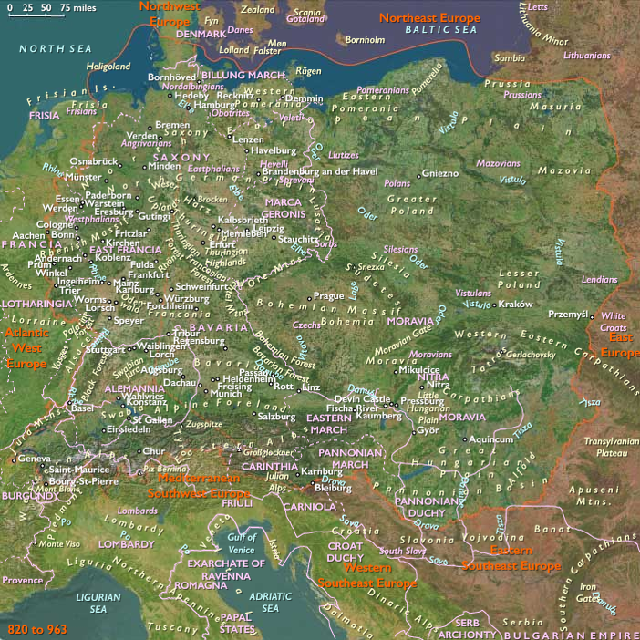
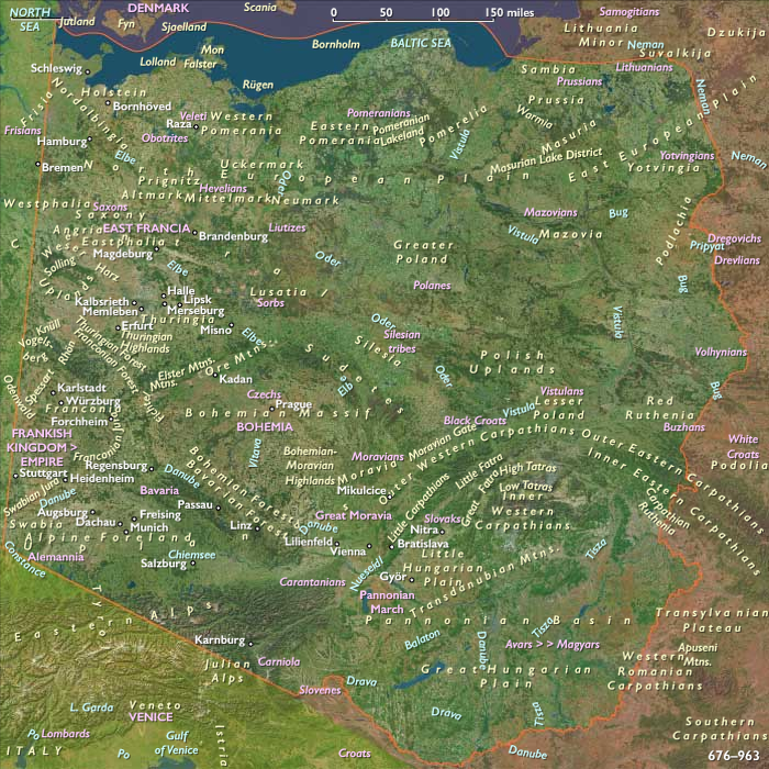
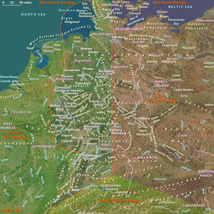
- Central Europe
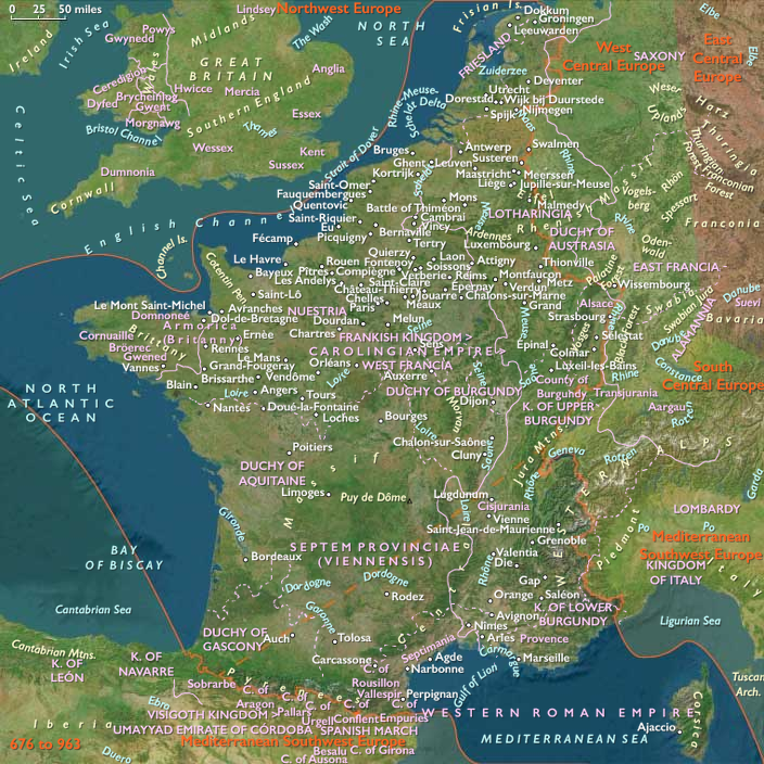
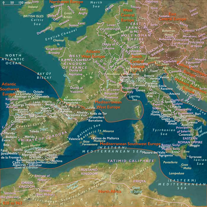
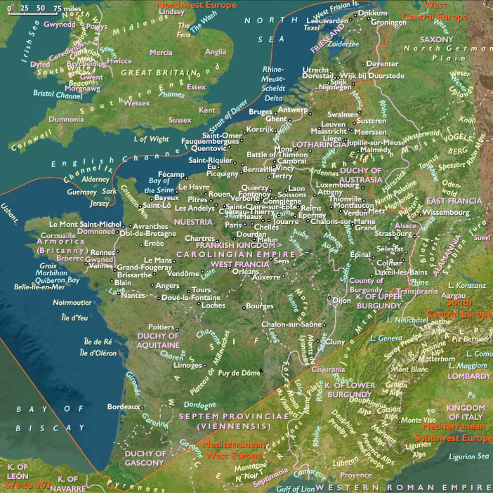
- West Europe
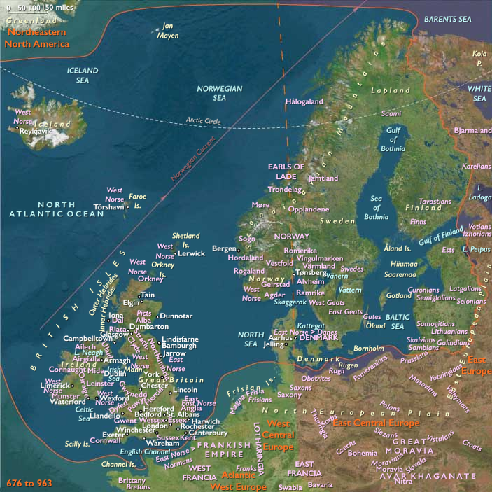
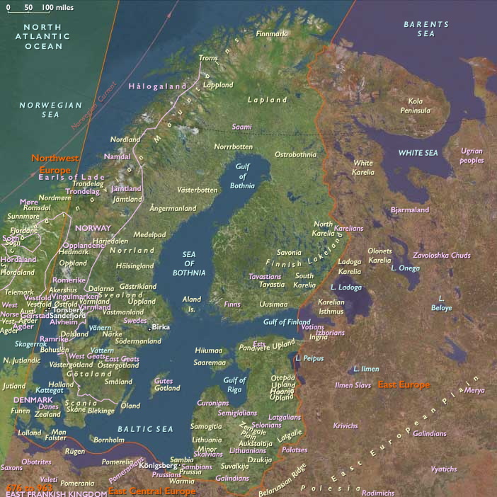
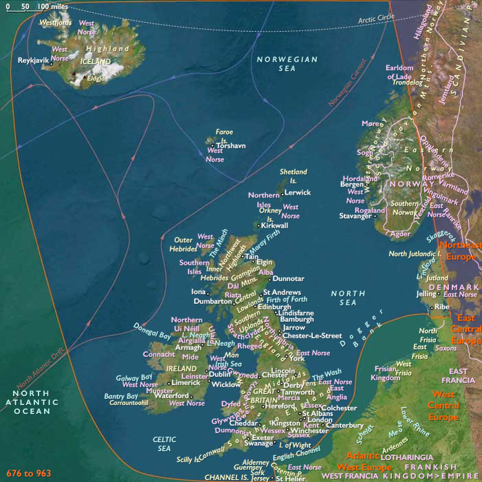
- North Europe
- North Africa
- Southwest Europe

Subregions
- Northeast Europe
- East Central Europe
- Eastern Southeast Europe
- Middle East
- Near East
- Western Southeast Europe
- Mediterranean West Europe
- Mediterranean Southwest Europe
- North Africa
- Atlantic Southwest Europe
- Atlantic West Europe
- West Central Europe
- Northwest Europe
Years: 892 - 903
Subjects
Regions
- The Near and Middle East
- Southeast Europe
- Central Europe
- West Europe
- North Europe
- North Africa
- Southwest Europe
Subregions
- Northeast Europe
- East Central Europe
- Eastern Southeast Europe
- Middle East
- Near East
- Western Southeast Europe
- Mediterranean West Europe
- Mediterranean Southwest Europe
- North Africa
- Atlantic Southwest Europe
- Atlantic West Europe
- West Central Europe
- Northwest Europe