Central Europe (49,293 – 28,578 BCE): Upper …
Years: 49293BCE - 28578BCE
Central Europe (49,293 – 28,578 BCE): Upper Pleistocene I — Ice-Edge Worlds and the Corridors Between the Rivers
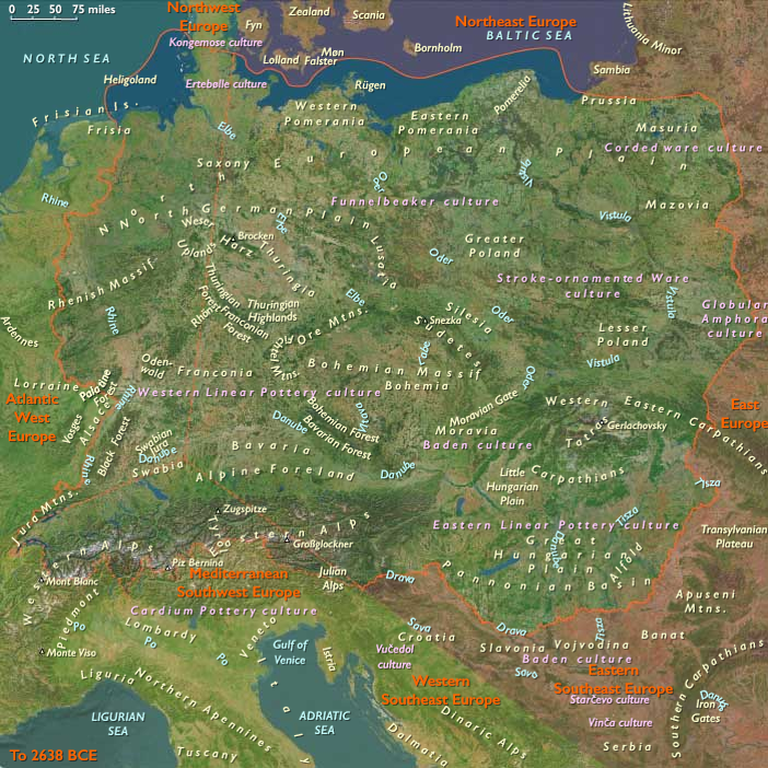
Geographic and Environmental Context
Late-Pleistocene Central Europe was less a single land than a loose archipelago of habitats caught between ice and plain, forest and steppe.
Its three great subregions formed parallel worlds, each facing a different horizon of connection:
-
East Central Europe, stretching from the Carpathian Basin through the Moravian and Polish uplands, was a broad loess-steppe platform—cold, windy, and open, linked eastward to the Ukrainian plains.
-
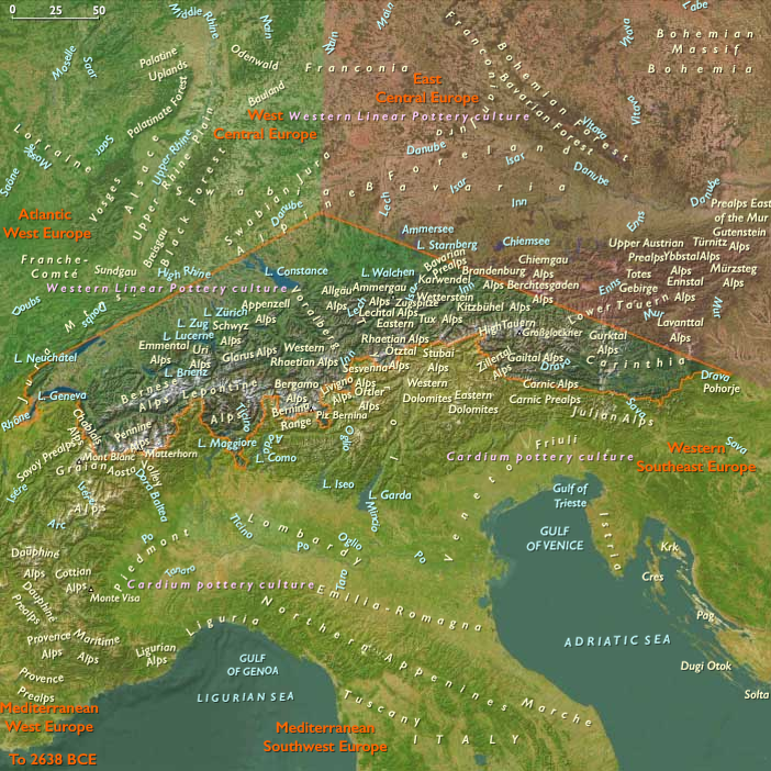
South Central Europe, the Alpine and Carpathian forelands, was a world of glacial valleys, meltwater terraces, and limestone shelters, continuous in culture with the northern Mediterranean refugia.
-
West Central Europe, defined by the Rhine–Jura arc, served as a bridge between the Atlantic basins and the continental interior, its valleys and caves preserving the densest traces of human symbolism.
These three subregions touched but rarely blended. Each possessed its own climate rhythm, resource base, and exchange direction—making Central Europe a corridor of encounter rather than a unified realm.
Climate and Environmental Shifts
The era encompassed the build-up to the Last Glacial Maximum, marked by advancing ice sheets and periglacial drought.
-
East Central Europe lay beneath fierce katabatic winds; loess mantled the plains, rivers braided across frozen ground, and vegetation shrank to steppe and tundra grasses.
-
South Central Europe oscillated between frozen winters and brief warm interstadials: glaciers filled Alpine troughs while lowland oases along the Danube and Rhine supported willow, pine, and migrating herds.
-
West Central Europe experienced repeated cycles of forest retreat and regrowth, its limestone valleys offering milder refuges when the northern plains froze.
Across the region, short-lived thaws—the Bölling–Allerød precursors—brought pulses of moisture and game, reawakening networks of movement before renewed cold sealed them again.
Lifeways and Settlement Patterns
Human presence threaded these worlds along rivers, caves, and terrace ridges.
Bands of twenty to forty people followed predictable seasonal circuits, their economies tuned to local constraints:
-
On the eastern loess plains, foragers pursued mammoth, horse, and reindeer in open steppe country, camping on wind-sheltered bluffs above the Danube, Morava, or Vistula.
-
In the southern forelands, smaller groups alternated between glacial valley hunts—ibex, chamois, red deer—and winter residence in limestone shelters such as those of the Swiss Plateau and Tyrol.
-
Along the western Rhine and Jura, semi-recurrent occupation of caves and river terraces sustained communities rich in art and ornament, their subsistence broadening to include fish, birds, and gathered plants during interstadials.
Despite distance, these groups shared mutual rhythms: winter aggregation in protected valleys, spring dispersal onto the plains, and late-summer exchange at river junctions where herds converged and trade could occur.
Technology and Material Culture
A shared Upper Paleolithic toolkit unified the region while regional ecology drove variation.
-
Blade and microblade industries dominated across the loess plains; Moravian and Polish sites specialized in fine chert and radiolarite production.
-
In the Alpine forelands, antler and bone working produced projectile points, needles, and pendants—artistry often preserved in caves such as Vogelherd and Hohle Fels.
-
Ochre use was near-universal; beads of shell, ivory, and amber marked social identity and inter-group alliance.
These artifacts reveal not only adaptation but memory—the technological continuity linking Magdalenian, Gravettian, and Aurignacian horizons across multiple climatic pulses.
Movement and Interaction Corridors
Rivers and passes stitched the subregions together, defining both movement and meaning.
-
The Danube–Tisza–Morava Axis served as the region’s vertebra, carrying people and materials from the Pannonian Basin westward to the Rhine and eastward toward the Pontic steppe.
-
The Rhine–Moselle–Jura Corridor connected the interior to the Atlantic, exchanging flint, shells, and ideas with France and the Low Countries.
-
The Alpine and Carpathian Passes—Brenner, St. Gotthard, and Moravian Gate—linked Central Europe with Italy’s northern refugia and the Balkans.
Through these conduits flowed not only tools and pigments but shared symbolic grammars—evidence that even as geography divided, communication endured.
Cultural and Symbolic Life
Symbolic creativity reached a profound maturity.
Across caves and campgrounds alike appear engraved plaquettes, figurines, and ochred burials, mirroring yet localizing the broader European Ice-Age tradition.
-
In the west, ivory and limestone Venus figurines embodied fertility or continuity, perhaps exchanged among allied bands.
-
In the south, painted and engraved animals—ibex, horse, bison—evoked the seasonal pulse of the hunt.
-
In the east, portable ornaments and engraved bone served as tokens of connection across the wide steppe.
Ritual practices—hearth renewal, pigment scattering, burial of tools with the dead—provided spiritual ballast in an unstable world, rooting identity in cyclical return.
Environmental Adaptation and Resilience
Adaptation in Central Europe depended on mobility, cooperation, and foresight.
Layered clothing, well-insulated shelters, and stored fuel extended occupation deep into glacial winters.
Networks of kin and alliance allowed information to travel faster than ice: which valley still held red deer, which cave spring had thawed, which flint source remained exposed.
The interplay of diverse habitats—steppe, riverine, alpine—offered redundancy against failure; when one closed, another opened.
In this diversity lay the region’s strength: not uniformity but connectivity.
Transition Toward the Last Glacial Maximum
By 28,578 BCE, the Central European corridor tightened between advancing ice sheets and rising aridity.
Yet life persisted: steppe herds still crossed the loess plains, smoke still curled from Jura caves, and travelers still traced the Danube from one refuge to another.
Its three natural subregions—the eastern loess plains, the southern glacial valleys, and the western limestone uplands—remained largely self-contained, but each was part of a wider web reaching far beyond the heart of Europe.
Thus even at the peak of cold, Central Europe exemplified the premise of The Twelve Worlds: that the coherence of a region lies not in its unity but in the tension between its neighboring worlds, whose dialogue across ice, river, and mountain sustained human culture through the harshest ages of Earth’s memory.
Groups
Topics
Commodoties
Subjects
Regions
Subregions


Related Events
Showing 10 events out of 69706 total
Years: 49293BCE - 28578BCE
Groups
Topics
Commodoties
Subjects
Regions
Subregions